Crescent Beach – Lockeport
Open year-round
South Shore, Lockeport


These are two very distinct trails that are linked by Highway 103 and Highway 3. If you choose to travel the loop be careful of the highway road traffic. Local residents describe walking the Tom Tigney Trail and the Foot Bridge Trail as “going around the river.” The Sable River has great significance to the people who live on both the east and west sides of it. It physically divides them but in actual fact unites their sense of community and spirit.
Tom Tigney Trail
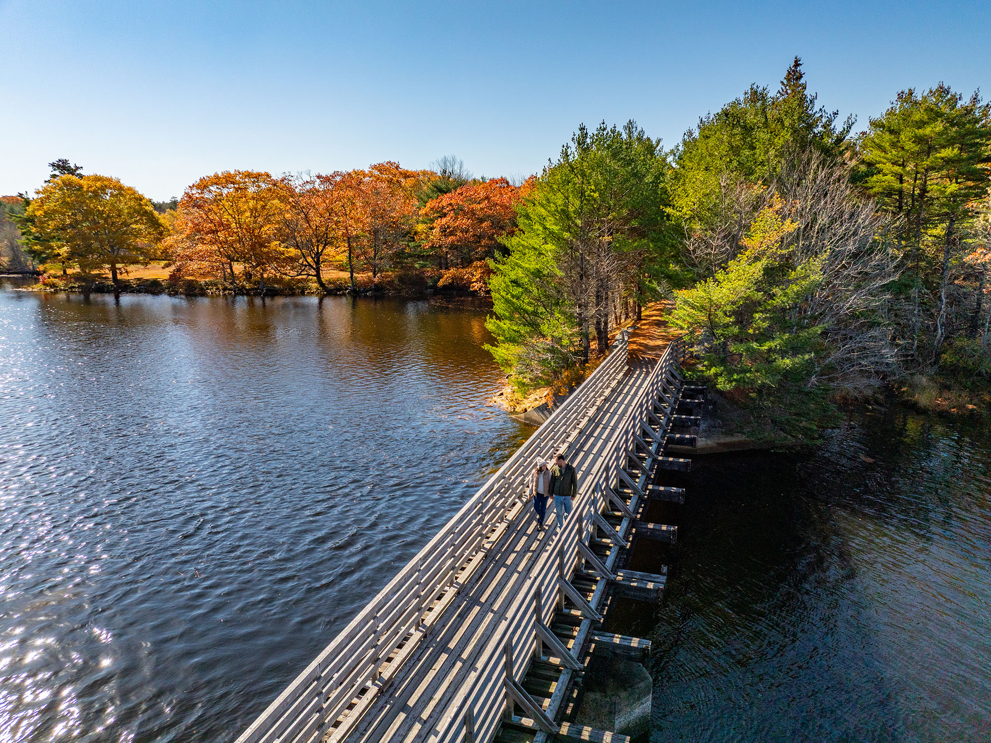
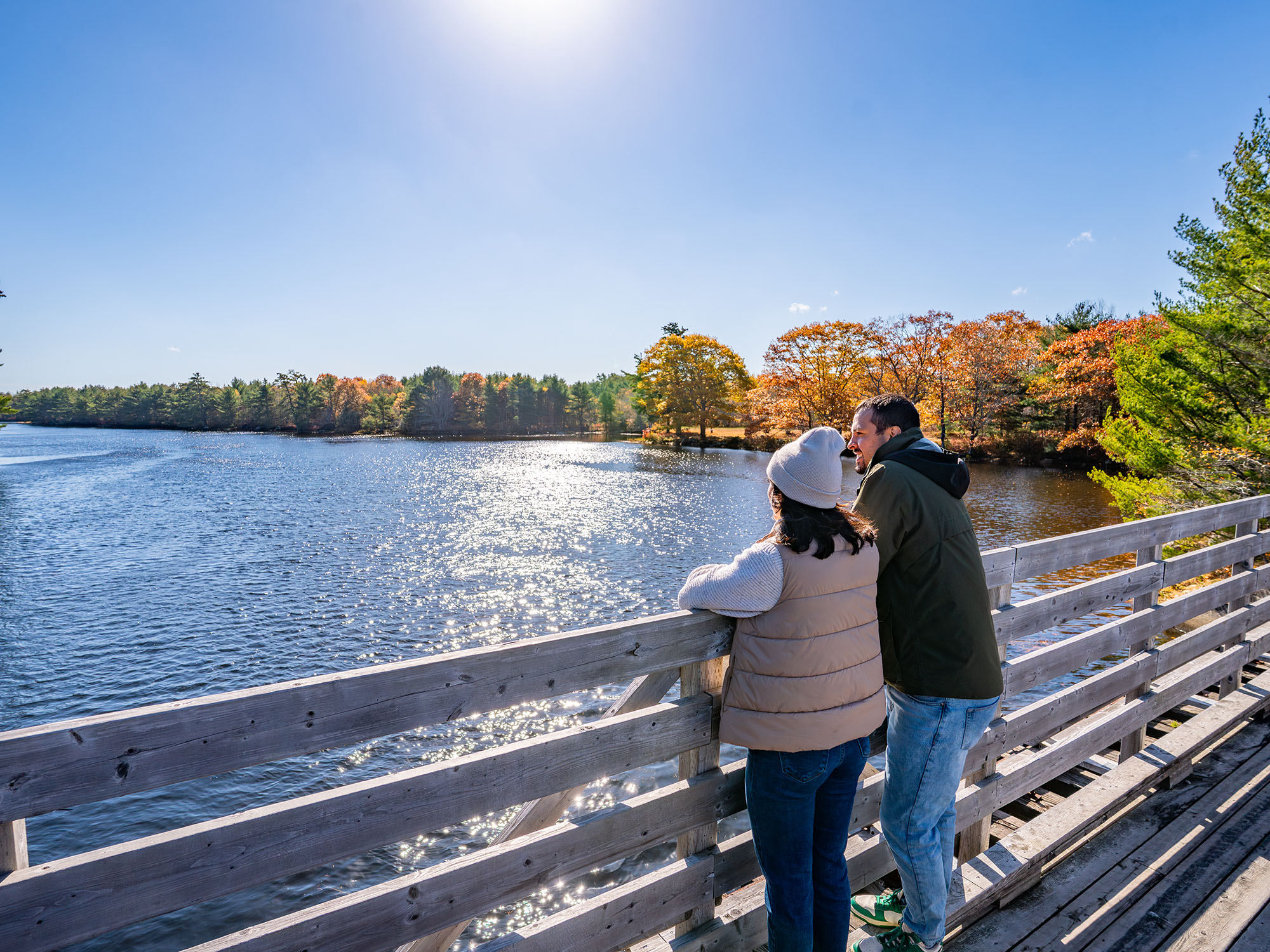
The Tom Tigney Trail is located along the abandoned Halifax and Southwestern railway line. The railway carried passengers and freight between Halifax and Yarmouth from 1907 to 1969. The trail winds through a quiet residential area beside the Tom Tigney River, across the highway several times, and then across the planked and railed former CN rail bridge, ending at Highway 3. From the bridge there is a wonderful view both up and down the Sable River.
The trailhead is located just off Highway 103 beside the East Sable Road. Signage, a picnic table, and hand-painted mural invite the traveler to stop and rest. Other hand-painted murals by local artist and historian Bessie Robart can be viewed along the trail. Trail uses include walking, cycling and motorized ATV use, making it a shared-use trail. This trail links up on both ends with trails developed and maintained by the Woodland Multi-use Trail Association. At the Highway 103 end it links with 8.3 kilometres of trail going to Wilkins Lake and the Queens County line and then to the Broad River Bridge in Port Mouton. The other end of the Tom Tigney Trail at Highway 3 connects to 10 kilometres of trail through marsh and forested areas, and past a lake to Canada Hill Road. This trail is great for birdwatching and observing other wildlife.
A return trip on the trail is about 2 kilometres on a flat graveled surface. A leisurely stroll stopping to enjoy the scenery may take about 40 minutes.
The trail is open year-round but is only maintained seasonally. Respect private property and stay on the trails at all times. Beware of traffic where trails cross roads. Leave nothing behind except your footprints. Pets are welcome but must be on a leash. Please clean up after your pet.
Footbridge Trail
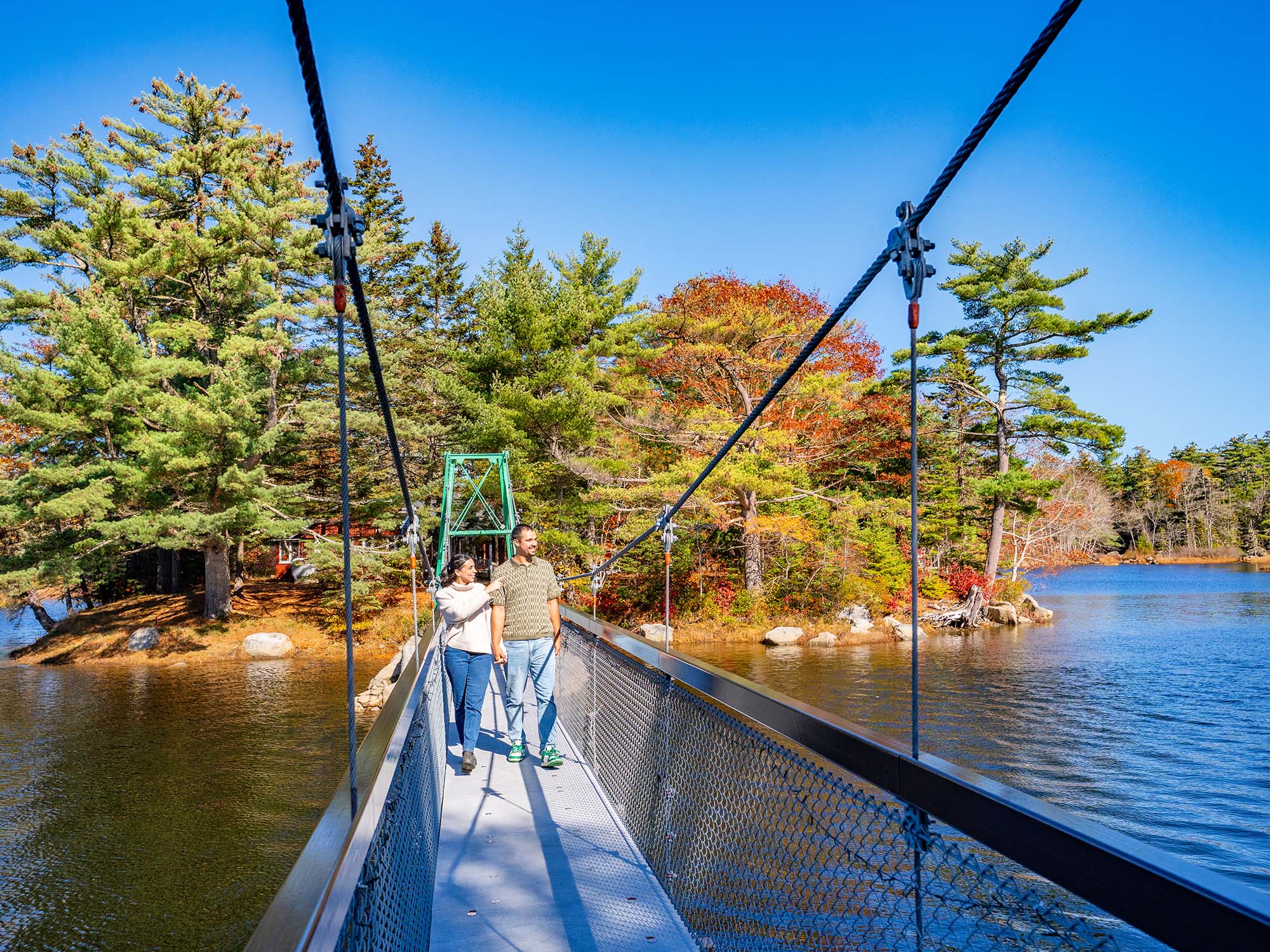
The Footbridge trailhead is located on property owned by the Sable River Volunteer Fire Department. The trail, which leads from the parking area to the century-old swinging bridge known as “The Footbridge”, is clearly marked and only accessed on foot. The bridge takes you across the Sable River. It is a strange sensation to feel the bridge moving up and down under your feet. Many photos have been snapped of this unique historic site. Local painter and historian Bessie Robart has painted a beautiful mural to recognize the role the railroad played in Sable River’s past. An interpretive panel at the bridge provides historical information regarding the Mi’kmaq people, who were early residents in Sable River. After leaving the bridge you have the option to follow the Freeman Mill Road to Highway 103, which will take you to the Tom Tigney Trail.
A return trip on the trail is about 2 kilometres on a flat graveled surface and dirt road. A leisurely stroll stopping to enjoy the scenery may take about 40 minutes.
Looking for a bite to eat or something else to do during your visit? Check out these popular nearby activities and attractions!

Open year-round
Open year-round

From May 17 to October 14


Open year-round

Tag your travel photos to be featured.
