Mary Ann Falls Trail – Cape Breton Highlands National Park
Cape Breton Island, Cape Breton Highlands National Park (Ingonish side)
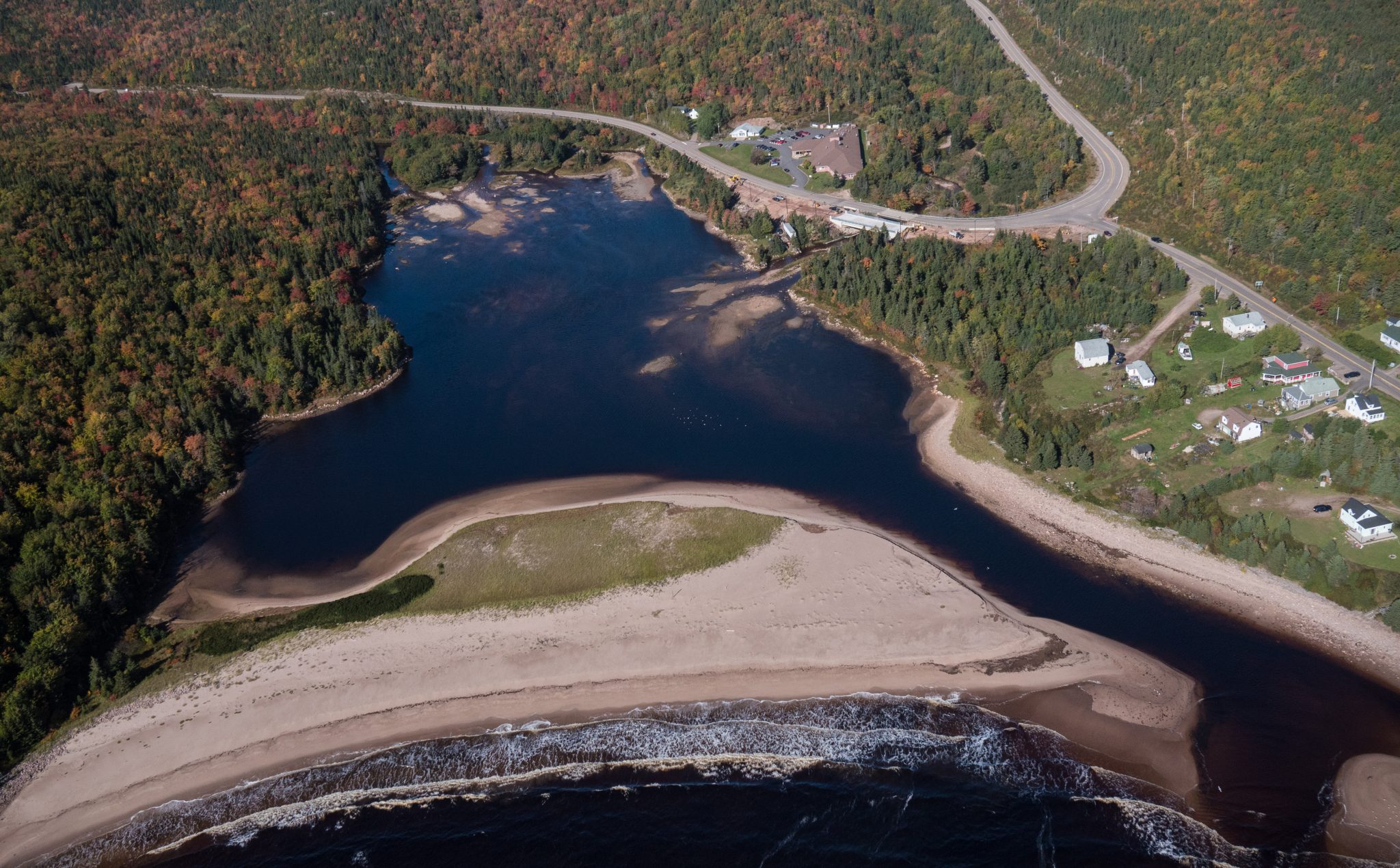
A leisurely walk through boreal forest, with its seasonally changing understory, to the lesser explored end of Neil’s Harbour Beach, bordering an estuary teeming with life. Take 45-50 minutes on this easy 2.5 km (1.5 mi) return hike and be greeted by a beautiful sandy beach nestled between Neil’s Harbour on the Atlantic Ocean and Neils Harbour Pond.
Length: 2.5km (1.5 mi) return
Rating: Easy
Elevation: 0=45m (0-150 ft)
Time: 45-50 minutes
Trailhead: Lat: 46.807398 Long: -60.344756
Park is open year-round but full visitor services are only available from mid-May until mid-October. A park pass is required for hiking or use of other services in the park; a park entry fee applies.
Check in at the Parks Canada visitor centres in Chéticamp (16 Visitor Centre Road, situated on the west side of the park) or in Ingonish (37637 Cabot Trail, on the east side of the park) to obtain passes, information on visitor safety and any other information you may need, including a trail location map.
For your comfort and safety:
Recreational drone use is prohibited within the national park for the safety of wildlife and other visitors.
FRENCH: Plage du Ruisseau Neil
Une agréable promenade à travers la forêt boréale, dont le sous-bois change au fil des saisons, mène à l’extrémité moins fréquentée de la plage de Neil’s Harbour, en bordure d’un estuaire foisonnant de vie. Cette randonnée facile de 2,5 km (1,5 mi) aller-retour se parcourt en 45 à 50 minutes et vous accueille sur une magnifique plage de sable nichée entre le port de Neil’s Harbour, sur l’océan Atlantique, et l’étang de Neil’s Harbour.
Longueur : 2,5 km (1,5 mi) aller-retour
Niveau de difficulté : Facile
Dénivelé : 0 à 45 m (0 à 150 pi)
Durée : 45 à 50 minutes
Point de départ :
Latitude : 46.807398
Longitude : -60.344756


Identifiez-nous sur vos photos de voyage pour qu’elles soient mises en vedette.
