Listings (Page 14)
Lisa Drader-Murphy Studio
URL: https://novascotia.com/listing/lisa-drader-murphy-studio/
Main Featured Image: https://novascotia.com/wp-content/uploads/2024/09/36330.webp

- Listing_type_tax: 4
- Attraction_type:
- Artisan_gallery_type: Artist/Artisan Studio, Artisan Shops & Galleries, Unique Shop
- Region: Bay of Fundy & Annapolis Valley
- Street_address: 1901 Evangeline Trail, RR1
- Postal_code: B0P 1L0
- City: 269, Falmouth
- Latitude: 44.998066
- Longitude: -64.162909
- Phone: 902-790-1937
- Email: Studio@LisaDraderMurphy.com
- Contact_details: Phone, Email
- Description: Lisa Drader-Murphy is an award-winning Canadian fashion designer, based in Nova Scotia. With posh boutiques on Halifax’s waterfront and in Bedford’s Sunnyside Mall, the LDM Studio in Falmouth is where the design and production take place. Shop the full retail showroom, gift shop, gallery, and fabric store, while observing the production operations of a vertical fashion house, all nestled in an apple orchard at Drader-Murphy’s boutique resort, Willow Vale Estate.
- Period_of_operation: Open within a date range
- Open_start_date: April 21, 2025
- Open_end_date: October 30, 2025
- Images: https://novascotia.com/wp-content/uploads/2024/09/36330.webp, https://novascotia.com/wp-content/uploads/2024/09/36331.webp, https://novascotia.com/wp-content/uploads/2024/09/36332.webp
- Facebook: https://www.facebook.com/LisaDraderMurphyOfficial/
- Instagram: https://www.instagram.com/lisadradermurphy_official/
- Business: Willow Vale Estate / Lisa Drader-Murphy Studio
- Active_listing: 1
- Website: https://LisaDraderMurphy.com
- Notes:
- General_area: 93, Windsor Area
- Google_rating: 5
- Primary_contact: 2736
Liscombe Lodge Marina
URL: https://novascotia.com/listing/liscombe-lodge-marina/
Main Featured Image: https://novascotia.com/wp-content/uploads/2024/09/23490.webp

- Listing_type_tax: 9
- Tours_outdoors:
- Boating_sailing_type: Marina & Yacht Club
- Region: Eastern Shore
- Street_address: 2884 Highway 7
- Postal_code: B0J 2A0
- City: 461, Liscomb Mills
- General_area: 81, Sherbrooke Area
- Latitude: 45.012017
- Longitude: -62.103599
- Phone: 902-779-2307
- Toll_free: 1 800-665-6343
- Email: liscombe@liscombelodge.ca
- Contact_details: Phone, Toll Free, Email
- Description: Land ahoy! One of the most accommodating Nova Scotia marinas can be found at Liscombe Lodge Resort and Conference Centre – the perfect spot for an impromptu stopover or a planned mooring to stretch your sea legs before setting sail again.
The Marina offers both dockside berths ($50) and three moorings ($50) along the Nova Scotia Eastern Shore.
Note: moorings require your own tender.
Dates of Operation: May to November
Latitude and Longitude: 45° 00’52” N., 62° 06’38” W
Minimum water depth at low tide: 12’
Maximum length and draft of vessel: 100’ x 10’
VHF channel monitored: 16 and 68
- Period_of_operation: Open within a date range
- Open_start_date: May 5, 2025
- Open_end_date: November 24, 2025
- Date_details_hours_of_operation: Open May - November
- Payment_types:
- Images: https://novascotia.com/wp-content/uploads/2024/09/23490.webp, https://novascotia.com/wp-content/uploads/2024/09/23491.webp, https://novascotia.com/wp-content/uploads/2024/09/23492.webp, https://novascotia.com/wp-content/uploads/2024/09/23493.webp, https://novascotia.com/wp-content/uploads/2024/09/23494.webp, https://novascotia.com/wp-content/uploads/2024/09/23495.webp, https://novascotia.com/wp-content/uploads/2024/09/23496.webp, https://novascotia.com/wp-content/uploads/2024/09/23497.webp, https://novascotia.com/wp-content/uploads/2024/09/23498.webp, https://novascotia.com/wp-content/uploads/2024/09/23499.webp
- Accessibility: Wheelchair accessible
- Facebook: https://www.facebook.com/liscombelodge
- Instagram: https://instagram.com/liscombelodge
- Twitter: https://twitter.com/liscombelodge
- Youtube: https://www.youtube.com/user/LiscombeLodge
- Business: Liscombe Lodge Resort & Conference Centre / Marina / Trail System / Riverside Dining Room
- Active_listing: 1
- Website: https://www.liscombelodge.ca/
- Notes:
- Google_rating: 4.1
- Primary_contact: 693
Liscombe Lodge Resort & Conference Centre
URL: https://novascotia.com/listing/liscombe-lodge-resort-conference-centre/
Main Featured Image: https://novascotia.com/wp-content/uploads/2024/09/21586.webp

- Listing_type_tax: 3
- Accommodation_type:
- Eat_drink_type:
- Tours_outdoors:
- Tara_registration_num: STR2627T4890
- Region: Eastern Shore
- Street_address: 2884 Highway 7
- Postal_code: B0J 2A0
- City: 461, Liscomb Mills
- General_area: 81, Sherbrooke Area
- Latitude: 45.012921
- Longitude: -62.10142
- Phone: 902-779-2307
- Toll_free: 800-665-6343
- Email: liscombe@liscombelodge.ca
- Contact_details: Phone, Toll Free, Email
- Description: Liscombe Lodge Resort and Conference Centre is located two and a half hours from Halifax, and makes you feel like you are worlds away from city life. This Eastern Shore resort is peacefully tucked away on the tranquil shores of the Liscomb River, not far from Sherbrooke and the largest provincial museum, Sherbrooke Village, a living history site.
Liscombe Lodge delivers the ideal Nova Scotia accommodations you’ve been looking for – a rustic and comfortable experience for every occasion. The well-appointed Riverside Lodge offers 30 air conditioned guestrooms and a luxury junior suite, while the 17 open-concept chalets and five four-bedroom cottages feature cozy fireplaces and spacious private-use verandas. Two hotel rooms and two chalets are wheelchair accessible.
Don’t forget your four-legged guests! The resort also offers select pet-friendly accommodations.
The incredible selection of activities available at the secluded resort will ensure a perfect vacation. Enjoy the indoor heated pool, or embark on a water tour of the Liscombe River from our Liscombe River Marina, explore the shoreline on a kayak or canoeing adventure; or reconnect with nature with more than 16 kilometres of beautiful Nova Scotia trails on the Liscombe River Trail System.
Enjoy Maritime cuisine with spectacular river views at our Riverside Dining Room. The savory menu features incredible local flavors and the resort’s famous planked Atlantic salmon, cooked daily over an open fire.
Come explore the unexplored!
All major credit cards accepted. Check-in 4pm.
- Period_of_operation: Open within a date range
- Open_start_date: May 15, 2026
- Open_end_date: November 28, 2026
- Date_details_hours_of_operation: May 15 to Oct 11: open seven days a week; Oct 16 to Nov 28: Open weekends
- Low_rate: 244
- High_rate: 305
- Rate_period: Per Night
- Cancellation_policy: Must cancel 72 hours prior to day of arrival for a refund of your deposit or to avoid a credit card charge.
- Rate_details: Packages available.
- Payment_types:
- Images: https://novascotia.com/wp-content/uploads/2024/09/21586.webp, https://novascotia.com/wp-content/uploads/2024/09/22614.webp, https://novascotia.com/wp-content/uploads/2024/09/22615.webp, https://novascotia.com/wp-content/uploads/2024/09/22616.webp, https://novascotia.com/wp-content/uploads/2024/09/22617.webp, https://novascotia.com/wp-content/uploads/2024/09/22618.webp, https://novascotia.com/wp-content/uploads/2024/09/22619.webp, https://novascotia.com/wp-content/uploads/2024/09/22620.webp, https://novascotia.com/wp-content/uploads/2024/09/22621.webp, https://novascotia.com/wp-content/uploads/2024/09/22623.webp
- Accessibility: Partially accessible, Wheelchair accessible
- Accommodation_common_amenities: Air Conditioning, Fitness Centre / Gym, Kitchen/Kitchenette, Pool (Indoor), Room Service, TV (Cable/Sat TV/Smart), Water / Ocean View
- Onsite_amenities: Gift Shop, Parking, Picnic Tables, Restaurant/Canteen/Tea Room, WiFi
- Pets_policy:
- Number_of_units: 73
- Online_booking:
- Facebook: http://www.facebook.com/liscombelodge
- Instagram: http://instagram.com/liscombelodge
- Pinterest: https://www.pinterest.com/liscombelodge
- Business: Liscombe Lodge Resort & Conference Centre / Marina / Trail System / Riverside Dining Room
- Active_listing: 1
- Website: https://www.liscombelodge.ca
- Notes:
- Google_rating: 4.1
- Primary_contact: 693
- Highlights:
Choose from a variety of accommodation options, including guestrooms in the Riverside Lodge and a luxury junior suite, 17 open-concept chalets and five four-bedroom cottages feature cozy fireplaces and spacious private-use verandas
Spend the day by the heated indoor pool, and enjoy a delicious dinner in the evening in our onsite restaurant
View the Liscomb River on a scenic river cruise and take advantage of many complimentary activities such as hiking, kayaking, canoeing, bird watching, and biking
- Campaign_category: 72
- Videos:
- Ratings_programs: Canada Select
- Trip_advisor: https://www.tripadvisor.ca/Hotel_Review-g660787-d262654-Reviews-Liscombe_Lodge_Resort_and_Conference_Center-Liscomb_Mills_Nova_Scotia.html
- Cs_rating_resort: 3.5
Liscombe River Trail System
URL: https://novascotia.com/listing/liscombe-river-trail-system/
Main Featured Image: https://novascotia.com/wp-content/uploads/2024/09/15801.webp

- Listing_type_tax: 9
- Tours_outdoors:
- Region: Eastern Shore
- Street_address: Highway 7 (near #2884)
- City: 461, Liscomb Mills
- General_area: 81, Sherbrooke Area
- Latitude: 45.014704
- Longitude: -62.096985
- Toll_free: 800-665-6343
- Email: liscombe@liscombelodge.ca
- Contact_details: Toll Free, Email
- Description: Whether you are looking for a romantic retreat or an outdoor adventure on Nova Scotia trails, Liscombe Lodge Resort is the perfect location for you. Their hiking trails are designed to accommodate hikers of all experience levels.
Guests can choose from guided nature hikes for the nature enthusiasts or an early morning power walk! You can discover the beauty of Eastern Shore in a variety of different ways. If you’re looking for more of a challenge, try the more difficult trails like the Liscomb River Trail or the Mayflower Trail.
The most popular trails are:
Liscomb River Trail (9.6 km)
The sound of water rushing over rocks and the warmth of the sun radiating off massive boulders left by the ancient glaciers will put you in touch with nature. The trail includes a suspension bridge that overlooks a waterfall and the nearby fish ladder, which was constructed to help restock Atlantic salmon. The ladder is formed by 15 pools separated by concrete weirs. The Liscomb River salmon-run begins the first two weeks in June and ends in late October, and peaks in July before the water warms.
Mayflower Trail (2.9 km)
The Mayflower Trail is a rugged coastal hiking trail that winds along the mouth of the Liscomb River. Scenic lookouts exist on the trail and there are many opportunities to view local flora and fauna.
Woodpecker and Prospector Trails (400 m)
Interpretive signage is positioned at the start of the walking trail to highlight natural points of interest and cultural history of the region.
- Period_of_operation: Open year-round
- Date_details_hours_of_operation: no winter maintenance
- Images: https://novascotia.com/wp-content/uploads/2024/09/15801.webp, https://novascotia.com/wp-content/uploads/2024/09/15802.webp
- Cell_service:
- Facebook: https://facebook.com/liscombelodge
- Instagram: https://instagram.com/liscombelodge
- Twitter: https://twitter.com/liscombelodge
- Business: Liscombe Lodge Resort & Conference Centre / Marina / Trail System / Riverside Dining Room
- Active_listing: 1
- Website: https://trails.gov.ns.ca/SharedUse/g008.html
- Notes:
- Google_rating: 3.3
- Primary_contact: 693
- Trail_distance: 12.9
- Highlights: Please note: The suspension bridge is currently closed but the trails remain open.
- Trail_distance_measurement: one way
- Trail_type: Day use
- Trail_surface: Gravel
- Trail_difficulty_level: Easy
- Trail_pet_policy: Leashed
- Trail_uses: Hiking, Snowshoeing, Walking
Lisette’s on Long Hill
URL: https://novascotia.com/listing/lisettes-on-long-hill/
Main Featured Image: https://novascotia.com/wp-content/uploads/2025/04/Lisettes-1920x1080-1.jpg

- Active_listing: 1
- Business: Lisette’s on Long Hill Cottage
- Primary_contact: 2991
- Listing_type_tax: 3
- Accommodation_type:
- Tara_registration_num: STR2627D6644
- Region: South Shore
- Street_address: 66 Long Hill Road
- City: 516, Mahone Bay
- General_area: 51, Mahone Bay Area
- Postal_code: B0J 2E0
- Latitude: 44.452931453905066
- Longitude: -64.39520366102724
- Contact_details: Phone, Email
- Phone: 902-637-8448
- Description: Lisette’s on Long Hill Cottage
Unwind the moment you arrive at this beautifully styled two-bedroom cottage just minutes from the heart of Mahone Bay. Step into a sunlit solarium featuring a cozy daybed and games table—perfect for relaxing or reconnecting.
Thoughtfully designed with comfort in mind, the cottage features brand-new queen and double beds, hotel-quality linens, and plenty of pillows. The fully equipped kitchen has everything you need to prepare a great meal, and the heat pump ensures year-round comfort.
Enjoy the outdoors with a private deck, BBQ, and a sunken propane firepit area—ideal for starry evenings. Traveling with a furry friend? Pets are welcome, and we’ve got treats waiting.
Need to catch up on work? There’s a quiet office nook with high-speed internet to keep you connected.
- Period_of_operation: Open year-round
- Images: https://novascotia.com/wp-content/uploads/2025/04/Lisettes-1920x1080-1.jpg
- Accommodation_common_amenities: Kitchen/Kitchenette
- Onsite_amenities: WiFi
- Number_of_units: 1
- Pets_policy:
- Online_booking:
- Facebook: https://www.facebook.com/people/Lisettes-on-Long-Hill/61560040019630/#
- Notes:
- Email: lisette@thinksmart-training.com
Lismore Sheep Farm
URL: https://novascotia.com/listing/lismore-sheep-farm/
Main Featured Image: https://novascotia.com/wp-content/uploads/2024/09/37181.webp

- Listing_type_tax: 4
- Attraction_type:
- Artisan_gallery_type: Artisan Shops & Galleries
- Region: Northumberland Shore
- Street_address: 1389 Louisville Road
- City: 729, River John
- Latitude: 45.748899
- Longitude: -63.089862
- Phone: 902-351-2594
- Email: info@lismoresheepfarmwoolshop.com
- Contact_details: Phone, Email
- Description: A working farm with 200 sheep, LowLine Angus cows and a range of field crops. Lovely woolen and sheepskin products made on the farm or locally: wool blankets, mitts, slippers, hats, pillows, yarn, felting supplies. Visit the barn, meet the sheep and learn about wool.
- Period_of_operation: Open within a date range
- Open_start_date: May 1, 2025
- Open_end_date: December 23, 2025
- Date_details_hours_of_operation: 10:00am-4:00pm daily.
- Payment_types:
- Images: https://novascotia.com/wp-content/uploads/2024/09/37181.webp, https://novascotia.com/wp-content/uploads/2024/09/37184.webp, https://novascotia.com/wp-content/uploads/2024/09/37185.webp, https://novascotia.com/wp-content/uploads/2024/09/37186.webp, https://novascotia.com/wp-content/uploads/2024/09/2023_Pictou_County_MDoucette_116_Lismore_Sheep_Farm.jpg, https://novascotia.com/wp-content/uploads/2024/09/Lismore_Sheep_Farm_004_image_credit_Cailin_ONeil_IMG_3267.jpg, https://novascotia.com/wp-content/uploads/2024/09/Tatamagouche_Radiate_Shoot_2024_Final_TIFF_11.jpg, https://novascotia.com/wp-content/uploads/2024/09/Lismore-Sheep-Farm-by-Nova-Social-Media-Marketing-13_NovaScotia.com_2000x1500.jpg, https://novascotia.com/wp-content/uploads/2024/09/Lismore-Sheep-Farm-by-Nova-Social-Media-Marketing-16_NovaScotia.com_2000x1500.jpg
- Accessibility: Wheelchair accessible
- Facebook: https://www.facebook.com/people/Lismore-Sheep-Farm/100064368742400/?fref=ts
- Instagram: https://www.instagram.com/lismoresheepfarm
- Business: Lismore Sheep Farm
- Active_listing: 1
- Website: https://www.lismoresheepfarmwoolshop.com
- Notes:
- General_area: 76, River John Area
- Google_rating: 4.7
- Primary_contact: 975
- Gardens_parks_&_farms_types: Agri-tourism / Farm / U-pick
Little Brook Cottages
URL: https://novascotia.com/listing/little-brook-cottages/
Main Featured Image: https://novascotia.com/wp-content/uploads/2025/12/Little-Brook-Cottages-aerial-view-1920x1080-1.jpg
- Active_listing: 1
- Business: Little Brook Cottages
- Primary_contact: 3227
- Listing_type_tax: 3
- Accommodation_type:
- Tara_registration_num: STR2627T3931
- Google_rating: 4.8
- Region: Cape Breton Island
- Street_address: 535 White Point Rd
- City: 790, South Harbour
- General_area: 62, North Highlands Area
- Postal_code: B0C 1C0
- Latitude: 46.87049772993999
- Longitude: -60.43831500302177
- Contact_details: Phone, Email
- Description:
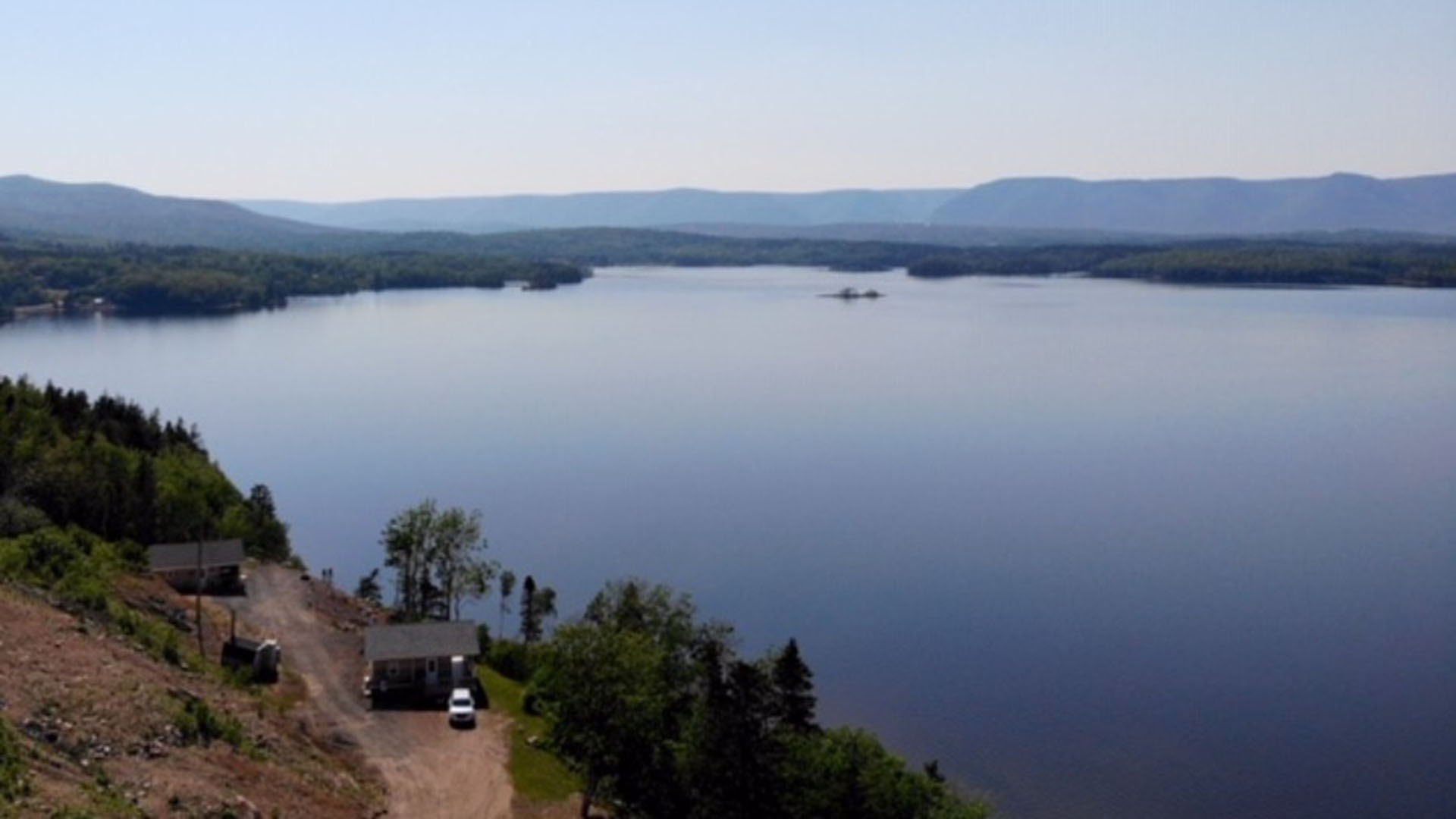
Little Brook cottages are situated on the edge of South harbour, just off the scenic route on the Cabot Trail.
Situated at the top of the Cabot Trail makes it the perfect base camp to explore all 36 world class hiking trails, plus we have some of the most beautiful beaches for you to explore and relax on.
The night times are the most magical, if you are from a populated area then light pollution would blur the night sky, at Little Brook cottages, we have had guests spend a whole night out gazing at the stars, you don’t have to spend a whole night but look in amazement.
The silence will be deafening, listen carefully and when eagles pass overhead all you will hear are the flapping of wings and if lucky hear them chatting to each other.
- Period_of_operation: Open year-round
- Low_rate: 342
- High_rate: 342
- Rate_period: Per Night
- Rate_details: Two night minimum
- Cancellation_policy: 24 hours notice required for a full refund
- Payment_types:
- Images: https://novascotia.com/wp-content/uploads/2025/12/Little-Brook-Cottages-aerial-view-1920x1080-1.jpg, https://novascotia.com/wp-content/uploads/2025/12/Little-Brook-Cottages-view-1920x1080-1.jpg, https://novascotia.com/wp-content/uploads/2025/12/Little-Brook-Cottages-1920x1080-1.jpg, https://novascotia.com/wp-content/uploads/2025/12/bedroom-1-1.jpg, https://novascotia.com/wp-content/uploads/2025/12/sunset-1.jpg
- Accommodation_common_amenities: Beach Access on Property, Kitchen/Kitchenette, Water / Ocean View
- Onsite_amenities: WiFi
- Number_of_units: 3
- Pets_policy:
- Website: https://www.littlebrookcottage.ca/
- Online_booking:
- Notes:
- Phone: 902-285-0242
- Email: info@littlebrookcottage.ca
Little School Museum
URL: https://novascotia.com/listing/little-school-museum/
Main Featured Image: https://novascotia.com/wp-content/uploads/2024/09/download_1.jpg

- Listing_type_tax: 4
- Attraction_type:
- Museumhistoric_site_type: Museum
- Region: South Shore
- Street_address: 29 & 37 Locke Street
- City: 480, Lockeport
- General_area: 80, Shelburne/Lockeport Area
- Latitude: 43.697067
- Longitude: -65.115316
- Phone: 902-656-2216
- Email: townoflockeport@ns.sympatico.ca
- Contact_details: Phone, Email
- Description: The first schoolhouse in Lockeport, built in 1845. Collection of local historical material, artifacts relating to early life in the community, a replica of an early schoolroom and a marine room.
- Period_of_operation: Open within a date range
- Open_start_date: July 1, 2025
- Open_end_date: September 4, 2025
- Date_details_hours_of_operation: 10am–5pm daily.
- Rate_details: Admission free, donations welcome.
- Images: https://novascotia.com/wp-content/uploads/2024/09/download_1.jpg
- Accessibility: Wheelchair accessible
- Onsite_amenities: Parking, Picnic Tables
- Business: Town of Lockeport
- Active_listing: 1
- Website: https://www.lockeport.ns.ca/index.php/tourism-recreation/little-school-museum
- Notes:
- Primary_contact: 496
- Google_rating: 4.2
Little White Schoolhouse Museum
URL: https://novascotia.com/listing/little-white-schoolhouse-museum/
Main Featured Image: https://novascotia.com/wp-content/uploads/2024/09/20278.webp

- Listing_type_tax: 4
- Attraction_type:
- Museumhistoric_site_type: Museum
- Region: Bay of Fundy & Annapolis Valley
- Street_address: 20 Arthur Street
- City: 872, Truro
- General_area: 88, Truro Area
- Latitude: 45.360125
- Longitude: -63.288912
- Phone: 902-895-5170
- Email: littlewhiteschoolhousemuseum@bellaliant.com
- Contact_details: Phone, Email
- Description: Discover the impact of the “new” education system on our province! The effects of the 1864 Education Act and the improvements in teacher training are explored in this one-room common school located on the former Nova Scotia Teachers College campus.
The archives contain records of students of the Normal School/Teachers College. Volunteers are happy to assist genealogists in locating records of their ancestors.
Hours of Operation:
September 1 to May 31: Wednesdays, 10 am – 12 pm (or by appointment)
June 1 to August 31: Tuesday to Saturday, 10 am – 5 pm
- Period_of_operation: Open within a date range
- Open_start_date: June 1, 2025
- Open_end_date: August 31, 2025
- Images: https://novascotia.com/wp-content/uploads/2024/09/20278.webp, https://novascotia.com/wp-content/uploads/2024/09/heritage_fair_lwsh_workshop_may4_2018b.jpg, https://novascotia.com/wp-content/uploads/2024/09/Ink-pot.jpg, https://novascotia.com/wp-content/uploads/2024/09/LWSM_side-view.jpg, https://novascotia.com/wp-content/uploads/2024/09/100_2920.jpg, https://novascotia.com/wp-content/uploads/2024/09/100_2973.jpg
- Onsite_amenities: Gift Shop, Parking
- Facebook: https://www.facebook.com/littlewhiteschoolhousemuseum/
- Business: Little White Schoolhouse Museum
- Active_listing: 1
- Website: https://www.littlewhiteschool.ca
- Notes:
- Google_rating: 4.2
- Primary_contact: 2713
Little Yellow House In The Heart Of The Valley
URL: https://novascotia.com/listing/little-yellow-house-in-the-heart-of-the-valley/
Main Featured Image: https://novascotia.com/wp-content/uploads/2024/09/33651.webp

- Listing_type_tax: 3
- Accommodation_type:
- Tara_registration_num: STR2627A2596
- Region: Bay of Fundy & Annapolis Valley
- Street_address: 1127 Church St
- City: 709, Port Williams
- Latitude: 45.110097
- Longitude: -64.434148
- Phone: 902-706-3985
- Email: kbladvantage@gmail.com
- Contact_details: Phone, Email
- Description: This small yet charming house is a stone’s throw to local vineyards. Equipped with everything you need, this is the perfect place to relax and explore everything the valley has to offer.
This very central location is surrounded by farmland. Enjoy the amenities close by, and the tranquility of nature.
Located close to the towns of Wolfville, New Minas, and Kentville and the communities of Canning, Blomidon and Halls Harbour.
- Period_of_operation: Open year-round
- Low_rate: 100
- High_rate: 250
- Rate_period: Per Night
- Payment_types:
- Images: https://novascotia.com/wp-content/uploads/2024/09/33651.webp, https://novascotia.com/wp-content/uploads/2024/09/33652.webp, https://novascotia.com/wp-content/uploads/2024/09/33653.webp, https://novascotia.com/wp-content/uploads/2024/09/33654.webp, https://novascotia.com/wp-content/uploads/2024/09/33655.webp, https://novascotia.com/wp-content/uploads/2024/09/33656.webp, https://novascotia.com/wp-content/uploads/2024/09/33657.webp, https://novascotia.com/wp-content/uploads/2024/09/33658.webp, https://novascotia.com/wp-content/uploads/2024/09/33659.webp
- Accommodation_common_amenities: Kitchen/Kitchenette
- Onsite_amenities: WiFi
- Pets_policy:
- Number_of_units: 1
- Website: https://kbladvantage.com/en/little-yellow-house-in-the-heart-of-the-valley
- Online_booking:
- Business: KBL Advantage
- Active_listing: 1
- Notes:
- General_area: 94, Wolfville Area
- Google_rating: 5.0
- Primary_contact: 2741
Live Life in Tents
URL: https://novascotia.com/listing/live-life-in-tents/
Main Featured Image: https://novascotia.com/wp-content/uploads/2024/09/20986.webp

- Listing_type_tax: 3, 5, 9
- Accommodation_type:
- Campground_type:
- Tours_outdoors:
- Surf_water_sports_type: River Rafting, Stand Up Paddleboarding
- Tara_registration_num: STR2627B3883
- Region: Cape Breton Island
- Street_address: 8139 Cabot Trail
- City: 530, Margaree Forks
- Latitude: 46.340613
- Longitude: -61.096404
- Phone: 902-452-1600
- Email: info@livelifeintents.com
- Contact_details: Phone, Email
- Description: Live Life In Tents is a unique adventure experience company located on the Cabot Trail in Margaree Forks providing turn-key camping and glamping accommodations along with Margaree River tubing, SUP and kayak tours, and guided hiking tours.
Campground and Safari Tent Glamping
Each pitched bell tents are located on a platform and comes fully furnished and equipped with twin camping beds complete with linens and towels, cookware, camping stove, and fire pit. Each glamping tent in our eco-camping hostel can accommodate up to 4 people. Dogs are not permitted in our glamping accommodations.
Our campground is operational from June 1 through October 31st and campsites are suitable for tent, car, van, or small RV camping.
Campground Rates
Unserviced campsites: $35-$45/night
Glamping accommodations: $135 – 155/night
Guided Hiking Tours
Specializing in small group backcountry and custom/private hiking adventures as well as pre-packaged hiking tours, our guides will help you to experience Cape Breton Island’s wilder side! Whether you’re a seasoned hiker or a back-country hiking enthusiast exploring Cape Breton for your first time or 100th time, we guarantee you a hiking experience unlike anywhere else.
We also offer private guide services.
Choose from single day guided hiking tours or multi-day guided hiking tours, including:
Hidden Waterfall (1 day)
2-Peaks Challenge (1 day)
Seawall Trail (4 days)
Backcountry Course (2 days)
Gear rentals
To ensure you can enjoy a hassle-free vacation along the beautiful Cabot Trail in Cape Breton, Nova Scotia, we also provide rentals of:
camping gear
canoes
packrafts
Ask us about our season passes for camping and river tubing!
- Period_of_operation: Open within a date range
- Open_start_date: June 1, 2026
- Open_end_date: October 31, 2026
- Low_rate: 35
- High_rate: 155
- Rate_period: Per Night
- Rate_details: 50% deposit required
- Payment_types:
- Images: https://novascotia.com/wp-content/uploads/2024/09/20986.webp, https://novascotia.com/wp-content/uploads/2024/09/20987.webp, https://novascotia.com/wp-content/uploads/2024/09/20988.webp
- Onsite_amenities: Parking
- Campground_amenity: Cooking Shelter, Disposal Station, Showers, Swimming (Fresh Water), Unserviced Sites
- Pets_policy:
- Number_of_units: 4
- Online_booking:
- Facebook: https://facebook.com/livelifeintents
- Instagram: https://instagram.com/livelifeintents
- Twitter: https://twitter.com/livelifeintents
- Business: Live Life in Tents
- Active_listing: 1
- Website: https://www.livelifeintents.com
- Notes:
- General_area: 53, Margaree Area
- Google_rating: 4.8
- Primary_contact: 1941
- Num_short_term_campground_units: 14
- Campaign_category: 228
- Guided_tour: 1
- Tara_exempt: 1
- Equipment_rental: Camping equipment, Canoes
Live Life In Tents: Ingonish Beach
URL: https://novascotia.com/listing/live-life-in-tents-ingonish-beach/
Main Featured Image: https://novascotia.com/wp-content/uploads/2024/09/17954.webp

- Listing_type_tax: 9
- Tours_outdoors:
- Surf_water_sports_type: Stand Up Paddleboarding
- Region: Cape Breton Island
- Street_address: 90 Beach Rd
- Postal_code: B0C 1L0
- City: 396, Ingonish Beach
- Latitude: 46.65092789514485
- Longitude: -60.39017657413632
- Phone: 902-452-1600
- Email: info@livelifeintents.com
- Contact_details: Phone, Email
- Description: Live Life In Tents’ second location on the Cabot Trail is located next to Ingonish Beach & Freshwater Lake in the Cape Breton Highlands National Park, and offers equipment rentals and camping essentials in their retail shop, including.
90 min kayak and stand-up paddleboard (SUP) rentals for use on Freshwater Lake
Camping and hiking equipment rentals including tents, sleeping bags, and more
Pick up camping and hiking essentials such as stove fuel and freeze-dried camping meals
LLIT and other Cabot Trail merchandise
Our small retails shop also offers purchasable snacks, refreshments, ice cream, fresh, locally roasted coffee and tea, sunscreen and more!
Our shop is open daily from June to September and on weekends, September to October from 9 am – 6 pm.
Stop in and say hello!
- Period_of_operation: Open within a date range
- Payment_types:
- Images: https://novascotia.com/wp-content/uploads/2024/09/17954.webp, https://novascotia.com/wp-content/uploads/2024/09/17955.webp, https://novascotia.com/wp-content/uploads/2024/09/17959.webp, https://novascotia.com/wp-content/uploads/2024/09/17961.webp
- Facebook: http://www.facebook.com/livelifeintents
- Instagram: http://www.instagram.com/livelifeintents
- Twitter: http://twitter.com/livelifeintents
- Business: Live Life in Tents
- Active_listing: 1
- Website: https://www.livelifeintents.com
- Notes:
- General_area: 36, Ingonish Area
- Google_rating: 4.5
- Primary_contact: 1941
- Equipment_rental: Camping equipment, Hiking gear, Kayaks, SUP Paddleboards
- Open_start_date: June 1, 2025
- Open_end_date: September 29, 2025
Liverpool Adventure Outfitters
URL: https://novascotia.com/listing/liverpool-adventure-outfitters/
Main Featured Image: https://novascotia.com/wp-content/uploads/2024/09/33494.webp

- Listing_type_tax: 9
- Tours_outdoors:
- Surf_water_sports_type: Stand Up Paddleboarding
- Region: South Shore
- Street_address: 4003 Lighthouse Route, Highway 3
- Postal_code: B0J 1H0
- City: 112, Brooklyn (Liverpool area)
- Latitude: 44.052556
- Longitude: -64.712493
- Phone: 902-354-2702
- Email: info@liverpooladventureoutfitters.com
- Contact_details: Phone, Email
- Description: Discover Your Next Adventure with Liverpool Adventure Outfitters
From all inclusive Nova Scotia Adventure Tours to scenic Kayak Paddle Tours along our stunning coastline, Liverpool Adventure Outfitters is your home base for outdoor exploration. Paddle sparkling coastal waters, hike wild shorelines, and experience the best of Nova Scotia with expert local guides. Prefer to explore by sea at a faster pace? Join one of our exhilarating Zodiac Tours to visit hidden coves, offshore islands, and wildlife-rich waters. Looking to gear up? Our adventure retail shop is stocked with top-quality paddling, camping, and biking essentials — plus a full-service bike repair shop to keep you rolling smoothly. Whether you’re joining a tour, renting kayaks, canoes, or SUPs, or simply stopping in for a skate sharpening, outdoor gear or advice, we’re here to help you get outside and make the most of every adventure.
Retail Store & Bike Shop: Open year-round
Nova Scotia Adventure Tours: June to October
Kayak Paddle Tours: June to October
Zodiac Tours: June to October
Rentals: June to October
- Period_of_operation: Open seasonally
- Open_start_date: June 1, 2025
- Open_end_date: September 30, 2025
- Date_details_hours_of_operation: Retail Store & Bike Shop: Open year-round
- Payment_types:
- Images: https://novascotia.com/wp-content/uploads/2024/09/33494.webp, https://novascotia.com/wp-content/uploads/2024/09/33495.webp, https://novascotia.com/wp-content/uploads/2024/09/33496.webp
- Facebook: http://www.facebook.com/liverpooladventureoutfitters
- Instagram: https://www.instagram.com/liverpooladventureoutfitters/
- Youtube: https://www.youtube.com/watch?v=cYT66DDRt7A
- Business: Liverpool Adventure Outfitters Ltd.
- Active_listing: 1
- Website: https://www.liverpooladventureoutfitters.com
- Guided_tour: 1
- Notes:
- General_area: 46, Liverpool Area
- Google_rating: 4.6
- Primary_contact: 1575
- Months_open_seasonally:
Livingstone’s Cove Wharf Park
URL: https://novascotia.com/listing/livingstones-cove-wharf-park/
Main Featured Image: https://novascotia.com/wp-content/uploads/2024/09/11020.webp

- Listing_type_tax: 9
- Tours_outdoors:
- Region: Northumberland Shore
- Street_address: 190 Livingstone's Cove Wharf Road
- City: 475, Livingstone Cove
- Latitude: 45.868802
- Longitude: -61.981349
- Phone: 902-863-4640
- Email: mmaclellan@antigonishcounty.ns.ca
- Contact_details: Phone, Email
- Description: Livingstone’s Cove Wharf Park is located on the Northumberland Shore (Highway 337) and provides visitors with interpretive panels of community history, picnic tables, a warm sandy beach, a launch area for canoes and kayaks, and spectacular sunsets.
- Period_of_operation: Open within a date range
- Open_start_date: June 1, 2025
- Open_end_date: September 30, 2025
- Images: https://novascotia.com/wp-content/uploads/2024/09/11020.webp, https://novascotia.com/wp-content/uploads/2024/09/11021.webp, https://novascotia.com/wp-content/uploads/2024/09/IMG_2054_Edit.jpg
- Website: https://www.google.com/maps/place/Livingstone's+Cove+Wharf+Park/@45.86913,-61.980615,15z/data=!4m2!3m1!1s0x0:0xef59e8bb195f0a8?sa=X&ved=2ahUKEwjV18vWyMvuAhWOpFkKHeUMBXwQ_BIwCnoECBUQAw
- Business: Antigonish North Shore Development Association / Cape George Day Park/ Antigonish North Shore Lookoffs / Cape George Hiking Trail / Livingstone's Cove Wharf Park / Cape George Point Lighthouse / Ballantyne's Cove Tuna Interpretive Centre
- Active_listing: 1
- Notes:
- Google_rating: 4.3
- Primary_contact: 967
- General_area: 5, Arisaig/Cape George Area
lmfilo Arisaig E-Bike Adventures
URL: https://novascotia.com/listing/lmfilo-arisaig-e-bike-adventures/
Main Featured Image: https://novascotia.com/wp-content/uploads/2026/04/Imfilo-Arisaig.jpg

- Active_listing: 1
- Business: lmfilo Arisaig
- Primary_contact: 3307
- Listing_type_tax: 9
- Google_rating: 5
- Tours_outdoors:
- Region: Northumberland Shore
- Street_address: 5258 Hwy 245
- City: 21, Arisaig
- General_area: 5, Arisaig/Cape George Area
- Postal_code: 82G 2L1
- Latitude: 45.768103298761545
- Longitude: -62.14719102436097
- Contact_details: Phone, Email
- Phone: 902-971-0178
- Email: info@imfiloarisaig.com
- Description: Imfilo Arisaig E-Bike Adventures, where electric-assisted exploration meets the hidden wonders of Nova Scotia’s rugged Northumberland Shore.
- Period_of_operation: Open within a date range
- Open_start_date: May 1, 2026
- Open_end_date: October 30, 2026
- Images: https://novascotia.com/wp-content/uploads/2026/04/Imfilo-Arisaig.jpg
- Equipment_rental: Bicycles
- Website: https://www.imfiloarisaig.com/
- Facebook: https://www.facebook.com/imfiloarisaigebike
- Instagram: https://www.instagram.com/imfiloarisaig
- Notes:
Lobster Galley Restaurant
URL: https://novascotia.com/listing/lobster-galley-restaurant/
Main Featured Image: https://novascotia.com/wp-content/uploads/2024/09/28540.webp

- Listing_type_tax: 6
- Eat_drink_type:
- Region: Cape Breton Island
- Street_address: 51943 Cabot Trail
- Postal_code: B0E 1B0
- City: 791, South Haven
- Latitude: 46.208681
- Longitude: -60.597413
- Phone: 902-295-3100
- Email: jean@lobstergalley.com
- Contact_details: Phone
- Description: Waterfront dining overlooking St Ann’s Bay on the Cabot Trail. Lobster Pound on site and café with homemade baked good, takeout available.
- Period_of_operation: Open within a date range
- Open_start_date: May 23, 2026
- Open_end_date: October 23, 2026
- Images: https://novascotia.com/wp-content/uploads/2024/09/28540.webp, https://novascotia.com/wp-content/uploads/2024/09/28541.webp, https://novascotia.com/wp-content/uploads/2024/09/28542.webp, https://novascotia.com/wp-content/uploads/2024/09/28543.webp, https://novascotia.com/wp-content/uploads/2024/09/28544.webp, https://novascotia.com/wp-content/uploads/2024/09/28545.webp
- Accommodation_common_amenities: Water / Ocean View
- Onsite_amenities: Gift Shop, Parking
- Restaurant_amenities: 5, Children's Menu, 7, Patio
- Business: Lobster Galley Restaurant
- Active_listing: 1
- Notes:
- General_area: 83, St. Ann's Bay Area
- Google_rating: 4
- Primary_contact: 2928
- Campaign_category: 71
- Restaurant_type: Bakery/Cafe/Coffee House/Tea Room, Family Dining
Lobster Made Easy
URL: https://novascotia.com/listing/lobster-made-easy/
Main Featured Image: https://novascotia.com/wp-content/uploads/2024/09/34432.webp

- Listing_type_tax: 6
- Eat_drink_type:
- Region: South Shore
- Street_address: 249 Edgewater Street
- Postal_code: B0J 2E0
- City: 516, Mahone Bay
- Latitude: 44.455766
- Longitude: -64.381064
- Phone: 902-624-9119
- Email: mlowe@lobstermadeeasy.com
- Contact_details: Phone, Email
- Description: The Lob’Store by Lobster Made Easy, offers lobster rolls, frozen lobster products and has a local lobster-themed crafts shop.
- Period_of_operation: Open seasonally
- Images: https://novascotia.com/wp-content/uploads/2024/09/34432.webp
- Restaurant_amenities: 8
- Facebook: https://www.facebook.com/LobsterMadeEasy
- Instagram: https://www.instagram.com/lobstermadeeasy/?hl=en
- Business: Lobster Made Easy
- Active_listing: 1
- Website: http://www.lobstermadeeasy.com/
- Notes:
- General_area: 51, Mahone Bay Area
- Google_rating: 5
- Primary_contact: 2306
- Campaign_category: 71, 235
- Restaurant_type: Food Truck
- Restaurant_specialties: Seafood
- Months_open_seasonally:
Local Guy Adventures
URL: https://novascotia.com/listing/local-guy-adventures/
Main Featured Image: https://novascotia.com/wp-content/uploads/2024/09/28938.webp

- Listing_type_tax: 9
- Tours_outdoors:
- Boating_sailing_type: Boat Tour
- Surf_water_sports_type: Stand Up Paddleboarding
- Winter_activity_type: Snowshoeing
- Region: Bay of Fundy & Annapolis Valley
- Street_address: 757 Spencer's Beach Road
- Postal_code: B0M 1S0
- City: 805, Spencer’s Island
- Latitude: 45.354251
- Longitude: -64.713164
- Phone: 902-216-0134
- Email: localguyadventures@gmail.com
- Contact_details: Phone, Email
- Description: Nestled within the captivating Cliffs of Fundy UNESCO Global Geopark in Nova Scotia’s Bay of Fundy region, we specialize in guided adventure tours, equipment rentals, and seaside accommodations. Laurie, our owner and operator, has spent a lifetime in this Geopark, fostering a passion for year-round hiking and biking tours, paddleboarding, and boat excursions in the spring, summer, and fall, as well as snowshoeing adventures in winter. Once you set foot on this mesmerizing coast, you’ll understand why staying indoors simply isn’t an option.
The Cliffs of Fundy UNESCO Global Geopark boasts a rich heritage as the ancestral lands of the Mi’kmaq people and early settlers. Renowned for its dramatic 300-foot cliffs, this area beckons adventurers to thrilling hikes, slot canyon rappelling, serene waterfalls amidst lush woodlands, and breathtaking coastal vistas. Envision yourself fat biking across the ocean floor, passing by majestic sea stacks, and exploring sandstone arches carved by the powerful tides of the Bay of Fundy.
At our core, we believe in tailor-made experiences. Whether you seek a leisurely 5km bike ride or crave a more challenging 50km journey, our small-group tours are customized to your interests and fitness levels, ensuring an unforgettable adventure for every participant.
Hiking and Biking Tours
Bike the Fundy Coast (2 hour tour | 3 hour tour)
Fundy Flounder Fishing Tour (2 hour tour)
George Fraser Brook Waterfall Hike (3 hour tour)
Three Sisters Cape Chignecto Hike (3 hour tour)
Fat Bike & Paddleboard Package (2 hour tour | 3 hour tour)
Boat Tours
Experience the Bay of Fundy on one of our boat tours:
Best of the Bay of Fundy
Cape Split
Halls Harbour
Isle Haute
SUP Paddleboard Rentals
Paddleboard rentals can be made at our Spencer’s Island location for you to venture self-guided along the coastline nearby.
$25 for 1 hour rental
$40 for 2 hour rental
Rental comes with board, life jacket, paddle, and waterproof phone case. A go-pro can be fastened to the board too. Please call to book in advance.
Contact us directly to arrange your guided Bay of Fundy adventure, equipment rental, or overnight stay on one of our Wooden Tent accommodations. We just love crafting unforgettable outdoor experiences along this remarkable coastline and can’t wait to hear from you!
4 person minimum, 4 people are required for all tours.
- Period_of_operation: Open year-round
- Payment_types:
- Images: https://novascotia.com/wp-content/uploads/2024/09/28938.webp, https://novascotia.com/wp-content/uploads/2024/09/28939.webp, https://novascotia.com/wp-content/uploads/2024/09/28942.webp, https://novascotia.com/wp-content/uploads/2024/09/28943.webp, https://novascotia.com/wp-content/uploads/2024/09/36016.webp, https://novascotia.com/wp-content/uploads/2024/09/36017.webp, https://novascotia.com/wp-content/uploads/2024/09/Cumberland_128.jpg, https://novascotia.com/wp-content/uploads/2024/09/Cumberland_179.jpg, https://novascotia.com/wp-content/uploads/2024/09/DJI_0485_LocalGuyAdventures.jpg, https://novascotia.com/wp-content/uploads/2024/09/Cumberland_87.jpg
- Facebook: https://www.facebook.com/localguyadventures/
- Instagram: https://www.instagram.com/localguyadventures/
- Business: Local Guy Adventures
- Active_listing: 1
- Website: https://www.localguyadventures.com/
- Guided_tour: 1
- Notes:
- General_area: 1, Advocate Harbour/Cape d'Or Area
- Google_rating: 5
- Primary_contact: 2235
- Campaign_category: 69
- Highlights: 4 people are required for all tours.
- Equipment_rental: SUP Paddleboards
Local Guy Adventures Wooden Tents
URL: https://novascotia.com/listing/local-guy-adventures-wooden-tents/
Main Featured Image: https://novascotia.com/wp-content/uploads/2024/09/33047.webp

- Listing_type_tax: 3
- Accommodation_type:
- Tara_registration_num: STR2627T1566
- Region: Bay of Fundy & Annapolis Valley
- Street_address: 757 Spencers Beach Rd
- City: 805, Spencer’s Island
- Latitude: 45.354255
- Longitude: -64.713164
- Phone: 902-216-0134
- Email: localguyadventures@gmail.com
- Contact_details: Phone, Email
- Description: A unique and rustic camping experience located on the Bay of Fundy coast and within the Cliffs of Fundy UNESCO Global Geopark! These a-frame, unserviced wooden tents offer accommodations directly on the beach.
Fall asleep listening to the rise and fall of the Bay of Fundy tides (the highest in the world), marvel at the starry night sky overhead, relax and enjoy the simplicity of your prepared campsite, and enjoy a campfire on the beach.
There so much to see and do nearby, including our hiking and biking adventure packages, SUP rentals and boat tours.
The Tents
Our tents are 8′ x 12′ and 8′ high. Inside are two twin mattresses, a back screened in window and a zipper door to ensure you’re still able to hear the waves. Tents can accommodation 2 people but could be suitable for 2 adults and a child/children.
Amenities
Located not far from the tents is a outhouse and shower that has hot running water.
Price and booking
A one night stay is $60, please note that our tents can only be booked through emailing localguyadventures@gmail.com or calling us at 902-216-0134
What to bring
We ask that you please bring your own sleeping bag, cooking essentials, camping gear, and suitable outdoor clothing. And don’t forget your appetite for adventure!
- Period_of_operation: Open within a date range
- Open_start_date: May 1, 2026
- Open_end_date: October 31, 2026
- Low_rate: 60
- High_rate: 60
- Rate_period: Per Night
- Images: https://novascotia.com/wp-content/uploads/2024/09/33047.webp, https://novascotia.com/wp-content/uploads/2024/09/33906.webp, https://novascotia.com/wp-content/uploads/2024/09/Cumberland_10.jpg, https://novascotia.com/wp-content/uploads/2024/09/Cumberland_63.jpg, https://novascotia.com/wp-content/uploads/2024/09/Cumberland_256.jpg, https://novascotia.com/wp-content/uploads/2024/09/IMG_6673_Edit_2_LocalGuyAdventures.jpg, https://novascotia.com/wp-content/uploads/2024/09/Nova_Scotia_Fundy_tent_camp_4.jpg
- Accommodation_common_amenities: Water / Ocean View
- Pets_policy:
- Number_of_units: 5
- Instagram: https://www.instagram.com/localguyadventures/
- Business: Local Guy Adventures
- Active_listing: 1
- Website: https://www.localguyadventures.com/
- Notes:
- General_area: 1, Advocate Harbour/Cape d'Or Area
- Google_rating: 5
- Primary_contact: 2235
- Campaign_category: 228
- Facebook: https://www.facebook.com/localguyadventures/
Loch Lomond RV Park
URL: https://novascotia.com/listing/loch-lomond-rv-park/
Main Featured Image: https://novascotia.com/wp-content/uploads/2024/09/12789.webp

- Listing_type_tax: 5
- Campground_type:
- Tara_registration_num: n/a
- Region: Bay of Fundy & Annapolis Valley
- Street_address: 1 Loch Lomond Lane
- City: 889, Upper Nappan
- General_area: 2, Amherst/Tidnish Area
- Latitude: 45.801431
- Longitude: -64.204133
- Phone: 902-667-3890
- Toll_free: 877-809-1137
- Email: office@lochlomondrvpark.com
- Contact_details: Phone, Toll Free, Email
- Description: Loch Lomond RV Park contains open and wooded sites and is located next to a lake in Upper Nappan, close to the town of Amherst on the border of Nova Scotia and New Brunswick. The campground consists of:
90 overnight sites (electric (30- & 50-amp), Sewage and Water hook-ups); pull through sites and unserviced sites available
60 seasonal sites.
Campground amenities include:
heated washroom facilities with flush toilets and showers with ramped entrance for easy access
laundromat
dump station
heated pool with two waterslides
rec hall
snack bar
WiFi
wood and ice available for purchase
playground and children’s activities
We are located 1.5 km to shopping amenities in the town of Amherst.
- Period_of_operation: Open within a date range
- Open_start_date: May 15, 2025
- Open_end_date: September 30, 2025
- Low_rate: 32
- High_rate: 45
- Extra_person_rate: 5
- Rate_period: Per Night
- Rate_details: Plus HST.
- Payment_types:
- Images: https://novascotia.com/wp-content/uploads/2024/09/12789.webp, https://novascotia.com/wp-content/uploads/2024/09/12791.webp, https://novascotia.com/wp-content/uploads/2024/09/12792.webp, https://novascotia.com/wp-content/uploads/2024/09/12793.webp, https://novascotia.com/wp-content/uploads/2024/09/12794.webp, https://novascotia.com/wp-content/uploads/2024/09/12795.webp, https://novascotia.com/wp-content/uploads/2024/09/12796.webp, https://novascotia.com/wp-content/uploads/2024/09/12797.webp, https://novascotia.com/wp-content/uploads/2024/09/12798.webp, https://novascotia.com/wp-content/uploads/2024/09/12799.webp
- Accommodation_common_amenities: Pool (Outdoor)
- Onsite_amenities: Parking, WiFi
- Campground_amenity: Beach Access, Disposal Station, Electrical Hook-Up, Flush Toilets, Laundromat, Playground, Pool (Outdoor), Pull-Through Sites, Rec Hall, Sewage Hook-Up, Shaded Sites, Showers, Swimming (Fresh Water), Unserviced Sites, Water Hook-Up, Water / Ocean View Sites
- Pets_policy:
- Number_of_units: 150
- Business: Loch Lomond R.V. Park Ltd
- Active_listing: 1
- Website: https://www.lochlomondrvpark.com/
- Notes:
- Google_rating: 4.5
- Primary_contact: 396
- Num_seasonal_campground_units: 60
- Num_short_term_campground_units: 90
- Facebook: https://www.facebook.com/profile.php?id=100068185326659
Lochaber Lake Lodges
URL: https://novascotia.com/listing/lochaber-lake-lodges/
Main Featured Image: https://novascotia.com/wp-content/uploads/2024/10/Homesteader-Lodge-scaled.jpg

- Listing_type_tax: 3
- Accommodation_type:
- Tara_registration_num: STR2627T4765 / STR2627D5852
- Region: Northumberland Shore
- Street_address: 832 West Side Lochaber Rd
- Postal_code: B2G 2L3
- City: 980, West Lochaber
- General_area: 47, Lochaber/Goshen Area
- Latitude: 45.402279
- Longitude: -62.044663
- Toll_free: 833-562-4227
- Email: info@lochaberlakelodges.com
- Contact_details: Toll Free, Email
- Description: Stay with Lochaber Lake Lodges, offering five, year-round lakefront log home vacation rentals overlooking picturesque Lochaber Lake in Antigonish County.
Each log cabin vacation home is situated on one acre of private land with stunning lake views from the screened-in front porch or decks. Each vacation home has two or three bedrooms, full kitchens, BBQ, lofts, outdoor fire pits, private hot tubs and a living room with a gas, wood-style stove. The three bedroom, two bathroom Lochaber Lake View Cottage even has a hot tub along with a private in-ground swimming pool.
The Summit Lodge is a two bedroom, wheelchair accessible log cabin with a wheelchair accessible washroom.
Each of the vacation rentals at Lochaber Lake Lodges makes it an ideal place to spend your family vacation with 2-3 children or for a retreat for one to three couples or friends.
Kayaks available onsite to explore the lake with; pleasure boat launching is possible. The units are pet friendly.
- Period_of_operation: Open year-round
- Low_rate: 225
- High_rate: 525
- Images: https://novascotia.com/wp-content/uploads/2024/10/Homesteader-Lodge-scaled.jpg, https://novascotia.com/wp-content/uploads/2024/10/Islander-Lodge-From-the-Water-scaled.jpeg, https://novascotia.com/wp-content/uploads/2024/10/Lakeview-Pool-Lounge-Chairs.jpg, https://novascotia.com/wp-content/uploads/2024/10/Lakeview-Cottage.jpg, https://novascotia.com/wp-content/uploads/2024/10/Lochaber-Lake-Where-Friends-Family-Gather-scaled.jpg, https://novascotia.com/wp-content/uploads/2024/10/Retreat-Kitchen-1920x1080-1.jpg, https://novascotia.com/wp-content/uploads/2024/10/Retreat-Lodge-Fire-Pit-1920x1080-1.jpg, https://novascotia.com/wp-content/uploads/2024/10/Summit-Lodge-KayaksDeck-1920x1080-1.jpg
- Accessibility: Wheelchair accessible
- Accommodation_common_amenities: Hot Tub (Private), Kitchen/Kitchenette, Pool (Outdoor), Water / Ocean View, Woodstove/Fireplace
- Onsite_amenities: Parking
- Pets_policy:
- Number_of_units: 5
- Online_booking:
- Active_listing: 1
- Primary_contact: 2279
- Business: Lochaber Lake Lodges
- Google_rating: 4.2
- Website: https://www.lochaberlakelodges.com/
- Facebook: https://www.facebook.com/lochaberlakelodges
- Instagram: https://www.instagram.com/lochaberlakelodges
- Notes:
- Num_seasonal_campground_units: 1
Lochiel Lake Provincial Park
URL: https://novascotia.com/listing/lochiel-lake-provincial-park/
Main Featured Image: https://novascotia.com/wp-content/uploads/2024/09/LochielLakePP-1920x1080-1.jpg

- Listing_type_tax: 9
- Campground_type:
- Tours_outdoors:
- Region: Eastern Shore
- Street_address: 13575 Highway 7
- City: 479, Lochiel Lake
- Latitude: 45.35385
- Longitude: -62.058267
- Email: parkinfo@novascotia.ca
- Contact_details: Email
- Description: Lochiel Lake Provincial Park located on the Eastern Shore (Route 7, 6.5 km /4 mi north of Aspen) is a quiet picnic park with tables under mixed-wood trees by an open field, overlooking Lochiel Lake. The lake is suitable for boating and swimming. A short walking trail and some snow shoeing opportunities in winter.
- Period_of_operation: Open within a date range
- Open_start_date: May 17, 2025
- Open_end_date: October 14, 2025
- Date_details_hours_of_operation: (dates subject to change)
- Images: https://novascotia.com/wp-content/uploads/2024/09/LochielLakePP-1920x1080-1.jpg
- Government_level:
- Facebook: https://www.facebook.com/NSProvincialParks
- Business: Department of Natural Resources and Renewables / Provincial Park
- Active_listing: 1
- Website: https://parks.novascotia.ca/content/lochiel-lake
- Notes:
- Google_rating: 4.6
- Primary_contact: 1662
- General_area: 47, Lochaber/Goshen Area
Locke’s Lifestyle, Sporting & Outdoor Adventures
URL: https://novascotia.com/listing/lockes-lifestyle-sporting-outdoor-adventures/
Main Featured Image: https://novascotia.com/wp-content/uploads/2026/05/Locke-exterior.jpg
- Active_listing: 1
- Business: Locke’s Lifestyle, Sporting & Outdoor Adventures
- Primary_contact: 3383
- Listing_type_tax: 4
- Attraction_type:
- Artisan_gallery_type: Unique Shop
- Region: South Shore
- Street_address: 161 Water Street
- City: 770, Shelburne
- General_area: 80, Shelburne/Lockeport Area
- Postal_code: B0T 1W0
- Latitude: 43.763076850974606
- Longitude: -65.32368396944428
- Contact_details: Phone
- Phone: 902-875-3878
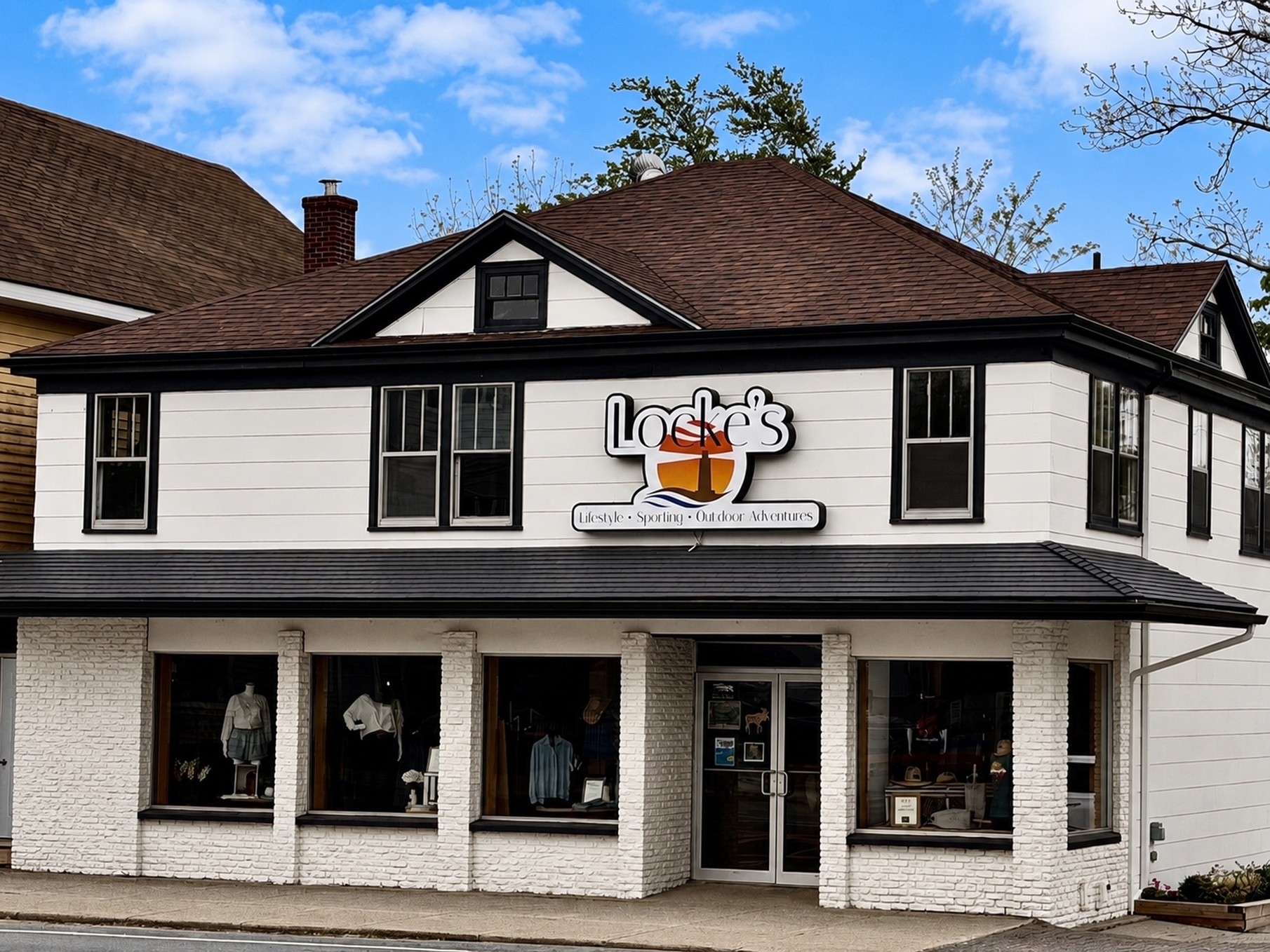
- Description: Located just steps from Shelburne’s historic waterfront, Locke’s Lifestyle, Sporting & Outdoor Adventures is a family owned, one of a kind shopping destination where fashion and outdoor living come together. Featuring a curated selection of products – including proudly Nova Scotia and Canadian-made items – Locke’s offers stylish mens and women’s fashion upstairs, along with a wide selection of hunting, fishing and sporting gear downstairs. Whether you’re refreshing your wardrobe or gearing up for your next adventure, Locke’s has something for every lifestyle under one roof.
- Period_of_operation: Open year-round
- Images: https://novascotia.com/wp-content/uploads/2026/05/Locke-exterior.jpg
- Website: https://www.lockessporting.com
- Facebook: https://www.facebook.com/p/Lockes-Lifestyle-Sporting-Outdoor-Adventure-61567265714432/
- Instagram: https://www.instagram.com/lockessportingadventures/
- Notes:
Lockeport Campground & Cottages
URL: https://novascotia.com/listing/lockeport-campground-cottages/
Main Featured Image: https://novascotia.com/wp-content/uploads/2024/09/DJI_0005-small-1920x1080-1-scaled.jpg

- Listing_type_tax: 3, 5
- Accommodation_type:
- Campground_type:
- Tara_registration_num: STR2627T1153
- Region: South Shore
- Street_address: 3318 Highway 3
- Postal_code: B0T 1L0
- City: 508, Lydgate
- General_area: 80, Shelburne/Lockeport Area
- Latitude: 43.7182529566874
- Longitude: -65.11874963211369
- Phone: 902-830-7091
- Email: lockeportcampground@gmail.com
- Contact_details: Phone, Email
- Description: Welcome to the Lockeport Campground & Cottages! Our campground and cottage property offers:
45 overnight sites
33 30 AMP 3 way service sites
3 30 AMP 2 way service sites
4 unserviced tent sites
1 double bunkie with 2 twin beds and electricity
1 quad bunkie with 2 twin bunk beds with electricity
3 one bedroom cottages
Each of the three 1 bedroom cottages come equipped with queen bed, sofa, small fridge and microwave, Web TV, 3 piece full bathroom and large deck overlooking our large pond. Minimum stay for the cottages is two nights however on long weekends it is three nights.
Our camping bunkies have been updated and now include a mini fridge and table and chairs along with the beds as well as a BBQ on the deck that overlooks the pond. Please bring your own locks for the bunkies or you can rent a lock from the campground office. Long weekends – minimum stay is three nights.
Campground amenities include:
washrooms with flush toilets and showers
coin operated laundry
fire pits available onsite including a community firepit
children’s playground
heated saltwater outdoor swimming pool
Level 2 (40 AMP) EV car charger located at the campground office
Families can also enjoy the pedal boat, kayak and canoe on our large pond. We now have e-Bikes available for rent as well!
We are 3 kms from the beautiful white sands of Crescent Beach.
- Period_of_operation: Open within a date range
- Open_start_date: April 24, 2026
- Open_end_date: October 25, 2026
- Low_rate: 36
- High_rate: 156
- Rate_period: Per Night
- Payment_types:
- Images: https://novascotia.com/wp-content/uploads/2024/09/DJI_0005-small-1920x1080-1-scaled.jpg, https://novascotia.com/wp-content/uploads/2024/09/20241001_091723-1920x1080-1.jpg, https://novascotia.com/wp-content/uploads/2024/09/DSCF6274-1-1920x1080-1.jpg, https://novascotia.com/wp-content/uploads/2024/09/Pool-1-1920x1080-1.jpg, https://novascotia.com/wp-content/uploads/2024/09/20240720_143216-1920x1080-1.jpg
- Accommodation_common_amenities: Air Conditioning, Kitchen/Kitchenette, Pool (Outdoor), TV (Cable/Sat TV/Smart), Water / Ocean View
- Onsite_amenities: Electric Vehicle (EV) Charging Station(s), Parking, Picnic Tables, WiFi
- Campground_amenity: Beach Access, Electrical Hook-Up, Flush Toilets, Laundromat, Playground, Pool (Outdoor), Rec Hall, Sewage Hook-Up, Shaded Sites, Showers, Swimming (Fresh Water), Unserviced Sites, Water Hook-Up
- Pets_policy:
- Number_of_units: 5
- Online_booking:
- Facebook: https://facebook.com/Lockeport-Campground-Cottages-332088944038921
- Business: Lockeport Cottages & Campgrounds
- Active_listing: 1
- Website: https://www.lockeportcampground.ca
- Notes:
- Google_rating: 4.4
- Primary_contact: 1029
- Num_seasonal_campground_units: 16
- Num_short_term_campground_units: 47
- Instagram: https://www.instagram.com/lockeportcampgroundcottages
Lockeport Inn
URL: https://novascotia.com/listing/lockeport-inn/
Main Featured Image: https://novascotia.com/wp-content/uploads/2025/03/Lockeport-Inn-1920x1080-1.jpg

- Active_listing: 1
- Business: Lockeport Inn
- Primary_contact: 2985
- Listing_type_tax: 3
- Accommodation_type:
- Tara_registration_num: STR2627B6180
- Google_rating: 5
- Region: South Shore
- Street_address: 18 Beech St
- City: 480, Lockeport
- General_area: 80, Shelburne/Lockeport Area
- Postal_code: B4V 0B8
- Latitude: 43.69911330023389
- Longitude: -65.11300433211476
- Contact_details: Phone, Email
- Description: The Lockeport Inn offers four separate rooms, each room is a different size to accommodate lots of different travelers. We are steps away from many beaches and located centrally in the small seaside town of Lockeport on the beautiful South Shore.
- Period_of_operation: Open year-round
- Low_rate: 99
- High_rate: 189
- Payment_types:
- Images: https://novascotia.com/wp-content/uploads/2025/03/Lockeport-Inn-1920x1080-1.jpg
- Accommodation_common_amenities: Kitchen/Kitchenette, TV (Cable/Sat TV/Smart)
- Onsite_amenities: WiFi
- Number_of_units: 1
- Pets_policy:
- Website: https://lockeportinn.ca/
- Online_booking:
- Facebook: https://www.facebook.com/people/Lockeport-Inn/100085096511436/?mibextid=ZbWKwL
- Instagram: https://www.instagram.com/lockeportinn?igshid=MzNlNGNkZWQ4Mg%3D%3D
- Notes:
- Phone: 902-875-6227
- Email: lockeportinn@gmail.com
Lockeport Town Market
URL: https://novascotia.com/listing/lockeport-town-market/
Main Featured Image: https://novascotia.com/wp-content/uploads/2025/04/Lockeport-town-market-1920x1080-1.jpg

- Active_listing: 1
- Business: Lockeport Town Market
- Primary_contact: 3006
- Listing_type_tax: 6
- Google_rating: 4.6
- Eat_drink_type:
- Region: South Shore
- Street_address: 15 North St
- City: 480, Lockeport
- General_area: 80, Shelburne/Lockeport Area
- Postal_code: B0T 1L0
- Latitude: 43.699291764826484
- Longitude: -65.1137625314223
- Contact_details: Phone, Email
- Description: Small town general store with ready made foods, subs, sandwiches and hot take-out food and grocery. Locally famous for its store made sausages and home to the only coffee roastery in Shelburne County, Lockeport Town Market Roasters.
- Period_of_operation: Open year-round
- Payment_types:
- Images: https://novascotia.com/wp-content/uploads/2025/04/Lockeport-town-market-1920x1080-1.jpg
- Accessibility: Wheelchair accessible
- Restaurant_amenities: 8
- Restaurant_type: Bakery/Cafe/Coffee House/Tea Room
- Restaurant_specialties: Canadian / American
- Website: https://www.lockeporttownmarket.com/
- Facebook: https://www.facebook.com/TownMarket2020
- Instagram: https://www.instagram.com/townmarket_2020
- Phone: 902-656-2514
- Email: contact@lockeporttownmarket.com
Lockeport Walking Trail
URL: https://novascotia.com/listing/lockeport-walking-trail/
Main Featured Image: https://novascotia.com/wp-content/uploads/2024/09/10648.webp

- Listing_type_tax: 9
- Tours_outdoors:
- Region: South Shore
- Street_address: 157 Locke Street
- City: 480, Lockeport
- General_area: 80, Shelburne/Lockeport Area
- Latitude: 43.695106
- Longitude: -65.122944
- Phone: 902-656-2565
- Email: lockeportrec@ns.aliantzinc.ca
- Contact_details: Phone, Email
- Description: 4-kilometre (2.5-mile) walk; boardwalk, sand dunes, two old CNR trestle bridges, salt marsh; views of traditional Cape Island fishing boats, birds. Interpretive signage. Brochures available.
- Period_of_operation: Open year-round
- Date_details_hours_of_operation: no winter maintenance.
- Images: https://novascotia.com/wp-content/uploads/2024/09/10648.webp, https://novascotia.com/wp-content/uploads/2024/09/10649.webp
- Accessibility: Wheelchair accessible
- Accommodation_common_amenities: Water / Ocean View
- Business: Town of Lockeport
- Active_listing: 1
- Website: https://www.lockeport.ns.ca/index.php/recreation-culture/crescent-beach-centre
- Notes:
- Google_rating: 4.6
- Primary_contact: 496
- Trail_distance: 4
- Trail_distance_measurement: one way
- Trail_type: Day use
- Trail_surface: Gravel
- Trail_difficulty_level: Easy
- Trail_pet_policy: Leashed
- Trail_uses: Cycling, Hiking, Snowshoeing, Walking
Logan’s Daily Catch
URL: https://novascotia.com/listing/logans-daily-catch/
Main Featured Image: https://novascotia.com/wp-content/uploads/2025/09/DSC9958_NovaScotia.com_2000x1500.jpg

- Active_listing: 1
- Business: North Nova Seafoods Limited / Logan’s Daily Catch / Harbour Nights RV Park
- Primary_contact: 3183
- Listing_type_tax: 6
- Campaign_category: 71
- Google_rating: 4.8
- Eat_drink_type:
- Region: Northumberland Shore
- Street_address: Pier B, Depot St.
- City: 667, Pictou
- General_area: 67, Pictou/Caribou Area
- Postal_code: B0K 1H0
- Latitude: 45.67532272301505
- Longitude: -62.70688145580899
- Contact_details: Phone
- Phone: 902-759-1620
- Description: Located on the Pictou waterfront, Logan’s Daily Catch offers fresh, local seafood for locals and visitors alike to take away and enjoy.
As a Taste of Nova Scotia member, they also serve up delicious lobster rolls to go, ready for you to enjoy as you stroll the waterfront boardwalk or relax on the scenic seating in the Pictou Vendor Village. Stop by for a true Taste of Nova Scotia and experience the fresh seafood by the sea.
A second location can be found at 2578 Westville Road in New Glasgow.
- Highlights:
Located on the Pictou waterfront
Purchase fresh, local seafood to take home
Enjoy lobster rolls to go
- Period_of_operation: Open within a date range
- Open_start_date: April 1, 2025
- Open_end_date: December 31, 2025
- Date_details_hours_of_operation: Thursday – Sunday, 9:00 a.m. – 5:00 p.m.
- Images: https://novascotia.com/wp-content/uploads/2025/09/DSC9958_NovaScotia.com_2000x1500.jpg, https://novascotia.com/wp-content/uploads/2025/09/DSC9983-2_NovaScotia.com_2000x1500.jpg, https://novascotia.com/wp-content/uploads/2025/09/lobster-roll-1920x1080-1.jpg, https://novascotia.com/wp-content/uploads/2025/09/lobster-sandwhich-1920x1080-1.jpg, https://novascotia.com/wp-content/uploads/2025/09/live-lobster-1920x1080-1.jpg, https://novascotia.com/wp-content/uploads/2025/09/oysters-1920x1080-1.jpg
- Accessibility: Wheelchair accessible
- Membership: Taste of Nova Scotia
- Restaurant_type: Ghost Restaurant / Takeout only
- Restaurant_specialties: Seafood
- Website: https://nnseafoods.ca/logans-daily-catch/
- Facebook: https://www.facebook.com/p/Logans-Daily-Catch-North-Nova-Seafoods-100064005544774/
- Notes:
- Email: paul@nnseafoods.ca
Londonderry Provincial Park
URL: https://novascotia.com/listing/londonderry-provincial-park/
Main Featured Image: https://novascotia.com/wp-content/uploads/2024/09/LondonderryPP-1920x1080-1.jpg

- Listing_type_tax: 4, 9
- Attraction_type:
- Museumhistoric_site_type: Memorial/Monument
- Campground_type:
- Tours_outdoors:
- Region: Bay of Fundy & Annapolis Valley
- Street_address: 1776 Station Road
- City: 481, Londonderry
- Latitude: 45.471717
- Longitude: -63.596383
- Email: parkinfo@novascotia.ca
- Contact_details: Email
- Description: Londonderry Provincial Park, in the Bay of Fundy & Annapolis Valley region, is a small memorial park with an interpretive display of the history of mining and iron production in Londonderry (Acadia Mines). Located off Hwy 4.
- Period_of_operation: Open within a date range
- Open_start_date: May 17, 2025
- Open_end_date: October 14, 2025
- Date_details_hours_of_operation: (dates subject to change)
- Images: https://novascotia.com/wp-content/uploads/2024/09/LondonderryPP-1920x1080-1.jpg
- Government_level:
- Facebook: https://www.facebook.com/NSProvincialParks
- Business: Department of Natural Resources and Renewables / Provincial Park
- Active_listing: 1
- Website: https://parks.novascotia.ca/content/londonderry
- Notes:
- Google_rating: 4.5
- Primary_contact: 1662
- General_area: 32, Great Village/Debert Area
Lone Shieling Trail – Cape Breton Highlands National Park
URL: https://novascotia.com/listing/lone-shieling-trail-cape-breton-highlands-national-park/
Main Featured Image: https://novascotia.com/wp-content/uploads/2024/09/27881.webp

- Listing_type_tax: 9
- Campground_type:
- Tours_outdoors:
- Winter_activity_type: Snowshoeing
- Region: Cape Breton Island
- Street_address: 24734 Cabot Trail
- City: 125, Cape Breton Highlands National Park (Cheticamp side)
- Latitude: 46.809804
- Longitude: -60.733019
- Phone: 902-224-2306
- Email: cbinfo@pc.gc.ca
- Contact_details: Phone, Email
- Description: Featuring 400-year-old sugar maple trees, the Grande Anse Valley is one of the largest old-growth hardwood forests in the Maritimes. As one of the most protected areas of the park, access is restricted to this short trail. A replica of a Scottish crofter’s hut is found at the beginning of the trail – find out why it’s here. Keep an eye out for wildlife – moose like it here too.
Trailhead: On the Cabot Trail at the base of North Mountain
Significant Feature: Old-growth Acadian forest, Scottish heritage
Length: 0.6 km (0.4 mi) loop
Hiking Time: 15 minutes
Elevation: 70 m (230 ft.); Interactive loop suitable for most skill levels.
Trail Rating: Easy
GPS Co-ordinates for Trailhead (in decimal degrees): Lat: 46.809804 Long: -60.733019
Park is open year-round but full visitor services are only available from mid-May until mid-October. A park pass is required all year for hiking or use of other services in the park. Check in at the Parks Canada Visitor Centres in Chéticamp (16 Visitor Centre Road, just off the Cabot Trail on the west side of the park) or in Ingonish (37637 Cabot Trail, on the east side of the park) to obtain passes, information on visitor safety and any other information you may need, including a trail location map.
For your comfort and safety
Do not approach, disturb or feed wild animals.
Take along appropriate clothing – rapid weather changes often occur on the plateau or along the coast.
Carry water with you, especially for longer trails, climbs or open barrens.
Bring insect repellent as black flies and mosquitoes are common all summer.
Mountain bikes are permitted only where indicated, for public safety and protection of the environment.
Stay on designated trails and boardwalks to protect fragile vegetation.
Do not throw food or scraps along the trails or roads.
Read “Keep it Wild, Keep it Safe” brochure, available at park visitor centres and on the Parks Canada website.
Recreational drone use is prohibited within the national park for the safety of wildlife and other visitors.
- Period_of_operation: Open within a date range
- Open_start_date: May 15, 2026
- Open_end_date: October 25, 2026
- Images: https://novascotia.com/wp-content/uploads/2024/09/27881.webp, https://novascotia.com/wp-content/uploads/2024/09/27882.webp, https://novascotia.com/wp-content/uploads/2024/09/27883.webp, https://novascotia.com/wp-content/uploads/2024/09/27884.webp, https://novascotia.com/wp-content/uploads/2024/09/27885.webp, https://novascotia.com/wp-content/uploads/2024/09/27886.webp, https://novascotia.com/wp-content/uploads/2024/09/27887.webp, https://novascotia.com/wp-content/uploads/2024/09/27888.webp, https://novascotia.com/wp-content/uploads/2024/09/1P0A7789-2.jpg
- Cell_service:
- Government_level:
- Website: https://parks.canada.ca/pn-np/ns/cbreton/activ/randonnee-hiking/loneshieling
- Facebook: https://www.facebook.com/CBHNP
- Instagram: https://www.instagram.com/parks.canada/
- Twitter: https://twitter.com/ParksCanada_NS
- Youtube: https://www.youtube.com/c/parkscanada
- Business: Parks Canada - Cape Breton
- Active_listing: 1
- Notes:
- General_area: 20, Cape Breton Highlands National Park Area
- Google_rating: 4.5
- Primary_contact: 2073
- Trail_distance: 0.6
- Trail_distance_measurement: one way
- Trail_type: Day use
- Trail_surface: Gravel
- Trail_difficulty_level: Easy
- Trail_pet_policy: Leashed
Lonely Rock Seaside Bungalows
URL: https://novascotia.com/listing/lonely-rock-seaside-bungalows/
Main Featured Image: https://novascotia.com/wp-content/uploads/2024/09/19379.webp

- Listing_type_tax: 3
- Accommodation_type:
- Tours_outdoors:
- Beach_type: Ocean beach
- Tara_registration_num: STR2627T6713
- Region: Eastern Shore
- Street_address: 150 New Harbour Road
- Postal_code: B0H 1T0
- City: 612, New Harbour
- Latitude: 45.16806
- Longitude: -61.45291
- Phone: 902-387-2668
- Email: info@lonelyrock.com
- Contact_details: Phone, Email
- Description: Lonely Rock Seaside Bungalows are nestled in the small fishing village of New Harbour in the Eastern Shore region of Nova Scotia, along one of the most scenic coastal drives in Atlantic Canada. Enjoy your evenings around the cozy campfire on the sandy beach, then spend your days hiking or cycling along the beautiful coastline, canoeing, or admiring local wildlife from a safe distance.
Local attractions that you may be interested in are the scenic Tor Bay Park, Little Dover Park, or Grassy Island in nearby Canso.
Our accommodations include six cottages (1-, 2-, and 3-bedrooms), with queen and twin beds, 4-piece bathrooms, satellite television, free wireless Internet, full kitchen, gas barbecue, and an ocean view. Bungalow 2-B is wheelchair accessible.
Visa, MasterCard and American Express are accepted.
- Period_of_operation: Open within a date range
- Open_start_date: May 1, 2026
- Open_end_date: October 31, 2026
- Date_details_hours_of_operation: Off-season rentals by reservation only.
- Low_rate: 189
- High_rate: 369
- Extra_person_rate: 10
- Rate_period: Per Night
- Cancellation_policy: Cancel 3 days before reservation, full refund. Cancel in the 3 days before reservation, you will be charged the price of your first nights reservation, the remainder will be refunded. No-shows will be charged the total price of the reservation.
- Rate_details: Two night stay minimum. $15 pet fee.
- Payment_types:
- Images: https://novascotia.com/wp-content/uploads/2024/09/19379.webp, https://novascotia.com/wp-content/uploads/2024/09/19380.webp, https://novascotia.com/wp-content/uploads/2024/09/19383.webp, https://novascotia.com/wp-content/uploads/2024/09/19384.webp, https://novascotia.com/wp-content/uploads/2024/09/19386.webp, https://novascotia.com/wp-content/uploads/2024/09/19387.webp, https://novascotia.com/wp-content/uploads/2024/09/20210815_141402.jpg, https://novascotia.com/wp-content/uploads/2024/09/lonely-rock.jpg, https://novascotia.com/wp-content/uploads/2024/09/Lonely-Rock-0848-scaled-e1646773341115.jpg, https://novascotia.com/wp-content/uploads/2024/09/Lonely-Rock-0872-scaled-e1646773291614.jpg
- Accessibility: Wheelchair accessible
- Accommodation_common_amenities: Kitchen/Kitchenette, TV (Cable/Sat TV/Smart), Water / Ocean View
- Onsite_amenities: WiFi
- Pets_policy:
- Number_of_units: 6
- Business: Lonely Rock Seaside Bungalows
- Active_listing: 1
- Website: https://www.lonelyrock.com
- Notes:
- Google_rating: 4.9
- Primary_contact: 759
- General_area: 31, Goldboro Area
- Ratings_programs: Canada Select
- Cs_rating_cottage: 4.5
Long Lake Adventure Company
URL: https://novascotia.com/listing/long-lake-adventure-company/
Main Featured Image: https://novascotia.com/wp-content/uploads/2024/10/26709.webp

- Listing_type_tax: 9
- Campground_type:
- Tours_outdoors:
- Surf_water_sports_type: Stand Up Paddleboarding
- Region: Halifax Metro
- Street_address: 75 Old Sambro Road
- City: 351, Halifax
- Latitude: 44.617003
- Longitude: -63.62171
- Phone: 902-830-7688
- Email: longlakeadventure@gmail.com
- Contact_details: Phone, Email
- Description: Long Lake Adventure Company is located at Long Lake, the centrepiece of Long Lake Provincial Park, a 5,000-acre wilderness oasis that borders on the edge of Halifax’s urban core, only a ten-minute drive from downtown Halifax. The lake is 3 kilometres long with absolutely pristine water and an uninterrupted, unaltered natural shoreline.
We offer kayak and stand-up paddleboard (SUP) rentals for adults and children and can accommodate large group bookings.
Long Lake is a great place to spend several hours traversing the lake and exploring the two islands, many inlets, and the old dam that created the lake’s current shape over two centuries ago.
- Period_of_operation: Open within a date range
- Open_start_date: June 1, 2025
- Open_end_date: September 30, 2025
- Date_details_hours_of_operation: Open 7 days a week until Labour Day, then weekends only.
- Payment_types:
- Images: https://novascotia.com/wp-content/uploads/2024/10/26709.webp, https://novascotia.com/wp-content/uploads/2024/10/26710.webp, https://novascotia.com/wp-content/uploads/2024/10/26711.webp, https://novascotia.com/wp-content/uploads/2024/10/26712.webp, https://novascotia.com/wp-content/uploads/2024/10/26713.webp, https://novascotia.com/wp-content/uploads/2024/10/26714.webp, https://novascotia.com/wp-content/uploads/2024/10/26715.webp
- Facebook: https://facebook.com/LongLakeAdventureCompany
- Instagram: https://instagram.com/longlakeadventure
- Twitter: https://twitter.com/LLadventureco
- Business: Long Lake Adventure Company
- General_area: 35, Halifax/Dartmouth Area
- Website: http://www.longlakeadventurecompany.ca
- Notes:
- Active_listing: 1
- Primary_contact: 2193
- Google_rating: 4.8
- Campaign_category: 72
- Equipment_rental: Kayaks, SUP Paddleboards
Long Pond Hockey Enterprises
URL: https://novascotia.com/listing/long-pond-hockey-enterprises/
Main Featured Image: https://novascotia.com/wp-content/uploads/2024/09/34347.webp

- Listing_type_tax: 4
- Attraction_type:
- Museumhistoric_site_type: Historic Site
- Region: Bay of Fundy & Annapolis Valley
- Street_address: 400 College Road
- City: 968, Windsor
- General_area: 93, Windsor Area
- Latitude: 44.980517
- Longitude: -64.137446
- Phone: 902-798-2728
- Contact_details: Phone
- Description: The cradle of hockey.
Long Pond is the site of the earliest recorded evidence of hockey which was first played in North America in 1800.
This is also the home of the Annual Long Pond Hockey Heritage Classic that takes place each winter (weather permitting).
- Period_of_operation: Open year-round
- Date_details_hours_of_operation: Mon–Fri 9am–5pm (daily in Sep & Oct).
- Rate_details: Admission free; donations welcome.
- Payment_types:
- Images: https://novascotia.com/wp-content/uploads/2024/09/34347.webp, https://novascotia.com/wp-content/uploads/2024/09/34348.webp
- Accessibility: Wheelchair accessible
- Onsite_amenities: Parking, Picnic Tables
- Website: https://www.gameofhockey.com
- Facebook: https://www.facebook.com/WindsorHockeyHeritageSociety
- Business: Howard Dill Enterprises
- Active_listing: 1
- Notes:
- Primary_contact: 561
Longfellow Restaurant
URL: https://novascotia.com/listing/longfellow-restaurant/
Main Featured Image: https://novascotia.com/wp-content/uploads/2024/09/32641.webp

- Listing_type_tax: 6
- Eat_drink_type:
- Region: Bay of Fundy & Annapolis Valley
- Street_address: 1168 Nova Scotia Trunk 1
- Postal_code: B0P 1M0
- City: 325, Grand Pré
- Latitude: 45.10283
- Longitude: -64.30515
- Phone: 902-697-2163
- Email: longfellow@evangeline.ca
- Contact_details: Phone, Email
- Description: Chef Ray Bear has crafted an approachable and refined menu showcasing the best ingredients the Valley has to offer. Serving breakfast, lunch, and dinner, with an expansive wine list and a cozy bar. Longfellow restaurant is located on the Evangeline property.
- Period_of_operation: Open year-round
- Date_details_hours_of_operation: November-April - Thurs-Sat Dinner 5-9pm, Sat & Sun Brunch 9-2pmMay-October: Monday-Sunday 9am-9pm
- Payment_types:
- Images: https://novascotia.com/wp-content/uploads/2024/09/32641.webp, https://novascotia.com/wp-content/uploads/2024/09/32642.webp, https://novascotia.com/wp-content/uploads/2024/09/32643.webp, https://novascotia.com/wp-content/uploads/2024/09/32646.webp, https://novascotia.com/wp-content/uploads/2024/09/32647.webp, https://novascotia.com/wp-content/uploads/2024/09/32648.webp, https://novascotia.com/wp-content/uploads/2024/09/Evangeline_Final_0034.jpg, https://novascotia.com/wp-content/uploads/2024/09/TheEvangeline_Final_0244.jpg, https://novascotia.com/wp-content/uploads/2024/09/TheEvangeline_Final_0530.jpg, https://novascotia.com/wp-content/uploads/2024/09/TheEvangeline_Final_9768.jpg
- Accessibility: Wheelchair accessible
- Restaurant_amenities: 10, 12
- Facebook: https://facebook.com/people/Longfellow-Restaurant/100086682306192/
- Instagram: https://www.instagram.com/longfellowrestaurant/
- Business: The Evangeline
- Active_listing: 1
- Website: https://www.theevangeline.ca/longfellow-restaurant
- Notes:
- General_area: 94, Wolfville Area
- Google_rating: 4.4
- Primary_contact: 2490
- Restaurant_type: Fine Dining / Gourmet, Pub / Lounge / Bar
Look Off Family Camping Park
URL: https://novascotia.com/listing/look-off-family-camping-park/
Main Featured Image: https://novascotia.com/wp-content/uploads/2024/09/10135.webp

- Listing_type_tax: 3, 5
- Accommodation_type:
- Campground_type:
- Tara_registration_num: RYA-2023-24-03011610305208009-3369
- Region: Bay of Fundy & Annapolis Valley
- Street_address: 3369 Highway 358
- City: 22, Arlington
- General_area: 94, Wolfville Area
- Latitude: 45.199774
- Longitude: -64.407734
- Phone: 902-582-3022
- Email: mdhubley@eastlink.ca
- Contact_details: Phone
- Description: The Look Off Family Camping Park is located in the Annapolis Valley on North Mountain, steps from a panoramic view over the Valley and Minas Basin. Located 20km from Cape Split.
Our open and wooded campground includes:
30 overnight sites (electrical and water hookups)
40 seasonal sites
2 camp cabins
1 RV camper
4 fully furnished rooms in our Guest House
Campground amenities include:
washrooms with flush toilets and showers
dump station
swimming pool
playground
firepits
firewood and ice
takeout and ice cream
long weekend activities
- Period_of_operation: Open within a date range
- Open_start_date: May 21, 2025
- Open_end_date: October 10, 2025
- Low_rate: 30
- High_rate: 149
- Rate_period: Per Night
- Payment_types:
- Images: https://novascotia.com/wp-content/uploads/2024/09/10135.webp, https://novascotia.com/wp-content/uploads/2024/09/10136.webp, https://novascotia.com/wp-content/uploads/2024/09/10137.webp, https://novascotia.com/wp-content/uploads/2024/09/20328.webp, https://novascotia.com/wp-content/uploads/2024/09/20329.webp, https://novascotia.com/wp-content/uploads/2024/09/20330.webp, https://novascotia.com/wp-content/uploads/2024/09/20331.webp
- Accommodation_common_amenities: Pool (Outdoor)
- Onsite_amenities: Parking, Restaurant/Canteen/Tea Room, WiFi
- Campground_amenity: Disposal Station, Electrical Hook-Up, Flush Toilets, Laundromat, Playground, Pool (Outdoor), Rec Hall, Shaded Sites, Showers, Unserviced Sites, Water Hook-Up
- Pets_policy:
- Number_of_units: 7
- Featured_listing: 1
- Online_booking:
- Business: Bear River Millyard Recreation / Look Off Family Camping Park / Orchard Queen Motel & R.V. Park
- Active_listing: 1
- Website: https://lookoffcampground.com/
- Notes:
- Google_rating: 4.5
- Primary_contact: 1683, 2692
- Num_seasonal_campground_units: 40
- Num_short_term_campground_units: 29
- Ratings_programs: Camping Select
- Cs_rating_facilities: 2.5
- Cs_rating_recreation: 3.0
Lord Nelson Hotel & Suites
URL: https://novascotia.com/listing/lord-nelson-hotel-suites/
Main Featured Image: https://novascotia.com/wp-content/uploads/2024/09/LordNelson-lobby-1920x1080-1.jpg

- Listing_type_tax: 3, 6
- Accommodation_type:
- Eat_drink_type:
- Tara_registration_num: STR2627T0300
- Region: Halifax Metro
- Street_address: 1515 South Park Street
- Postal_code: B3J 2L2
- City: 351, Halifax
- General_area: 35, Halifax/Dartmouth Area
- Latitude: 44.642575
- Longitude: -63.57976
- Phone: 902-423-6331
- Toll_free: 800-565-2020
- Email: ask@lordnelsonhotel.com
- Contact_details: Phone, Toll Free, Email
- Description: The Lord Nelson Hotel & Suites is a historic landmark in downtown Halifax, renowned for its elegance, charm, and signature Maritime hospitality. Guests can enjoy exceptional dining at our on-site restaurant, The Arms, open daily for breakfast, lunch, and dinner.
Conveniently located at the corner of Spring Garden Road and South Park Street, our hotel overlooks the iconic Public Gardens and the Halifax Citadel National Historic Site. Step outside and explore Halifax’s vibrant Spring Garden Road, home to upscale shopping, diverse dining options, and entertainment venues. Wander along the scenic waterfront boardwalk, spanning 10 city blocks, where you’ll discover unique shops, restaurants, live music pubs, historic sites, and attractions. Cultural highlights include Neptune Theatre, one of Canada’s oldest professional theatre companies, the Art Gallery of Nova Scotia, and a variety of museums.
Our accommodations feature 262 guest rooms and suites (King, Queen, Double) with air conditioning, 4-piece baths, remote cable television, in-room movies, telephones with free local calls, Nespresso coffee machines, and complimentary high-speed wireless Internet. Rooms also include deluxe in-room amenities to ensure your comfort, such as Lather bath products, which are free from synthetic fragrances, artificial colors, parabens, sulfates, and are vegan and cruelty-free. Additionally, guests can enjoy the convenience of Chromecast in their rooms, allowing them to stream their favourite shows and movies directly to the TV.
Guest facilities include a licensed restaurant, a 24-hour business centre, a fitness centre, complimentary self-service laundry, indoor parking, EV charging stations, and complimentary passes to the nearby YMCA swimming pool, just a short walk from the hotel. Additional amenities include 24-hour front desk service, room service, concierge assistance, and airport transportation (charges apply). We proudly welcome pets, offering a designated pet-friendly floor, and our property is entirely non-smoking.
For accessibility, we provide wheelchair-accessible rooms with large, barrier-free bathrooms and partial accessibility through Access Advisor.
The Lord Nelson Hotel & Suites is a proud member of the Tourism Industry Association of Nova Scotia and the Hotel Association of Nova Scotia. We accept all major credit cards for your convenience.
Cancellation Policy: Cancellations must be made by 1:00 p.m. on the day prior to arrival to receive a deposit refund or avoid a charge to your credit card.
- Period_of_operation: Open year-round
- Low_rate: 99
- High_rate: 599
- Extra_person_rate: 30
- Rate_period: Per Night
- Payment_types:
- Images: https://novascotia.com/wp-content/uploads/2024/09/LordNelson-lobby-1920x1080-1.jpg, https://novascotia.com/wp-content/uploads/2024/09/LordNelson-king-1920x1080-1.jpg, https://novascotia.com/wp-content/uploads/2024/09/LordNelson-suite-1920x1080-1.jpg, https://novascotia.com/wp-content/uploads/2024/09/LordNelson-1bed-1920x1080-1.jpg, https://novascotia.com/wp-content/uploads/2024/09/LordNelson-2beds-1920x1080-1.jpg, https://novascotia.com/wp-content/uploads/2024/09/LordNelson-patio-1920x1080-1.jpg, https://novascotia.com/wp-content/uploads/2024/09/LordNelson-rightlobby-1920x1080-1.jpg, https://novascotia.com/wp-content/uploads/2024/09/LordNelson-gym-1920x1080-1.jpg, https://novascotia.com/wp-content/uploads/2024/09/LordNelson-sittingarea-1920x1080-1.jpg, https://novascotia.com/wp-content/uploads/2024/09/LordNelson-eventspace-1920x1080-1.jpg
- Accessibility: Wheelchair accessible
- Accommodation_common_amenities: Air Conditioning, Fitness Centre / Gym, Kitchen/Kitchenette, Pool (Indoor), Room Service, TV (Cable/Sat TV/Smart)
- Onsite_amenities: Parking, WiFi
- Cell_service:
- Pets_policy:
- Restaurant_amenities: 7, 10, Vegetarian Options
- Number_of_units: 262
- Online_booking:
- Facebook: http://www.facebook.com/Lord.Nelson.Hotel
- Instagram: https://instagram.com/lordnelsonhotel
- Twitter: http://twitter.com/LordNelsonHotel
- Business: The Lord Nelson Hotel & Suites
- Active_listing: 1
- Website: https://www.lordnelsonhotel.ca
- Notes:
- Google_rating: 4.3
- Primary_contact: 2523
- Ratings_programs: Canada Select
- Cs_rating_hotel: 4.5
- Restaurant_type: Breakfast & Brunch, Contemporary Casual, Family Dining, Fine Dining / Gourmet
- Restaurant_specialties: Burgers, Canadian / American, Gluten-Free, Seafood, Steak, 42
Lordly House Museum
URL: https://novascotia.com/listing/lordly-house-museum/
Main Featured Image: https://novascotia.com/wp-content/uploads/2024/09/LordlyHouseMuseum-1920x1080-1.jpg

- Listing_type_tax: 4
- Attraction_type:
- Museumhistoric_site_type: Archive, Museum
- Region: South Shore
- Street_address: 133 Central Street
- Postal_code: B0J 1J0
- City: 159, Chester
- General_area: 21, Chester Area
- Latitude: 44.54136
- Longitude: -64.242396
- Phone: 902-277-4524
- Email: lordlyhouse@gmail.com
- Contact_details: Phone, Email
- Description: Lordly House Museum & Park, located in beautiful Chester in the South Shore region, is a fine example of Georgian architecture (c 1806) and offers a window into the social, political and cultural history of Chester. Lordly House was the family home of Charles Lordly, a prominent merchant, an entrepreneur, and the first municipal clerk. The museum showcases historical displays, and houses a local genealogy collection.
A park and playground surround the museum.
- Period_of_operation: Open within a date range
- Open_start_date: June 10, 2025
- Open_end_date: September 15, 2025
- Date_details_hours_of_operation: Tuesday to Saturday: 10am - 4pm
- Rate_details: Admission free.
- Images: https://novascotia.com/wp-content/uploads/2024/09/LordlyHouseMuseum-1920x1080-1.jpg
- Onsite_amenities: Parking, Public Washroom
- Business: Municipality of Chester
- Active_listing: 1
- Website: https://chesterheritage.ca
- Notes:
- Primary_contact: 1688
- Google_rating: 4.7
Los Toros Authentico Espanol
URL: https://novascotia.com/listing/los-toros-authentico-espanol/
Main Featured Image: https://novascotia.com/wp-content/uploads/2025/04/LosToros-1920x1080-1.jpg

- Active_listing: 1
- Business: Da Zero Ristorante / Los Toros Authentico Espanol / Orso
- Primary_contact: 3045
- Listing_type_tax: 6
- Google_rating: 4.3
- Eat_drink_type:
- Region: Halifax Metro
- Street_address: 5075 George Street
- City: 351, Halifax
- General_area: 35, Halifax/Dartmouth Area
- Postal_code: B3J 1M4
- Latitude: 44.64925195470637
- Longitude: -63.57195296089968
- Contact_details: Phone, Email
- Phone: 902-406-1415
- Email: lostoros.hfx@gmail.com
- Description: An unbelievably genuine combination of tradition with local ingredients, inspired by the culinary tradition of Spain specializing in European Spanish cuisine.
- Period_of_operation: Open year-round
- Images: https://novascotia.com/wp-content/uploads/2025/04/LosToros-1920x1080-1.jpg
- Accessibility: Wheelchair accessible
- Onsite_amenities: WiFi
- Restaurant_amenities: Children's Menu, 7, 8, Patio
- Restaurant_type: Family Dining, Fine Dining / Gourmet
- Restaurant_specialties: European, Seafood
- Website: https://lostoros.ca/
- Facebook: https://www.facebook.com/people/Los-TOROS-aut%C3%A9ntico-espa%C3%B1ol/100034348313459/#
- Instagram: https://www.instagram.com/lostoroshfx/
Lost Creek Golf Club
URL: https://novascotia.com/listing/lost-creek-golf-club/
Main Featured Image: https://novascotia.com/wp-content/uploads/2024/09/23921.webp

- Listing_type_tax: 9
- Tours_outdoors:
- Golf_type: Golf Course
- Region: Halifax Metro
- Street_address: 310 Kinsac Road
- City: 60, Beaver Bank
- General_area: 77, Sackville/Beaverbank Area
- Latitude: 44.842022
- Longitude: -63.670118
- Phone: 902-865-4653
- Email: info@lostcreek.ca
- Contact_details: Phone, Email
- Description: 18-hole, par 71, 6051 yd. Rating 69.2; Slope 131. Situated in mature forests with river and a lake; 25 km from Halifax.
- Period_of_operation: Open within a date range
- Open_start_date: April 15, 2025
- Open_end_date: November 15, 2025
- Payment_types:
- Images: https://novascotia.com/wp-content/uploads/2024/09/23921.webp, https://novascotia.com/wp-content/uploads/2024/09/23923.webp, https://novascotia.com/wp-content/uploads/2024/09/23924.webp, https://novascotia.com/wp-content/uploads/2024/09/23925.webp
- Accessibility: Wheelchair accessible
- Facebook: https://www.facebook.com/lostcreekgolfclub
- Instagram: https://www.instagram.com/lostcreekgolf
- Twitter: https://twitter.com/Lostcreek_golf
- Youtube: https://www.youtube.com/watch?v=XQS7coAe-qQ
- Business: Lost Creek Golf
- Active_listing: 1
- Website: https://lostcreek.ca
- Notes:
- Google_rating: 3.9
- Primary_contact: 820
Lot Six Bar & Restaurant
URL: https://novascotia.com/listing/lot-six-bar-restaurant/
Main Featured Image: https://novascotia.com/wp-content/uploads/2024/09/17761.webp

- Listing_type_tax: 6
- Eat_drink_type:
- Region: Halifax Metro
- Street_address: 1685 Argyle Street
- City: 351, Halifax
- Latitude: 44.646818
- Longitude: -63.574597
- Phone: 902-428-7428
- Contact_details: Phone
- Description: Inspired by the great bars of the world, Lot Six Bar & Restaurant looks to elevate palates through fine food, drink, oysters and service. Local ingredients will showcase the beauty of our province, and our collective travels and education will bring your on a journey.
Located in the heart of downtown Halifax, we are ready to welcome you, whether it be for a cocktail from one of our award winning bartenders or a full-course dining experience.
- Period_of_operation: Open year-round
- Date_details_hours_of_operation: Monday: ClosedTuesday-Sunday: Dinner 4:00pm-10:00pm Saturday & Sunday: Brunch 11:00am-4:00pm
- Images: https://novascotia.com/wp-content/uploads/2024/09/17761.webp, https://novascotia.com/wp-content/uploads/2024/09/2019_DHFX_deancas_final_1094.jpg, https://novascotia.com/wp-content/uploads/2024/09/2019_DHFX_deancas_final_1115.jpg
- Membership: Lobster Trail, Taste of Nova Scotia
- Restaurant_amenities: Patio, 9, 10
- Facebook: https://www.facebook.com/lotsixbar
- Twitter: https://twitter.com/lotsixbar
- Business: Lot Six Restaurant & Bar
- Active_listing: 1
- Website: https://www.lotsix.ca
- Notes:
- General_area: 35, Halifax/Dartmouth Area
- Google_rating: 4.3
- Primary_contact: 1942
- Restaurant_type: Fine Dining / Gourmet
Lotta Adventures Limited
URL: https://novascotia.com/listing/lotta-adventures-limited/
Main Featured Image: https://novascotia.com/wp-content/uploads/2024/09/36304.webp

- Listing_type_tax: 9
- Tours_outdoors:
- Region: Cape Breton Island
- Street_address: 43 Champlain Avenue.
- Postal_code: B1P 2B1
- City: 841, Sydney
- Latitude: 46.142688
- Longitude: -60.220462
- Phone: 902-979-2222
- Email: info@lottaadventures.com
- Contact_details: Phone, Email
- Description: Lotta Adventures is your one-stop-shop for all things fun and adventurous in Cape Breton Island. With our expert guides and world class hospitality, you get an experience like no other. See the island through the eyes of a local and learn the island’s rich history along the way.
We offer small group tours and shore excursions from the Port of Sydney and surrounding area. We have a clean spacious air-controlled Ford Transit that has a seating capacity of up to 8 total passengers and plenty of space for luggage and equipment.
We offer tours of all varieties. Simply select a shared small group tour or book a private tour and we’ll take care of the rest. Whether you’re an adventure seeker, cultural explorer, or an authentic experiencer, we have a tour for you.
Below is a list of our tours which include history, culture, culinary and outdoor adventure!
The Cabot Trail: Embark on an unforgettable adventure along Cape Breton’s Cabot Trail. Wind through majestic landscapes, witness dramatic ocean vistas, and encounter the heart of maritime culture. With every twist and turn, you’ll be captivated by nature’s beauty and the rich heritage of this iconic trail.
The Skyline Trail: Introducing Cape Breton’s captivating Skyline Trail – an enchanting journey where rugged cliffs meet the Atlantic, wildlife roams free, and sunsets paint the sky. Tailored for all adventurers, this tranquil escape offers educational insights and a chance to preserve nature’s legacy. Explore the Skyline Trail and discover Cape Breton’s untamed beauty.
Louisbourg Lighthouse Trail: Explore maritime history and stunning coastal beauty on the Louisbourg Lighthouse Trail. Follow a well-kept path through lush forests and pristine shoreline, with opportunities for birdwatching and wildlife spotting. Don’t miss the iconic Louisbourg Lighthouse, offering panoramic views of the Atlantic Ocean. Whether you love nature or history, this trail offers a memorable experience.
The Highland Village Museum Tour: Step into the past at Cape Breton’s Highland Village. Immerse yourself in living history as you explore authentic Scottish buildings, lush landscapes, and the vibrant traditions of Gaelic culture.
The Gaelic College Tour: Immerse yourself in Nova Scotia’s rich Gaelic heritage at the Gaelic College in St. Ann’s. Experience traditional music, dance, language, and art in a stunning Cape Breton setting. Join workshops, enjoy performances, and soak in the breathtaking views of Bras d’Or Lake. Whether you’re a Gaelic culture enthusiast or a newcomer, the Gaelic College offers a warm and welcoming experience for all.
Glenora Distillery Tour: Indulge in the spirit of Cape Breton at the Glenora Distillery. Nestled in scenic landscapes, this legendary spot crafts some of the finest single malt whisky. Immerse yourself in the art of distillation, savor the rich flavors, and experience a taste of the island’s soul.
Lobster Lunch: Savor the taste of the sea with a beautiful lobster lunch in Louisbourg. Delight in the freshest Atlantic catch, prepared to perfection, while surrounded by coastal beauty. Indulge in this memorable culinary experience that captures the essence of the maritime lifestyle. Join us for a feast that’s as unforgettable as the ocean views.
The Fortress of Louisbourg Tour: Uncover the secrets of the past at the Fortress of Louisbourg. Walk in the footsteps of history within meticulously reconstructed 18th-century walls. Experience life in a bustling French fortress, where costumed interpreters bring stories to life.
The Alexander Graham Bell Tour: Embark on a journey of discovery at the Alexander Graham Bell Museum in Cape Breton. Immerse yourself in the life and genius of the inventor behind the telephone and explore the captivating evolution of communication. Join us to celebrate innovation, creativity, and the indelible mark Alexander Graham Bell left on the world.
Call today and let Lotta Adventures be your guide to our beautiful little home!
- Period_of_operation: Open seasonally
- Months_open_seasonally:
- Images: https://novascotia.com/wp-content/uploads/2024/09/36304.webp, https://novascotia.com/wp-content/uploads/2024/09/38061.webp, https://novascotia.com/wp-content/uploads/2024/09/38062.webp, https://novascotia.com/wp-content/uploads/2024/09/38063.webp, https://novascotia.com/wp-content/uploads/2024/09/38064.webp
- Facebook: https://www.facebook.com/LottaAdventures/
- Instagram: https://www.instagram.com/lottaadventureslimited/
- Business: Lotta Adventures Limited
- Active_listing: 1
- Website: https://www.lottaadventures.com
- Guided_tour: 1
- Notes:
- General_area: 86, Sydney Area
- Google_rating: 3
- Primary_contact: 2421
- Campaign_category: 71
Louisbourg Harbour Inn
URL: https://novascotia.com/listing/louisbourg-harbour-inn/
Main Featured Image: https://novascotia.com/wp-content/uploads/2024/09/21114.webp

- Listing_type_tax: 3
- Accommodation_type:
- Tara_registration_num: STR2627T3827
- Region: Cape Breton Island
- Street_address: 9 Lower Warren Street
- Postal_code: B1C 1G6
- City: 485, Louisbourg
- General_area: 48, Louisbourg Area
- Latitude: 45.919092
- Longitude: -59.972463
- Phone: 902-733-3222
- Email: louisbourginns@gmail.com
- Contact_details: Phone, Email
- Description: Louisbourg Harbour Inn is a beautifully renovated century-old sea captain’s house, overlooking Louisbourg Harbour, situated in the heart of Louisbourg on Cape Breton Island. Our harbourfront inn’s beautifully decorated guest rooms provide all the comforts of home, and most rooms and balconies offer wonderful views of our picturesque harbour with the Atlantic Ocean and Fortress of Louisbourg in the background.
Louisbourg is located on the southeast coast of Cape Breton Island and offers miles of coastline with sandy beaches, hiking trails, a historic lighthouse, scenic picnic areas, restaurants and live entertainment. The Louisbourg Playhouse (adjacent to the boardwalk) is a 17th-century-style theatre in the round, a unique entertainment venue where visitors can enjoy outstanding performances of Cape Breton music interspersed with comedy and dance. The impressive walls and gates, homes, gardens, lively taverns and costumed re-enactors at the Fortress of Louisbourg National Historic Site, the largest historical reconstruction in North America, recreate life as it was lived in this important French stronghold in the mid-1700s. Cape Breton Highlands National Park and the renowned Cabot Trail are within easy driving distance.
Accommodations include 7 guest rooms (Queen; maximum 2 people), with ensuite 4-piece bath, hair dryer and wireless Internet access. There are no cots or cribs available (or permitted). A complimentary light breakfast is offered daily. Check-in is often a self-check-in with the host close by but not always on site. Pets are not permitted. Our property is completely non-smoking. Visa, MasterCard and Direct Debit are accepted.
- Period_of_operation: Open within a date range
- Open_start_date: June 1, 2026
- Open_end_date: October 17, 2026
- Low_rate: 160
- High_rate: 200
- Rate_period: Per Night
- Cancellation_policy: A $20 cancellation fee per night is charged; full rate is charged for reservations cancelled without notice of at least 72 hours prior to day of arrival. Written confirmation will not be mailed, but can be emailed, if requested.
- Payment_types:
- Images: https://novascotia.com/wp-content/uploads/2024/09/21114.webp, https://novascotia.com/wp-content/uploads/2024/09/21115.webp
- Accommodation_common_amenities: TV (Cable/Sat TV/Smart)
- Onsite_amenities: Restaurant/Canteen/Tea Room, WiFi
- Pets_policy:
- Number_of_units: 7
- Online_booking:
- Business: Louisbourg Harbour Inn / Louisbourg Heritage House Bed & Breakfast
- Active_listing: 1
- Website: https://www.louisbourgharbourinn.com
- Notes:
- Google_rating: 4.8
- Primary_contact: 348
Louisbourg Lighthouse – Fortress of Louisbourg National Historic Site
URL: https://novascotia.com/listing/louisbourg-lighthouse-fortress-of-louisbourg-national-historic-site/
Main Featured Image: https://novascotia.com/wp-content/uploads/2024/09/21509.webp

- Listing_type_tax: 4
- Attraction_type:
- Tara_registration_num: n/a
- Region: Cape Breton Island
- Street_address: 351 Havenside Road
- City: 485, Louisbourg
- Latitude: 45.906889
- Longitude: -59.95708
- Phone: 902-919-8392
- Email: louisbourg.info@pc.gc.ca
- Contact_details: Phone, Email
- Description: The Louisbourg Lighthouse, standing steadfast on the north side of Louisbourg Harbour, is a living testament to maritime heritage. The current lighthouse is the longest serving of all three that were erected on Lighthouse Point. Lighthouse Point is the site of the first lighthouse in what is now Canada.
Just in time for its centennial milestone, the Louisbourg Lighthouse underwent a significant refurbishment, completed in September 2024. This historic landmark, essential for marine navigation, not only served as a guiding light but also stood as a testament to Louisbourg’s rich heritage. The refurbishment ensured that future generations could continue to explore and appreciate the legacy of the Louisbourg Lighthouse for many years to come.
Please be responsible and join with us in caring for our environment. Take your garbage with you, keep wildlife at a safe distance, and stay on designated trails to protect fragile plant life. Nature, other visitors, and future generations will be thankful for your stewardship.
- Period_of_operation: Open year-round
- Images: https://novascotia.com/wp-content/uploads/2024/09/21509.webp, https://novascotia.com/wp-content/uploads/2024/09/21510.webp, https://novascotia.com/wp-content/uploads/2024/09/21511.webp, https://novascotia.com/wp-content/uploads/2024/09/27987.webp, https://novascotia.com/wp-content/uploads/2024/09/27988.webp, https://novascotia.com/wp-content/uploads/2024/10/27989.webp, https://novascotia.com/wp-content/uploads/2024/10/27991.webp, https://novascotia.com/wp-content/uploads/2024/10/27992.webp, https://novascotia.com/wp-content/uploads/2024/10/louisbourg.jpg
- Onsite_amenities: Parking, Picnic Tables
- Government_level:
- Facebook: https://www.facebook.com/FortressOfLouisbourgNHS
- Instagram: https://instagram.com/parks.canada
- Twitter: https://twitter.com/ParksCanada_NS
- Youtube: https://www.youtube.com/user/ParksCanadaAgency
- Business: Parks Canada - Cape Breton
- General_area: 48, Louisbourg Area
- Website: https://parks.canada.ca/lhn-nhs/ns/louisbourg/activ/sentiers-trails
- Notes:
- Active_listing: 1
- Primary_contact: 2073
- Google_rating: 4.7
- Highlights: See what awaits you in the Cape Breton Highlands National Park! English video | French video
Louisbourg Lighthouse Trail – Fortress of Louisbourg National Historic Site
URL: https://novascotia.com/listing/louisbourg-lighthouse-trail-fortress-of-louisbourg-national-historic-site/
Main Featured Image: https://novascotia.com/wp-content/uploads/2024/09/27929.webp

- Listing_type_tax: 9
- Campground_type:
- Tours_outdoors:
- Region: Cape Breton Island
- Street_address: Havenside Road
- City: 485, Louisbourg
- General_area: 48, Louisbourg Area
- Latitude: 45.906674
- Longitude: -59.957542
- Email: louisbourg.info@pc.gc.ca
- Contact_details: Email
- Description: Enjoy an iconic coastal hiking experience at the Lighthouse Trail, located across the harbour from the Fortress of Louisbourg. Known for its spectacular crashing waves and unsurpassed ocean vistas, this trail is not to be missed. Capture an authentic East Coast moment in front of the Louisbourg Lighthouse, located at the trailhead. Families can explore the gentle, 2-kilometre (1.3-mile) looped trail, watching for shorebirds and fishing boats sailing into the harbour. Experienced hikers can follow the rugged shoreline beyond, where the Coastal Connections Trail Association continues to develop the trail.
Contributions made in the donation box at the trailhead directly support the Coastal Connections Trail Association in their efforts to continue the development of the trail. Donation boxes are also located throughout the community of Louisbourg.
To access the trail year-round, follow the “Lighthouse” signs along Havenside Road. The iconic lighthouse is on the site of the first lighthouse in Canada (1734). Interpretive panels share the history of this pivotal spot and highlight the rare plant life and coastal ecology of the area.
Travelling with a beloved pet? Dogs on leash are permitted on the Royal Battery Trail, Old Town Trail, the Lighthouse Trail, and at Kennington Cove Beach. Thank you for cleaning up after your pet. Pick up droppings and place them in appropriate refuse containers.
For your comfort and safety:
Do not approach, disturb or feed wild animals.
Take along appropriate clothing – rapid weather changes often occur along the coast.
Carry water with you.
Bring insect repellent as black flies and mosquitoes are common all summer.
Stay on designated trails and boardwalks for your safety and to protect fragile vegetation.
Do not throw food or scraps along the trails or roads.
Read “Keep it Wild, Keep it Safe” brochure, available on the Parks Canada website.
- Period_of_operation: Open year-round
- Images: https://novascotia.com/wp-content/uploads/2024/09/27929.webp, https://novascotia.com/wp-content/uploads/2024/09/27930.webp, https://novascotia.com/wp-content/uploads/2024/09/27932.webp, https://novascotia.com/wp-content/uploads/2024/09/27933.webp, https://novascotia.com/wp-content/uploads/2024/09/27934.webp, https://novascotia.com/wp-content/uploads/2024/09/IMG_7229-1.jpg, https://novascotia.com/wp-content/uploads/2024/09/lighthouse_walk.jpg, https://novascotia.com/wp-content/uploads/2024/09/Louisbourg_Lighthouse_TrailREV.jpg
- Accommodation_common_amenities: 34
- Government_level:
- Facebook: https://www.facebook.com/FortressOfLouisbourgNHS
- Instagram: https://instagram.com/parks.canada
- Twitter: https://twitter.com/ParksCanada_NS
- Youtube: https://youtube.com/user/ParksCanadaAgency
- Business: Parks Canada - Cape Breton
- Active_listing: 1
- Notes:
- Google_rating: 4.8
- Website: http://www.pc.gc.ca/en/lhn-nhs/ns/louisbourg/activ/sentiers-trails
- Trail_distance: 2
- Primary_contact: 2073
- Trail_distance_measurement: loop/return
- Trail_type: Day use
- Trail_surface: Gravel
- Trail_difficulty_level: Easy
- Trail_pet_policy: Leashed
- Trail_uses: Hiking, Snowshoeing, Walking
Louisbourg Playhouse
URL: https://novascotia.com/listing/louisbourg-playhouse/
Main Featured Image: https://novascotia.com/wp-content/uploads/2024/09/11030.webp

- Listing_type_tax: 4
- Attraction_type:
- Region: Cape Breton Island
- Street_address: 11 Aberdeen Street
- City: 485, Louisbourg
- General_area: 48, Louisbourg Area
- Latitude: 45.919413
- Longitude: -59.971574
- Phone: 902-733-2996
- Email: michele@louisbourgplayhouse.ca
- Contact_details: Phone, Email
- Description: Live theatre and Cape Breton music in a 17th-century-style theatre. One of the most unique entertainment venues in Nova Scotia.
- Period_of_operation: Open within a date range
- Open_start_date: July 2, 2025
- Open_end_date: October 3, 2025
- Date_details_hours_of_operation: concerts nightly at 8pm.
- Payment_types:
- Images: https://novascotia.com/wp-content/uploads/2024/09/11030.webp, https://novascotia.com/wp-content/uploads/2024/09/11031.webp, https://novascotia.com/wp-content/uploads/2024/09/11032.webp, https://novascotia.com/wp-content/uploads/2024/09/Louisbourg_Cape_Breton_Playhouse_29_.jpg, https://novascotia.com/wp-content/uploads/2024/09/TNSTIFFs_1.jpg
- Accessibility: Wheelchair accessible
- Onsite_amenities: Gift Shop, Parking
- Facebook: https://www.facebook.com/louisbourgplayhouse
- Twitter: https://www.twitter.com/lsbg_playhouse
- Business: Louisbourg Playhouse Society
- Active_listing: 1
- Website: https://www.louisbourgplayhouse.ca
- Notes:
- Google_rating: 4.7
- Primary_contact: 667
LOVUS Coffee & Tea
URL: https://novascotia.com/listing/lovus-coffee-tea/
Main Featured Image: https://novascotia.com/wp-content/uploads/2024/09/38135.webp

- Listing_type_tax: 6
- Eat_drink_type:
- Region: Bay of Fundy & Annapolis Valley
- Street_address: 535 Prince Street
- Postal_code: B2N 1E8
- City: 872, Truro
- Latitude: 45.365724
- Longitude: -63.288013
- Phone: 902-895-3506
- Email: lovuscoffeeandtea@gmail.com
- Contact_details: Phone, Email
- Description: Welcome to LOVUS!
LOVUS Coffee & Tea is a music-themed cafe and restaurant located in the heart of Truro, Nova Scotia. We’re equipped with high-end audiophile system, providing you with the perfect ambiance to enjoy music while indulging in our delightful beverages and food offerings. Our menu features a variety of beverages, including Vietnamese coffee, bubble tea, fruit tea, Italian soda, smoothies, frappuccino and more. While our food menu is small, it is curated with a focus on signature Vietnamese dishes. Join and LOVE-US!
Our food menu currently offering the following dishes:
Pho (Vietnamese Beef Noodle Soup)
Vermicelli Bowl (Bun Thit Nuong) (vegetarian option available)
Vietnamese Spring Rolls
Chicken Wings
Grilled Pork Platter (Com Suon)
Vietnamese Beef Stew (Bo Kho)
House Fried Rice
Stir-Fry Lemongrass Chicken
‘Xi Dau’ Noodle Bowl
Vietnamese Meatballs (Xiu Mai)
- Period_of_operation: Open year-round
- Date_details_hours_of_operation: Tue - Sat 10:30am-8pm
- Images: https://novascotia.com/wp-content/uploads/2024/09/38135.webp, https://novascotia.com/wp-content/uploads/2024/09/38159.webp, https://novascotia.com/wp-content/uploads/2024/09/38160.webp, https://novascotia.com/wp-content/uploads/2024/09/38161.webp, https://novascotia.com/wp-content/uploads/2024/09/38162.webp, https://novascotia.com/wp-content/uploads/2024/09/38163.webp
- Accessibility: Wheelchair accessible
- Restaurant_amenities: 5, 7
- Facebook: https://www.facebook.com/lovuscoffee/
- Instagram: https://www.instagram.com/lovuscoffeeandtea/
- Business: LOVUS Coffee & Tea Ltd.
- Active_listing: 1
- Notes:
- General_area: 88, Truro Area
- Google_rating: 4.8
- Primary_contact: 2927
- Restaurant_type: Bakery/Cafe/Coffee House/Tea Room, Family Dining
Lower Selma Museum & Heritage Cemetery
URL: https://novascotia.com/listing/lower-selma-museum-heritage-cemetery/
Main Featured Image: https://novascotia.com/wp-content/uploads/2024/09/19603-scaled.webp

- Listing_type_tax: 4
- Attraction_type:
- Museumhistoric_site_type: Museum
- Region: Bay of Fundy & Annapolis Valley
- Street_address: 6971 Highway 215
- City: 498, Lower Selma
- General_area: 52, Maitland Area
- Latitude: 45.312201
- Longitude: -63.594704
- Phone: 902-261-2883
- Email: info@ehhs.ca
- Contact_details: Phone, Email
- Description: Original Presbyterian Church (1865) with a unique interior of decorative plaster painted by Lewis Baillie of Newport. Collection of shipbuilding and farming tools, personal mementos and genealogies; area photographs of shipbuilding events and scenes of days gone by, and school photos.
- Period_of_operation: Open within a date range
- Open_start_date: June 1, 2025
- Open_end_date: September 30, 2025
- Date_details_hours_of_operation: 10:00am–5:00pm.
- Rate_details: Admission free, donations welcome.
- Images: https://novascotia.com/wp-content/uploads/2024/09/19603-scaled.webp, https://novascotia.com/wp-content/uploads/2024/09/19604-scaled.webp, https://novascotia.com/wp-content/uploads/2024/09/19605-scaled.webp, https://novascotia.com/wp-content/uploads/2024/09/19606-scaled.webp, https://novascotia.com/wp-content/uploads/2024/09/19607-scaled.webp, https://novascotia.com/wp-content/uploads/2024/09/lower-selma.jpg
- Onsite_amenities: Parking, Picnic Tables
- Website: https://www.ehhs.ca
- Facebook: https://www.facebook.com/pages/East-Hants-Historical-Society/241534932553607
- Instagram: https://instagram.com/east_hants_historical_society/
- Youtube: https://youtube.com/channel/UCWHr6GYke9BG4OBSt7EMX3Q
- Business: East Hants Historical Society
- Active_listing: 1
- Notes:
- Google_rating: 4.6
- Primary_contact: 546
Loyalist Trail
URL: https://novascotia.com/listing/loyalist-trail/
Main Featured Image: https://novascotia.com/wp-content/uploads/2024/09/LoyalistTrail-Gmap.jpg

- Listing_type_tax: 9
- Tours_outdoors:
- Region: Eastern Shore
- Street_address: Highway 316 (near #14100)
- City: 832, Stormont
- Latitude: 45.205833
- Longitude: -61.693889
- Description: Near Isaac’s Harbour on Highway 316 in Stormont you’ll find the Loyalist Trail. Interpretive signs at the trail head describe the walk ahead and provide the context for the rich history and hard times experienced by the Black Loyalists that settled in the area. This 2km long trail (4km return) through the woods has a wonderful reward at the end with more history information, picnic tables, and a spectacular view of Country Harbour and the cable ferry.
- Period_of_operation: Open year-round
- Images: https://novascotia.com/wp-content/uploads/2024/09/LoyalistTrail-Gmap.jpg
- Cell_service:
- Business: Municipality of the District of Guysborough
- Active_listing: 1
- Notes:
- Primary_contact: 726
- Trail_distance: 2.2
- Trail_uses: Cycling, Hiking, Skiing, Snowshoeing, Walking
- Trail_distance_measurement: one way
- Trail_type: Day use
- Trail_surface: Gravel
- Trail_difficulty_level: Easy
- Trail_pet_policy: Leashed
- General_area: 31, Goldboro Area
Luckett Vineyards
URL: https://novascotia.com/listing/luckett-vineyards/
Main Featured Image: https://novascotia.com/wp-content/uploads/2024/09/36468.webp

- Listing_type_tax: 6
- Eat_drink_type:
- Region: Bay of Fundy & Annapolis Valley
- Street_address: 1293 Grand Pré Road
- Postal_code: B4P 2R3
- City: 909, Wallbrook
- Latitude: 45.072091
- Longitude: -64.29573
- Phone: 902-542-2600
- Email: wines@luckettvineyards.com
- Contact_details: Phone, Email
- Description: Crisp maritime breezes, legendary ocean tides and brilliant sunshine meet to create an outstanding terroir on a hillside overlooking the magnificent Gaspereau Valley.
Located in the Bay of Fundy and Annapolis Valley region of Nova Scotia, we are open daily in our wine shop and bistro. Shop the store full of wine, specialty local and international cheeses, charcuteries, and procure all the pantry items needed for your next gathering.
Our bistro operates daily, serving fresh fare designed to pair perfectly with a glass of LV wine overlooking the breathtaking view of the Gaspereau Valley and Bay of Fundy. In addition to our daily lunch, seasonally we offer an evening dinner service on Friday and Saturday nights, as well as exclusive private wine paired dinners in our cellar, upon request.
If you can’t make it in person, we offer shipping of our wines across Canada through our website.
Check our website or social platforms for special events and seasonal dinner offerings.
- Period_of_operation: Open seasonally
- Months_open_seasonally:
- Date_details_hours_of_operation: Open seasonally from May-December Tasting Bar + Wine Shop 10:00-5:00 daily Bistro 11:00-4:00 daily No reservations for daytime service Please check our website for seasonal dinner service hours www.luckettvineyards.com
- Payment_types:
- Images: https://novascotia.com/wp-content/uploads/2024/09/36468.webp, https://novascotia.com/wp-content/uploads/2024/09/36472.webp, https://novascotia.com/wp-content/uploads/2024/09/36473.webp, https://novascotia.com/wp-content/uploads/2024/09/11111_LuckettVineyards.jpg, https://novascotia.com/wp-content/uploads/2024/09/DJI_0760_LuckettVineyards.jpg, https://novascotia.com/wp-content/uploads/2024/09/DSC01676_LuckettVineyards.jpg, https://novascotia.com/wp-content/uploads/2024/09/DSC01716_LuckettVineyards.jpg, https://novascotia.com/wp-content/uploads/2024/09/DSC01831_LuckettVineyards.jpg, https://novascotia.com/wp-content/uploads/2024/09/IMG_6999.tif.jpg, https://novascotia.com/wp-content/uploads/2024/09/sept05_2023_m5_marketing_and_communications_Tourism_Nova_Scotia_Luckett_Vineyards_Grand_Pre_NS_photo_by_Aaron_McKenzie_Fraser_www_amfraser_com_0056_FINAL.jpg
- Accessibility: Wheelchair accessible
- Onsite_amenities: Gift Shop, Parking
- Membership: Chowder Trail, Good Cheer Trail, Taste of Nova Scotia
- Restaurant_amenities: 10, 11, Patio
- Facebook: http://www.facebook.com/luckettvineyards
- Instagram: http://instagram.com/luckettvineyards
- Business: Luckett Vineyards
- Active_listing: 1
- Website: https://www.luckettvineyards.com
- Notes:
- General_area: 94, Wolfville Area
- Google_rating: 4.6
- Primary_contact: 1772
- Highlights:
Taste wines that are distinctly Nova Scotian in the wine shop from 10 a.m to 5 p.m.
Enjoy a bistro lunch, served from 11 a.m. to 4 p.m.
A family-run winery & vineyard with gorgeous varieties and some of the most breathtaking views in Canada.
Indulge in our delectable fare and wonderful wine while enjoying an experience truly worth phoning home about.
- Campaign_category: 68
- Restaurant_type: Fine Dining / Gourmet, Casual Dining
Lumsden Pond Provincial Park
URL: https://novascotia.com/listing/lumsden-pond-provincial-park/
Main Featured Image: https://novascotia.com/wp-content/uploads/2024/09/10410.webp

- Listing_type_tax: 9
- Campground_type:
- Tours_outdoors:
- Region: Bay of Fundy & Annapolis Valley
- Street_address: 2530 Corkum and Burns Road
- City: 506, Lumsden Dam
- General_area: 94, Wolfville Area
- Latitude: 45.0259
- Longitude: -64.39835
- Email: parkinfo@novascotia.ca
- Contact_details: Email
- Description: Lumsden Pond Provincial Park is located in the Bay of Fundy and Annapolis Valley region. This small picnic park overlooks Lumsden Pond, with easy access to the shore for water activities. Change houses and vault toilets are on site.
- Period_of_operation: Open within a date range
- Open_start_date: May 17, 2025
- Open_end_date: October 14, 2025
- Date_details_hours_of_operation: (dates subject to change)
- Images: https://novascotia.com/wp-content/uploads/2024/09/10410.webp, https://novascotia.com/wp-content/uploads/2024/09/10411.webp, https://novascotia.com/wp-content/uploads/2024/09/10412.webp
- Government_level:
- Facebook: https://www.facebook.com/NSProvincialParks
- Business: Department of Natural Resources and Renewables / Provincial Park
- Active_listing: 1
- Website: https://parks.novascotia.ca/content/lumsden-pond
- Notes:
- Google_rating: 4.4
- Primary_contact: 1662
Lunar Adventures
URL: https://novascotia.com/listing/lunar-adventures/
Main Featured Image: https://novascotia.com/wp-content/uploads/2024/09/Bike_Trail.jpg

- Listing_type_tax: 9
- Tours_outdoors:
- Surf_water_sports_type: Stand Up Paddleboarding
- Region: Halifax Metro
- Street_address: 1823 St. Margarets Bay Road, Building #2
- Postal_code: B3T 1B8
- City: 863, Timberlea
- Latitude: 44.645972
- Longitude: -63.714791
- Phone: 782-370-0805
- Toll_free: 866-483-3995
- Email: management@lunar-adventures.com
- Contact_details: Phone, Toll Free, Email
- Description: Lunar Adventures specializes in inclusive and beginner-friendly non-motorized water sport equipment rentals—from kayaks and paddleboards to pedal boats and bikes—we make it easy for people of all backgrounds, abilities, and experience levels to enjoy the natural beauty of our lakefront locations in Halifax and Dartmouth.
We now have a second location as of June 2025 at:
Kiwanis Centre Beach and Park Morris Lake, 759 Caldwell Road, Dartmouth, Nova Scotia
Kayak & stand-up paddleboard (SUP) rentals, lessons and fitness classes available at the Dartmouth location.
Kayak, SUP, pedal boat and bike rentals, lessons and fitness classes available at the Timberlea location.
Both locations will open on the Saturday of Victoria Day Weekend & Close for the season on November 1st.
Toll-Free Number: 866-483-3995 can reach either location
- Period_of_operation: Open within a date range
- Open_start_date: June 1, 2026
- Open_end_date: November 1, 2026
- Images: https://novascotia.com/wp-content/uploads/2024/09/Bike_Trail.jpg, https://novascotia.com/wp-content/uploads/2024/09/Bikers-scaled.jpg, https://novascotia.com/wp-content/uploads/2024/09/Governor_Lake.jpg, https://novascotia.com/wp-content/uploads/2024/09/Kayak_Group.jpg, https://novascotia.com/wp-content/uploads/2024/09/Kayaker.jpg, https://novascotia.com/wp-content/uploads/2024/09/Kayakers.jpg, https://novascotia.com/wp-content/uploads/2024/09/Morris_Lake.jpg, https://novascotia.com/wp-content/uploads/2024/09/Pedal_Boat_1-scaled.jpg, https://novascotia.com/wp-content/uploads/2024/09/SUP_Instructor.jpg, https://novascotia.com/wp-content/uploads/2024/09/SUP_Yoga.jpg
- Facebook: https://www.facebook.com/Lunar-Adventures-100094980842804/
- Instagram: https://www.instagram.com/lunaradventureshfx
- Business: Lunar Adventures
- Active_listing: 1
- Website: https://www.lunar-adventures.com/shop
- Google_rating: 4.4
- Primary_contact: 2368
- General_area: 35, Halifax/Dartmouth Area
- Equipment_rental: Bicycles, Kayaks, Pedal boat/board, SUP Paddleboards
- Notes:
Lunenburg Academy National Historic Site
URL: https://novascotia.com/listing/lunenburg-academy-national-historic-site/
Main Featured Image: https://novascotia.com/wp-content/uploads/2024/10/29165.webp

- Listing_type_tax: 4
- Attraction_type:
- Museumhistoric_site_type: Historic Site, Interpretive Centre
- Tara_registration_num: n/a
- Region: South Shore
- Street_address: 97 Kaulbach St
- Postal_code: B0J 2C0
- City: 507, Lunenburg
- Latitude: 44.380108
- Longitude: -64.315918
- Phone: 902-634-8130
- Email: admin@lunengburgacademyfoundation.ca
- Contact_details: Phone, Email
- Description: Known as “the Castle on the Hill”, this iconic landmark in Old Town Lunenburg UNESCO World Heritage Site, was designed by New Brunswick architect H.H. Mott in 1893 in a time of transition from one-room schoolhouses to public educational buildings. Designated a National Historic Site, the Lunenburg Academy operated as a public school for grades primary to nine from 1895 until 2012, and remains the only surviving, intact 19th century academy building in Nova Scotia and one of very few in Canada.
The Heritage Interpretive Classroom tells the story of the Academy’s many contributions to both the local community and provincial education system, and sheds light on historical social and educational inequities. This permanent instalment will include displays on the academic curriculum, extra curricular activities, and customs.
The Heritage Interpretive Classroom is operated by the Lunenburg Academy Foundation to provide a meaningful experience to alumni, past staff, visitors and residents.
Heritage Interpretive Classroom
off season Hours of Operation: call for information or to request a group tour
Admission: by donation
Lunenburg Academy is one of the very few large scale wooden buildings in Canada still surviving from the nineteenth century. Its unique and picturesque design makes it an excellent representation of late Victorian eclectic architecture. The exterior remains intact and many interior features also remain, including wainscoting, stairways and banisters, detailed hinges and doorknobs, and the layout of classrooms and cloakrooms. The Academy’s imposing form and prominent towers can be seen for miles around, and it is visible from many approaches to Lunenburg. It is often referred to as ‘the Castle on the Hill’ and it is one of the most striking of Lunenburg’s large stock of nineteenth century buildings. The colour scheme of the building – white, black and red – helps to bring out the details of the exterior and make it even more visible within the streetscapes and view planes of Lunenburg. Uniting the town and county beyond, the school connected citizens near and far in ways they had never been before and became a cornerstone in the development of Lunenburg that remains to this day.
- Period_of_operation: Open within a date range
- Open_start_date: May 1, 2025
- Open_end_date: September 30, 2025
- Date_details_hours_of_operation: Free admission: donations welcomed!
- Payment_types:
- Images: https://novascotia.com/wp-content/uploads/2024/10/29165.webp, https://novascotia.com/wp-content/uploads/2024/10/29166.webp, https://novascotia.com/wp-content/uploads/2024/10/29167.webp, https://novascotia.com/wp-content/uploads/2024/10/29168.webp, https://novascotia.com/wp-content/uploads/2024/10/29169.webp, https://novascotia.com/wp-content/uploads/2024/10/29170.webp
- Accessibility: Wheelchair accessible
- Onsite_amenities: Picnic Tables
- Facebook: https://www.facebook.com/LunenburgAcademyFoundation/
- Business: Lunenburg Academy Foundation
- General_area: 49, Lunenburg Area
- Website: https://www.lunenburgacademyfoundation.com
- Active_listing: 1
- Primary_contact: 2245
- Google_rating: 4.7
- Highlights:
Explore the new Heritage Interpretive Classroom to learn about the historic of this iconic landmark, -Summer hours – Tuesday – Saturday 10am – 4:30 pm, Winter hours: call 902-634-8130
Attend a musical performance at Lunenburg Academy of Music Performance (LAMP), which offers advanced studies in performance and showcases world-class performers
Bring the family for a picnic on the Academy grounds with a playground or relax with a book in the on-site library
Lunenburg Academy of Music Performance
URL: https://novascotia.com/listing/lunenburg-academy-of-music-performance/
Main Featured Image: https://novascotia.com/wp-content/uploads/2024/09/24188.webp

- Listing_type_tax: 4
- Attraction_type:
- Region: South Shore
- Street_address: 97 Kaulbach Street
- City: 507, Lunenburg
- Latitude: 44.380105
- Longitude: -64.31373
- Phone: 902-634-8667
- Email: gm@lampns.ca
- Contact_details: Phone, Email
- Description: The Lunenburg Academy of Music Performance (LAMP) is located on the top floor of the historic Lunenburg Academy, offering year-round concerts and community events in a variety of genres. With gorgeous views out of every window and superb acoustics, performances at LAMP engage Canadian and international superstars in classical, jazz, world music, and folk music. Past performers include Dinuk Wijeratne, Angela Hewitt, Barbara Hannigan, Steven Isserlis, Mike Murley, Nick Halley, the Verona Quartet, Roddy Ellias and Joel Quarrington. LAMP also hosts academies and residencies for young artists, introducing the public to future leaders in the music world. In addition to ticketed performances, LAMP presents frequent free-of-charge concerts, workshops and community events.
- Period_of_operation: Open within a date range
- Open_start_date: January 18, 2026
- Open_end_date: December 20, 2026
- Rate_details: Admission: ticketed concerts $30–300; many free events
- Payment_types:
- Images: https://novascotia.com/wp-content/uploads/2024/09/24188.webp, https://novascotia.com/wp-content/uploads/2024/09/24190.webp, https://novascotia.com/wp-content/uploads/2024/09/academyphoto-manuel-1920x1080-1.jpg, https://novascotia.com/wp-content/uploads/2024/09/B-Hannigan-LAMP-1920x1080-1.jpg, https://novascotia.com/wp-content/uploads/2024/09/DSC_8843-1-1920x1080-1.jpg, https://novascotia.com/wp-content/uploads/2024/09/DSC_8894-1920x1080-1.jpg, https://novascotia.com/wp-content/uploads/2024/09/Intermedio-concert-1920x1080-1.jpg, https://novascotia.com/wp-content/uploads/2024/09/opera-students-perform-1920x1080-1.jpg, https://novascotia.com/wp-content/uploads/2024/09/sandeepteach-1920x1080-1.jpg, https://novascotia.com/wp-content/uploads/2024/09/standing-ovation-early-music-2023-1920x1080-1.jpg
- Accessibility: Wheelchair accessible
- Onsite_amenities: Parking, Picnic Tables
- Facebook: https://www.facebook.com/LunenburgAcademyofMusicPerformance
- Twitter: https://twitter.com/lampns
- Business: Lunenburg Academy of Music Performance
- Active_listing: 1
- Website: https://www.lampns.ca
- Notes:
- General_area: 49, Lunenburg Area
- Google_rating: 4.9
- Primary_contact: 2031
Lunenburg Arms Hotel & Spa
URL: https://novascotia.com/listing/lunenburg-arms-hotel-spa/
Main Featured Image: https://novascotia.com/wp-content/uploads/2024/09/10043.webp

- Listing_type_tax: 3, 4
- Accommodation_type:
- Attraction_type:
- Tara_registration_num: STR2627T4595
- Region: South Shore
- Street_address: 94 Pelham Street
- Postal_code: B0J 2C0
- City: 507, Lunenburg
- General_area: 49, Lunenburg Area
- Latitude: 44.376911
- Longitude: -64.310587
- Phone: 902-640-4040
- Toll_free: 800-679-4950
- Email: reservations@lunenburgarms.com
- Contact_details: Phone, Toll Free, Email
- Description: Nestled in the heart of historic Old Town Lunenburg on the South Shore region of Nova Scotia, Lunenburg Arms Hotel & Spa allows you to savour the sights of the beautiful seaside town as you indulge in an exceptional relaxation experience. Each of our guest rooms offers a richly unique experience for our guests and our friendly, knowledgeable staff exemplify the true meaning of Maritime hospitality. Whether staying for business or pleasure, you will be met with world-class facilities, spa treatments, cuisine and accommodations. We have many rooms overlooking the harbour and the famous schooner Bluenose II, when in port. Our full-service spa sets us apart, and we trust that the time you spend with us will be complete with ease, elegance and comfort.
Guests can spend a day swimming, body-surfing, snorkeling, or just soaking up the sun at one of the great beaches in the area, including Westhaver’s in Mader’s Cove, Bachman’s in Second Peninsula, Hirtle’s in Kingsburg, or Crescent and Risser’s beaches near Petite Rivière. Visit the Fisheries Museum of the Atlantic, which commemorates the fishing heritage of the Atlantic coast of Canada. Housed in brightly-painted red buildings, with floating vessels at wharfside, the museum offers a host of attractions, a maritime gift shop and restaurant. The South Shore Genealogical Society is also located at the museum.
Explore local artists’ wares at various shops, studios and galleries and find unique crafts, folk art and gifts.
Our accommodations include 28 graciously-appointed, air-conditioned rooms (queen- and king-sized beds) with 4-piece baths, many of which overlook the water. Guest robes, complimentary wireless Internet, cable television, hair dryer, iron and ironing board are all available. Our property has its own parking lot, meeting room and garden deck. There is also a full-service spa on site, which offers massage, esthetic services, and a hair salon. Pets are welcome.
We have a Canada Select rating of 4.5 stars. We are a proud member of the Tourism Industry Association of Nova Scotia and Destination Southwest Nova Scotia. All major credit cards are accepted.
Cancellation policy: Must cancel 48 hours prior to day of arrival for a refund of a deposit or to avoid a credit card charge.
- Period_of_operation: Open year-round
- Low_rate: 189
- High_rate: 299
- Extra_person_rate: 20
- Rate_period: Per Night
- Payment_types:
- Images: https://novascotia.com/wp-content/uploads/2024/09/10043.webp, https://novascotia.com/wp-content/uploads/2024/09/10044.webp, https://novascotia.com/wp-content/uploads/2024/09/10045.webp, https://novascotia.com/wp-content/uploads/2024/09/2021_08_14_TNS_highres_deancas_DSC1755.jpg, https://novascotia.com/wp-content/uploads/2024/09/IMG_0875_HDR.jpg
- Accommodation_common_amenities: Air Conditioning, Kitchen/Kitchenette, Spa, TV (Cable/Sat TV/Smart), Water / Ocean View
- Onsite_amenities: WiFi
- Cell_service:
- Membership: Clean It Right
- Pets_policy:
- Number_of_units: 28
- Online_booking:
- Business: Lunenburg Arms Hotel & Spa
- Active_listing: 1
- Website: https://lunenburgarmshotel.ca/
- Notes:
- Google_rating: 4.6
- Primary_contact: 941
- Ratings_programs: Canada Select
- Cs_rating_inn: 4.5
Lunenburg Bike Shop
URL: https://novascotia.com/listing/lunenburg-bike-shop/
Main Featured Image: https://novascotia.com/wp-content/uploads/2024/09/37477.webp

- Listing_type_tax: 9
- Tours_outdoors:
- Region: South Shore
- Street_address: 169 Montague Street
- City: 507, Lunenburg
- Latitude: 44.37645934215436
- Longitude: -64.30769347423349
- Phone: 902-521-6115
- Email: lunenburg.bike.studio@gmail.com
- Contact_details: Phone, Email
- Description: Based in the UNESCO World Heritage Site of Lunenburg, we are a full-service bicycle shop offering sales, repairs, and rentals. Our bike rentals include Hybrid, Gravel, E-bikes, and Road Mountain Bikes.
Whether it be a self-guided day trip or a multi-day group tour, we have beautiful local routes and the gear to make your cycling experience awesome!
- Period_of_operation: Open year-round
- Images: https://novascotia.com/wp-content/uploads/2024/09/37477.webp
- Facebook: https://www.facebook.com/LunenburgBikeShop
- Business: Rhumb Line Bicycle Shop/Lunenburg Bike Shop
- Active_listing: 1
- Website: https://www.lunenburgbikeshop.com
- Notes:
- General_area: 49, Lunenburg Area
- Google_rating: 4.4
- Primary_contact: 2041
- Equipment_rental: Bicycles
Lunenburg County Winery
URL: https://novascotia.com/listing/lunenburg-county-winery/
Main Featured Image: https://novascotia.com/wp-content/uploads/2024/09/7015.webp

- Listing_type_tax: 6
- Eat_drink_type:
- Region: South Shore
- Street_address: 813 Walburne Road
- City: 618, Newburne
- General_area: 59, New Germany Area
- Latitude: 44.590162
- Longitude: -64.578109
- Phone: 902-644-2415
- Email: info@canada-wine.com
- Contact_details: Phone, Email
- Description: The winery sits on a drumlin surrounded by Acadian forest and a multitude of lakes in the community of Newburne, nestled along the north branch of the LaHave River near Indian Falls Municipal Park – a half-hour drive (35 kilometres) from Old Town Lunenburg UNESCO World Heritage Site.
The vineyards and award-winning winery are located on Hackmatack Farm, a commercial blueberry farm, and produces over 28 premium wines made from 100% Nova Scotia-grown fruits. A selection of our wines are available at NSLC stores throughout the province.
Come take a pleasant drive into the country and visit us to taste wine, pick blueberries in our u-pick, picnic, and tour the farm winery.
- Period_of_operation: Open within a date range
- Open_start_date: May 1, 2026
- Open_end_date: October 31, 2026
- Date_details_hours_of_operation: 9am-5pm, Monday to Friday May to October; 9am-5pm daily in August. Open by appointment only between October and May.
- Rate_details: Admission free.
- Payment_types:
- Images: https://novascotia.com/wp-content/uploads/2024/09/7015.webp, https://novascotia.com/wp-content/uploads/2024/09/17886.webp
- Onsite_amenities: Gift Shop, Parking, Picnic Tables
- Facebook: https://www.facebook.com/LunenburgCountyWinery
- Business: Lunenburg County Winery
- Active_listing: 1
- Website: https://canada-wine.com/
- Notes:
- Google_rating: 4.8
- Primary_contact: 511
Lunenburg Farmers’ Market
URL: https://novascotia.com/listing/lunenburg-farmers-market/
Main Featured Image: https://novascotia.com/wp-content/uploads/2024/09/14103.webp

- Listing_type_tax: 6
- Eat_drink_type:
- Region: South Shore
- Street_address: 15 Green Street
- Postal_code: B0J 2C0
- City: 507, Lunenburg
- Latitude: 44.37481
- Longitude: -64.321033
- Phone: 902-277-1697
- Email: lfm@lunenburgfarmersmarketns.ca
- Contact_details: Phone, Email
- Description: Enjoying 30+ years, the Lunenburg Farmers’ Market is a community tradition for the residents and visitors of Lunenburg. The market offers a fabulous selection of local products, local music and more. Please visit our website for more info on vendors and events.
Market location and hours:
Lunenburg Arena (19 Green St.): May to December on Thursdays, 8:00 am – 12:00 pm
Lunenburg Community Centre (15 Green St.): January to April on Thursdays, 8:30 am – 12:00 pm
We look forward to meeting you at our year-round Lunenburg Farmers’ Market on Nova Scotia’s beautiful South Shore.
- Period_of_operation: Open year-round
- Payment_types:
- Images: https://novascotia.com/wp-content/uploads/2024/09/14103.webp, https://novascotia.com/wp-content/uploads/2024/09/14104.webp, https://novascotia.com/wp-content/uploads/2024/09/14105.webp, https://novascotia.com/wp-content/uploads/2024/09/14106.webp, https://novascotia.com/wp-content/uploads/2024/09/14107.webp, https://novascotia.com/wp-content/uploads/2024/09/14108.webp, https://novascotia.com/wp-content/uploads/2024/09/14109.webp, https://novascotia.com/wp-content/uploads/2024/09/14111.webp, https://novascotia.com/wp-content/uploads/2024/09/14112.webp, https://novascotia.com/wp-content/uploads/2024/09/14872.webp
- Facebook: http://www.facebook.com/pages/Lunenburg-Farmers-Market/130488833651863
- Business: Lunenburg Farmers' Market
- Active_listing: 1
- Website: https://www.lunenburgfarmersmarketns.ca
- Notes:
- General_area: 49, Lunenburg Area
- Google_rating: 4.6
- Primary_contact: 1800
Lunenburg Harbourfront Hideaway
URL: https://novascotia.com/listing/lunenburg-harbourfront-hideaway/
Main Featured Image: https://novascotia.com/wp-content/uploads/2024/09/LunenburgHarbourfrontHideaway-living-view-1920x1080-1.jpg

- Listing_type_tax: 3
- Accommodation_type:
- Tara_registration_num: STR2627B0747
- Region: South Shore
- Street_address: 110 Montague Street
- Postal_code: B0J 2C0
- City: 507, Lunenburg
- Latitude: 44.376363
- Longitude: -64.31005
- Phone: 902-298-9256
- Email: melissa.zinck@hotmail.com
- Contact_details: Phone
- Description: Welcome to Lunenburg Harbourfront Hideaway, a fully updated studio suite with breathtaking views over Lunenburg Harbour. Sprawl out on the king-size bed or sofa bed and take in the views and let your dreams set sail as you watch boats and horse-drawn carriage tours pass by along iconic Bluenose Drive
The suite is located on the lower level of this 19th century renovated dwelling and has its own private entrance and offers the perks of a boutique hotel including bathrobes, LED TV, iron, hairdryer, Keurig, microwave, mini fridge. You will even have access to 2 person infrared sauna during your stay.
- Period_of_operation: Open year-round
- Images: https://novascotia.com/wp-content/uploads/2024/09/LunenburgHarbourfrontHideaway-living-view-1920x1080-1.jpg, https://novascotia.com/wp-content/uploads/2024/09/LunenburgHarbourfrontHideaway-bathroom-1920x1080-1.jpg, https://novascotia.com/wp-content/uploads/2024/09/LunenburgHarbourfrontHideaway-bedroom-1920x1080-1.jpg, https://novascotia.com/wp-content/uploads/2024/09/LunenburgHarbourfrontHideaway-living-bed-1920x1080-1.jpg
- Accommodation_common_amenities: Air Conditioning, Kitchen/Kitchenette, Sauna (Shared Access), Self Check-In, TV (Cable/Sat TV/Smart), Water / Ocean View
- Pets_policy:
- Number_of_units: 1
- Online_booking:
- Business: Lunenburg Harbourfront Hideaway
- Active_listing: 1
- General_area: 49, Lunenburg Area
- Google_rating: 5
- Primary_contact: 2184
- Website: https://www.airbnb.ca/rooms/35944907
- Facebook: https://www.facebook.com/p/Lunenburg-Harbourfront-Hideaway-100057038486461/
- Notes:
Lunenburg Heritage Fishing Tours
URL: https://novascotia.com/listing/lunenburg-heritage-fishing-tours/
Main Featured Image: https://novascotia.com/wp-content/uploads/2024/09/13352.webp

- Listing_type_tax: 9
- Tours_outdoors:
- Boating_sailing_type: Boat Tour
- Region: South Shore
- Street_address: Fisheries Museum wharf
- City: 507, Lunenburg
- General_area: 49, Lunenburg Area
- Latitude: 44.37598
- Longitude: -64.30923
- Phone: 902-640-3535
- Toll_free: 877-386-3535
- Email: info@boattour.ca
- Contact_details: Phone, Toll Free, Email
- Description: Lobster boat Harbour Star (12 passengers); 45-min harbour tours; experienced crew; informative commentary on Lunenburg’s historic working waterfront; seals, eagles, lighthouses; binoculars provided. Fishing charters available; equipment provided.
- Period_of_operation: Open within a date range
- Open_start_date: May 20, 2025
- Open_end_date: September 30, 2025
- Payment_types:
- Images: https://novascotia.com/wp-content/uploads/2024/09/13352.webp
- Business: Star Charters / Heritage Fishing
- Active_listing: 1
- Website: https://www.boattour.ca
- Guided_tour: 1
- Notes:
- Google_rating: 4.5
- Primary_contact: 622
Lunenburg Inn
URL: https://novascotia.com/listing/lunenburg-inn/
Main Featured Image: https://novascotia.com/wp-content/uploads/2024/09/JPEG-image.jpeg
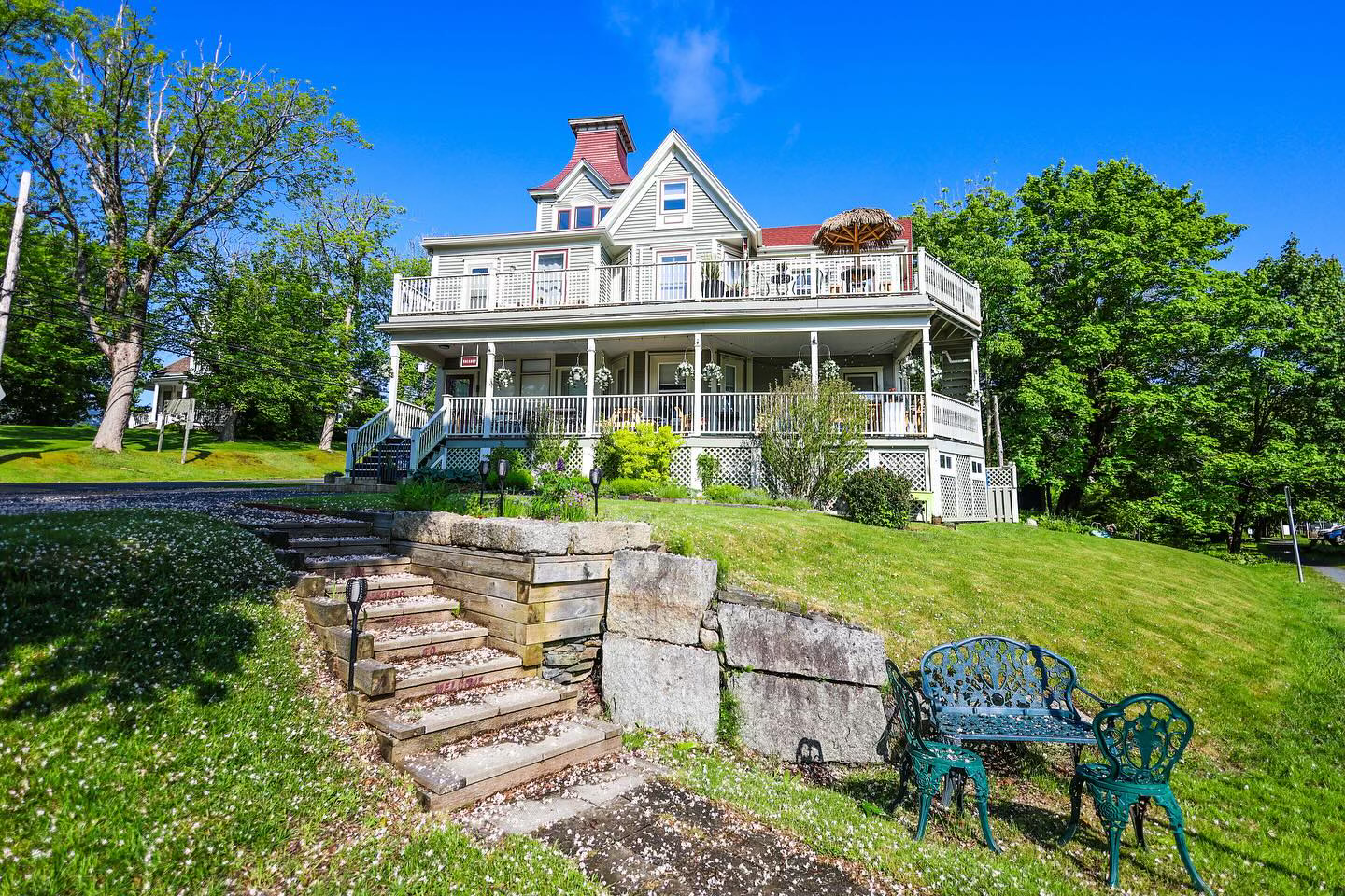
- Listing_type_tax: 3
- Accommodation_type:
- Tara_registration_num: STR2627T1275
- Region: South Shore
- Street_address: 26 Dufferin Street
- Postal_code: B0J 2C0
- City: 507, Lunenburg
- General_area: 49, Lunenburg Area
- Latitude: 44.378879
- Longitude: -64.31802
- Phone: 902-634-3963
- Email: innkeepers@lunenburginn.com
- Contact_details: Phone, Email
- Description: The History of this magnificent Heritage Property dates back to 1893. The home was built by a local carpenter, Reuben A. Conrad, as a home for his new bride.
In 1913 the home was purchased by blacksmith George W. Hamm and his wife Sophia from the Conrad’s heirs. When Sophia and George divorced in 1924, Sophia was left to take care of the home by herself. To make ends meet, she opened her home to paying guests. Sophia aptly named it “The Hillside Hotel”. Ever since that time, the Inn has been welcoming guests, making it the OLDEST Inn in Lunenburg to this day.
As it was adjacent to the new train station which opened in 1923, many of the first guests arrived by train. While the tracks are now gone and the station is now a historic building, the tracks now make up the “bay to bay” trail where runners, cyclists, and dog owner enjoys this wonderous trail and it expands from The Lunenburg Inn all the way to Mahone Bay.
During prohibition in the 1930s, Lunenburg was a popular destination so much that Joseph Kennedy, father of US President John F. Kennedy, was a frequent guest at The Hillside Hotel.
In 1987 the building was rescued from a period of disrepair, restored to the condition befitting a registered heritage property, and reopened as The Lunenburg Inn.
In 2022 it was again purchased and has undergone some extensive renovations to get ready for the Inn’s 100th birthday in 2024.
Amenities:
Free parking for all guests
Complimentary continental breakfast
Premium cable channels
Mini fridge and coffee makers in all rooms
Located on the Bay-to-Bay walking trail.
A short walk into the town of Lunenburg
Balconies to enjoy your morning coffee or a glass of wine in the evening
Cancellation Policy:
Please visit our Website at lunenburginn.com
- Period_of_operation: Open within a date range
- Open_start_date: April 1, 2026
- Open_end_date: November 30, 2026
- Low_rate: 229
- High_rate: 399
- Extra_person_rate: 15
- Rate_period: Per Night
- Rate_details: Deposit required.
- Payment_types:
- Images: https://novascotia.com/wp-content/uploads/2024/09/JPEG-image.jpeg, https://novascotia.com/wp-content/uploads/2024/09/2L7A8026-1920x1080-1.jpg, https://novascotia.com/wp-content/uploads/2024/09/2L7A8035-2-1920x1080-1.jpg, https://novascotia.com/wp-content/uploads/2024/09/IMG_3546-1920x1080-1.jpg, https://novascotia.com/wp-content/uploads/2024/09/IMG_3548-1920x1080-1.jpg, https://novascotia.com/wp-content/uploads/2024/09/IMG_3549-1920x1080-1.jpg, https://novascotia.com/wp-content/uploads/2024/09/IMG_3551-1920x1080-1.jpg, https://novascotia.com/wp-content/uploads/2024/09/IMG_3553-1920x1080-1.jpg, https://novascotia.com/wp-content/uploads/2024/09/IMG_3554-1920x1080-1.jpg
- Accommodation_common_amenities: Air Conditioning, Breakfast Included, TV (Cable/Sat TV/Smart)
- Onsite_amenities: Parking, WiFi
- Pets_policy:
- Number_of_units: 7
- Facebook: https://www.facebook.com/profile.php?id=100063647706979
- Instagram: https://www.instagram.com/lunenburginn/
- Business: Lunenburg Inn
- Active_listing: 1
- Website: https://www.lunenburginn.com
- Notes:
- Google_rating: 4.8
- Primary_contact: 300
- Ratings_programs: Canada Select
- Cs_rating_bed_breakfast: 4.5
- Cs_rating_inn: 4.5
Lunenburg Kayak Rentals & Floating Cottages
URL: https://novascotia.com/listing/lunenburg-kayak-rentals-floating-cottages/
Main Featured Image: https://novascotia.com/wp-content/uploads/2025/01/LunenburgKayakRentals-FloatingCottages-cottage1-1080x1920-1-e1750356204262.jpg
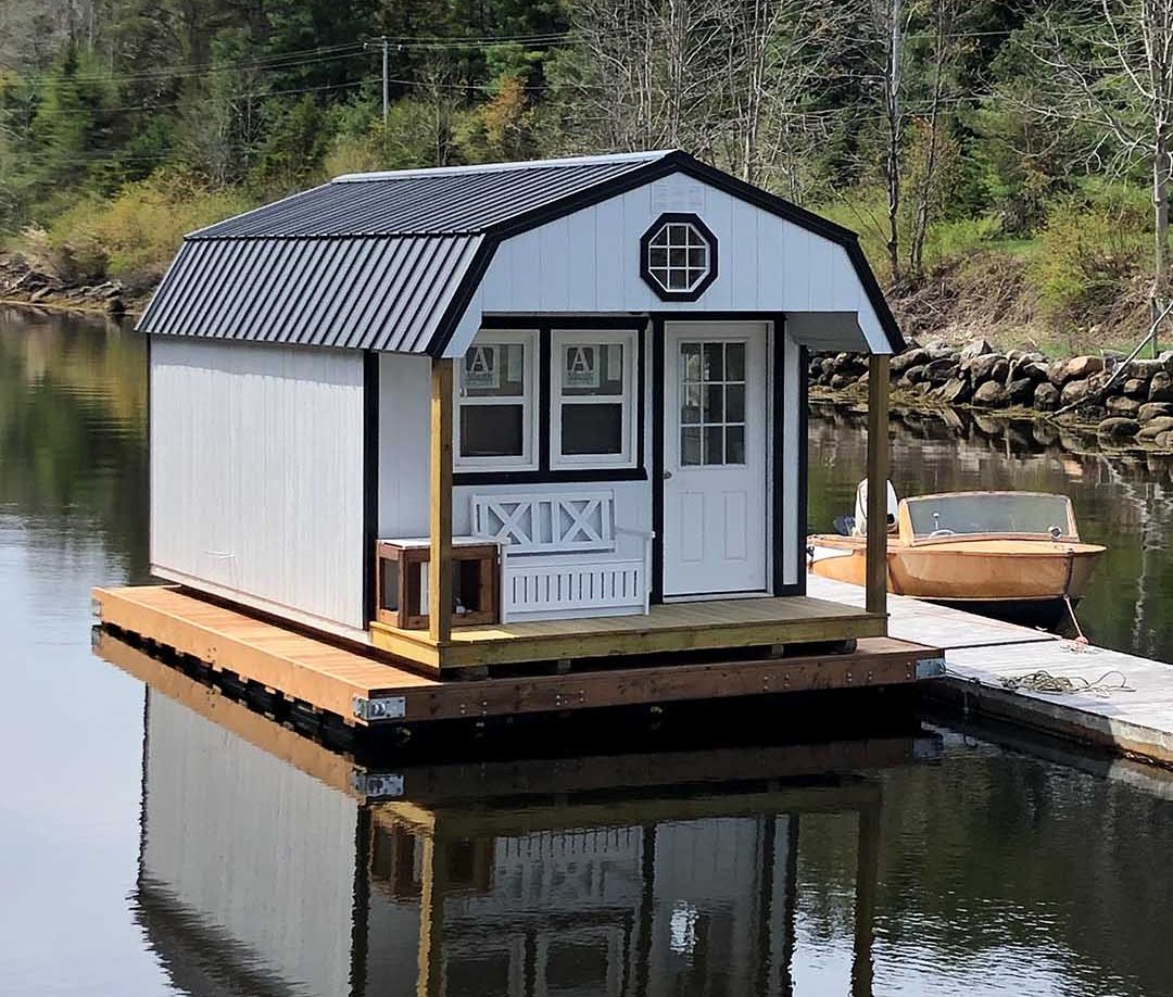
- Active_listing: 1
- Business: Lunenburg Kayak Rentals & Floating Cottages / Sunnybrook Mill Market
- Primary_contact: 2480
- Listing_type_tax: 3, 9
- Guided_tour: 1
- Accommodation_type:
- Tara_registration_num: STR2627B6387
- Google_rating: 4.6
- Tours_outdoors:
- Region: South Shore
- Street_address: 6 Sunnybrook Road
- City: 507, Lunenburg
- General_area: 49, Lunenburg Area
- Postal_code: B0J 2C0
- Latitude: 44.4139607
- Longitude: -64.345964
- Contact_details: Phone, Email
- Description: Lunenburg Kayak Rentals & Floating Cottages is an eco-tourism company offering affordable, unique and unforgettable experiences along the south shore of Nova Scotia, just minutes from the UNESCO World Heritage Site town of Lunenburg. Paddle the calm ocean waters off Lunenburg from our inlet and explore the area with one of our rental kayaks, canoes or SUP boards on a self-guided tour or book a guided kayak, canoe or motorboat tour to learn about the area with one of our tour guides where they can take you ashore to the white sand beaches of beautiful Bachmans or Covey Island for a stroll and swim before returning to your floating cottage to relax after your day on the ocean.
Accommodations
New for 2025 – stay in our first floating cottage! Our newly constructed, off-grid floating cottage sleeps 2-3 comfortably with a pull-out couch on the main floor and a queen size bed in the loft. The kitchen has an apartment-size fridge and a two burner cook top propane stove. All the desired amenities are included along with a separate bathroom with a hot water shower and flush toilet located on land by the wharf. This floating cabin is anchored approximately 150 metres from our private dock on a calm, ocean inlet where you can paddle to it from our wharf.
Rentals and Guided Tours
Rentals
We have three styles of sea kayaks available for rent:
tandem sea kayak (two person)
single sea kayak
sit-on-top leisure kayak
All kayak, canoe and stand-up paddleboard (SUP) rentals come with paddles, professional paddling PFD lifejackets, map of the area including must see landmarks, a 10 L dry bag with waterproof cellphone case, and a safety kit.
Rentals are available for 2 hour, 4 hour, or for a full day (up to 8 hour) increments. Minimum two (2) people per rental booking required as we don’t allow individuals to go out alone for safety reasons unless they are properly qualified. Minimum age is 13 for single kayaks.
Guided Kayak and Canoe Tours and Boat Tours
Experience the white sand beaches of nearby Bachmans or Covey Island where you can go for a stroll and swim in the ocean water when you join us on a guided kayak or canoe tour or on a boat tour. Our fleet included top bran sea kayaks and canoes and our motorboat can accommodation 4-5 passengers. Guided tours provide customers with professional paddling PFD lifejackets, and a 10 L dry bag with waterproof cellphone case.
Minimum two (2) people for guided tours; 15% discount for groups of four or more. Minimum age is 13 for single kayaks on rentals and guided seakayaking tours.
If you are visiting us on a weekend, be sure to visit the onsite farm market, Sunnybrook Mill Market, for all your local meats, produce, preserves, giftware and more. Don’t miss saying hello to the resident goats and Norwegian horses!
On the first Saturday in June, July, August and September, Saturdays by the Sea, an outdoor summer concert series, takes place on the property. Bring your own chairs or blankets as musicians bring the entertainment. A BBQ will be available onsite. All are welcome to attend!
Come experience Lunenburg from the water and make memories that you won’t soon forget. Do something different!
- Period_of_operation: Open seasonally
- Images: https://novascotia.com/wp-content/uploads/2025/01/LunenburgKayakRentals-FloatingCottages-cottage1-1080x1920-1-e1750356204262.jpg, https://novascotia.com/wp-content/uploads/2025/01/kayak-sunset-1920x1080-2.jpg, https://novascotia.com/wp-content/uploads/2025/01/kayaks-dock-1920x1080-2.jpg, https://novascotia.com/wp-content/uploads/2025/01/motorboat-sunset-1920x1080-2.jpg, https://novascotia.com/wp-content/uploads/2025/01/SaturdaysByTheSea-event-1920x1080-1.jpg, https://novascotia.com/wp-content/uploads/2025/01/Lunenburg-FloatingCottage-kitchen-1080x1920-1.jpg, https://novascotia.com/wp-content/uploads/2025/01/Lunenburg-FloatingCottage-dining-1080x1920-1.jpg, https://novascotia.com/wp-content/uploads/2025/01/Lunenburg-FloatingCottage-interior2-1080x1920-1.jpg, https://novascotia.com/wp-content/uploads/2025/01/Lunenburg-FloatingCottage-interior-1080x1920-1.jpg
- Accommodation_common_amenities: Beach Access on Property, Kitchen/Kitchenette, Water / Ocean View
- Equipment_rental: Canoes, Kayaks, SUP Paddleboards
- Number_of_units: 1
- Website: http://www.lunenburgkayakrentals.com
- Facebook: https://www.facebook.com/p/Lunenburg-Kayak-Rentals-Tours-61554245736600/
- Instagram: https://www.instagram.com/lunenburgkayakrentals/
- Notes:
- Phone: 902-514-9222
- Email: mike@lunenburgkayakrentals.com
- Months_open_seasonally:
- Boating_sailing_type: Boat Tour
Lunenburg Ocean Adventures
URL: https://novascotia.com/listing/lunenburg-ocean-adventures/
Main Featured Image: https://novascotia.com/wp-content/uploads/2024/09/33801.webp

- Listing_type_tax: 9
- Tours_outdoors:
- Boating_sailing_type: Boat Tour
- Surf_water_sports_type: Diving, Shark Expedition
- Region: South Shore
- Street_address: Fisheries Museum Wharf, 68 Bluenose Drive
- Postal_code: B0J 2C0
- City: 507, Lunenburg
- General_area: 49, Lunenburg Area
- Latitude: 44.3755
- Longitude: -64.30983
- Phone: 902-521-0251
- Email: wflower@eastlink.ca
- Contact_details: Email
- Description: Experience the open North Atlantic Ocean off Lunenburg, Nova Scotia aboard the ISLANDER VIII, a 49ft Transport Canada approved fishing vessel built in Nova Scotia. At the helm of this family-owned and operated boat tour is Capt. Bill, a lobster fisherman throughout the winter months and an avid fly fisherman who has over 35 years experience as a commercial diver. He is also active in the local film industry providing guidance as a Marine Co-ordinator.
Lunenburg Ocean Adventures offers boat tours that include:
Deep Sea fishing charters
Morning tour: 8am – 12pm
Afternoon tour: 1pm – 5pm
Shark fishing charters (available July through October)
Group and private charters for up to 40 passengers
Dive charters to HMS Saguenay shipwreck organized by local dive shops: Torpedo Rays, Divers World, East Coast Scuba
Bathroom is available onboard. Maximum 20 people for fishing trips.
Please visit our website to learn more about our fishing tours and boat charters and to book your adventure.
- Period_of_operation: Open within a date range
- Open_start_date: June 15, 2026
- Open_end_date: October 31, 2026
- Payment_types:
- Images: https://novascotia.com/wp-content/uploads/2024/09/33801.webp, https://novascotia.com/wp-content/uploads/2024/09/33802.webp, https://novascotia.com/wp-content/uploads/2024/09/34387.webp, https://novascotia.com/wp-content/uploads/2024/09/34388.webp, https://novascotia.com/wp-content/uploads/2024/09/34390.webp, https://novascotia.com/wp-content/uploads/2024/09/34391.webp, https://novascotia.com/wp-content/uploads/2024/09/34392.webp, https://novascotia.com/wp-content/uploads/2024/09/34393.webp
- Business: Lunenburg Ocean Adventures
- Active_listing: 1
- Website: https://www.lunenburgoceanadventures.com
- Guided_tour: 1
- Notes:
- Google_rating: 4.5
- Primary_contact: 623
- Facebook: https://www.facebook.com/LunenburgOceanAdventures/
- Instagram: https://www.instagram.com/lunenburg_ocean_adventures/
- Trip_advisor: https://www.tripadvisor.ca/Attraction_Review-g182187-d7083806-Reviews-Lunenburg_Ocean_Adventures-Lunenburg_Southwest_Nova_Scotia_Nova_Scotia.html
Lunenburg Oceanview Chalets
URL: https://novascotia.com/listing/lunenburg-oceanview-chalets/
Main Featured Image: https://novascotia.com/wp-content/uploads/2024/09/30788.webp

- Listing_type_tax: 3
- Accommodation_type:
- Tara_registration_num: STR2627T5507
- Region: South Shore
- Street_address: 78 Old Blue Rocks Road
- Postal_code: B0J 2C0
- City: 507, Lunenburg
- General_area: 49, Lunenburg Area
- Latitude: 44.373252
- Longitude: -64.295632
- Phone: 902-640-3344
- Toll_free: 855-640-3344
- Email: info@lunenburgoceanview.com
- Contact_details: Phone, Toll Free, Email
- Description: The Lunenburg Oceaview Chalets are log-style chalets situated in a peaceful and quiet setting just outside of Lunenburg, along the South Shore region of Nova Scotia.
The historic town of Lunenburg, a UNESCO World Heritage Site, has a working fishing village and possesses vivid colours and fascinating history. Visit the many shops, galleries, museums and restaurants in the scenic coastal town. The Fisheries Museum of the Atlantic tells the tale of the town’s seafaring heritage and you can view the famed schooner Bluenose II in her home port.
We are minutes to the Rails to Trails Walking Trail, and just next door to sailing tours and bicycle rentals. The chalets are in a central South Shore location, making day trips to Peggy’s Cove and its world-famous lighthouse, the picturesque Three Churches of Mahone Bay or the vineyards and orchards of the Annapolis Valley a breeze.
Our accommodations include six well-equipped 1- and 2-bedroom log chalets with twin or queen beds and sofa beds, and 4-piece baths with air-jet tub; one with a roll-in shower. Cable television, DVD player, wireless Internet, a fireplace, a full kitchen, iron and ironing board available in each cabin and guests can take advantage of our covered deck and barbecue. Relax in front of the fire and watch a movie. Small pets are welcome with permission.
We are a proud member of the Tourism Industry Association of Nova Scotia. Most major credit cards accepted.
- Period_of_operation: Open year-round
- Date_details_hours_of_operation: Peak season ( June 1st - September 30th )
- Low_rate: 199
- High_rate: 349
- Extra_person_rate: 20
- Rate_period: Per Night
- Cancellation_policy: Must cancel 7 days prior to the day of arrival
- Payment_types:
- Images: https://novascotia.com/wp-content/uploads/2024/09/30788.webp, https://novascotia.com/wp-content/uploads/2024/09/30789.webp, https://novascotia.com/wp-content/uploads/2024/09/30790.webp, https://novascotia.com/wp-content/uploads/2024/09/30791.webp, https://novascotia.com/wp-content/uploads/2024/09/30792.webp
- Accommodation_common_amenities: Kitchen/Kitchenette, TV (Cable/Sat TV/Smart), Water / Ocean View
- Onsite_amenities: WiFi
- Pets_policy:
- Number_of_units: 6
- Business: Lunenburg Oceanview Chalets
- Active_listing: 1
- Website: https://www.lunenburgoceanview.com
- Notes:
- Google_rating: 4.8
- Primary_contact: 986
- Ratings_programs: Canada Select
- Cs_rating_cottage: 4.0
Lunenburg RV Park & Campground
URL: https://novascotia.com/listing/lunenburg-rv-park-campground/
Main Featured Image: https://novascotia.com/wp-content/uploads/2024/09/37806.webp

- Listing_type_tax: 5
- Campground_type:
- Region: South Shore
- Street_address: 11 Blockhouse Hill Road
- Postal_code: B0J 2C0
- City: 507, Lunenburg
- General_area: 49, Lunenburg Area
- Latitude: 44.377405
- Longitude: -64.304149
- Phone: 902-634-8100
- Toll_free: 888-615-8305
- Email: campground@lunenburgns.com
- Contact_details: Phone, Toll Free, Email
- Description: Perched atop Blockhouse Hill, the Lunenburg RV Park & Campground offers an unsurpassed location from which to launch your Lunenburg adventures. Our 3 star campground is nestled in the heart of the World UNESCO Heritage Site of Old Town Lunenburg, only a few minutes walk from the famous colorful working waterfront and the birthplace of the Bluenose.
Award winning restaurants, unique shops and art galleries and an eclectic array of festivals are at your fingertips. Enjoy a tour by horse and buggy, on foot or by bus and boat. There is even a golf course nearby and we’re just 45 minutes from the famous Peggy’s Cove and less than 90 minutes from Halifax.
True to Nova Scotian hospitality (it’s in the genes!), we pride ourselves on our knowledgeable & super helpful campground staff here at Lunenburg RV Park & Campground. They’re always happy to share the wealth of information at their disposal to help you have the trip of a lifetime.
Pets are welcome.
Approved by Quality Visitor Services Nova Scotia, Camping Select, Nova Scotia Approved and CAA
Cancellation: 48 hours prior to arrival date.
- Period_of_operation: Open within a date range
- Open_start_date: May 19, 2025
- Open_end_date: October 15, 2025
- Low_rate: 39.1
- High_rate: 57.5
- Rate_period: Per Night
- Payment_types:
- Images: https://novascotia.com/wp-content/uploads/2024/09/37806.webp, https://novascotia.com/wp-content/uploads/2024/09/37807.webp, https://novascotia.com/wp-content/uploads/2024/09/37808.webp, https://novascotia.com/wp-content/uploads/2024/09/37809.webp
- Campground_amenity: Electrical Hook-Up, Flush Toilets, Pull-Through Sites, Sewage Hook-Up, Showers, Unserviced Sites, Water Hook-Up
- Pets_policy:
- Number_of_units: 55
- Website: https://www.campinlunenburg.ca
- Facebook: https://www.facebook.com/campinlunenburg
- Business: Lunenburg Board of Trade Society
- Active_listing: 1
- Notes:
- Google_rating: 3.8
- Primary_contact: 299
- Num_short_term_campground_units: 55
- Ratings_programs: Camping Select
- Cs_rating_facilities: 3.0
- Cs_rating_recreation: 1.0
Lunenburg Walking Tours
URL: https://novascotia.com/listing/lunenburg-walking-tours/
Main Featured Image: https://novascotia.com/wp-content/uploads/2024/09/35987.webp

- Listing_type_tax: 9
- Tours_outdoors:
- Region: South Shore
- Street_address: 97 Kaulbach Street
- Postal_code: B0J 2C0
- City: 507, Lunenburg
- General_area: 49, Lunenburg Area
- Latitude: 44.38024
- Longitude: -64.31360
- Phone: 902-521-6867
- Email: info@lunenburgwalkingtours.com
- Contact_details: Phone, Email
- Description: Your authentic Lunenburg experience starts here!
For more than 30 years, Lunenburg Walking Tours has provided exceptional travel experiences in one of Canada’s most treasured destinations. Our local guides offer a unique insider’s perspective to our picturesque town, and they bring captivating tales of history, folklore, and superstitions to life on every tour.
Tours are suitable for people of most mobility levels. Our gentle pace allows time to admire the sites, take photographs, and smell the salty air as you absorb the richness and beauty of Old Town Lunenburg. You’ll come as a visitor, leave as a friend. Daily and nightly tours from May to October.
Our tours and packages include:
Essential Lunenburg
Immerse yourself in the spectacular sites and intriguing stories of Old Town Lunenburg as you explore stunning architecture & a colourful history.
Haunted Lunenburg: Ghost Walk
Uncover the secrets of Lunenburg’s chilling past. Let our seasoned guides fill your head with tales of hauntings, superstitions and ghost sightings.
Sights & Spirits Lunenburg
Embark on three amazing local experiences all in one fun-filled package. Includes an Old Town walking tour, a harbour tour aboard a traditional fishing boat and a spirited tasting at Ironworks Distillery.
Lunenburg Day Tripper
Discover the very best UNESCO Lunenburg has to offer. Let us plan your perfect Lunenburg day with this all-inclusive package.
Tastes of Lunenburg Food Tour
Savour this fun and flavorful experience, with tastes drawn from the bounty of land and sea. This multi-stop walking food tour serves up the best of Lunenburg’s traditional fare, while also introducing contemporary chefs’ creations.
Book your Lunenburg Walking Tour now! Individual, family, group, and private bookings welcome.
- Period_of_operation: Open within a date range
- Open_start_date: May 15, 2026
- Open_end_date: October 30, 2026
- Date_details_hours_of_operation: Please check our website for tour dates and availabilities.
- Rate_details: Adult - $25
Youth (6-17) - $15
Child (0-5) - free
Family - $75
(taxes included, $US on par)
- Payment_types:
- Images: https://novascotia.com/wp-content/uploads/2024/09/35987.webp, https://novascotia.com/wp-content/uploads/2024/09/35989.webp, https://novascotia.com/wp-content/uploads/2024/09/35990.webp, https://novascotia.com/wp-content/uploads/2024/09/35991.webp, https://novascotia.com/wp-content/uploads/2024/09/35992.webp, https://novascotia.com/wp-content/uploads/2024/09/35993.webp, https://novascotia.com/wp-content/uploads/2024/09/35994.webp, https://novascotia.com/wp-content/uploads/2024/09/35995.webp, https://novascotia.com/wp-content/uploads/2024/09/35996.webp
- Online_booking:
- Facebook: https://www.facebook.com/lunenburgwalkingtours/
- Instagram: https://www.instagram.com/lunenburgtours/
- Business: Lunenburg Walking Tours
- Active_listing: 1
- Website: https://www.lunenburgwalkingtours.com
- Guided_tour: 1
- Notes:
- Google_rating: 5
- Primary_contact: 1754
- Highlights:
Experience a UNESCO World Heritage Site, brimming with local history, 18th century and Victorian architecture AND home of Canada’s iconic Bluenose
Our guides are local and take pride in delighting visitors from around the world with their extensive knowledge and gifted storytelling
A fantastic array of tours, packages and adventures to suit all ages and interests. Daily and nightly, May to October.
Lunenburg Waterfront Marina
URL: https://novascotia.com/listing/lunenburg-waterfront-marina/
Main Featured Image: https://novascotia.com/wp-content/uploads/2024/09/15837.webp

- Listing_type_tax: 9
- Tours_outdoors:
- Boating_sailing_type: Marina & Yacht Club
- Region: South Shore
- Street_address: 146 Bluenose Dr
- City: 507, Lunenburg
- Latitude: 44.375059
- Longitude: -64.30384
- Phone: 902-521-3012
- Email: lunenburgmarina@buildns.ca
- Contact_details: Phone, Email
- Description: Chart your course for one of the world’s most spectacular coastlines and make us your next port of call.
Nova Scotia’s magnificent coastline, dotted with endless inlets, coves, and harbours, stretches over 7,000 kilometres (more than 4,300 miles) – including the numerous islands, it’s over 13,300 kilometres (8,300 miles). Offering a collection of incredible boating opportunities and ports of call around the province, with rich cultural, adventure and culinary tourism experiences in both rural and urban settings, and marine-related supply and service businesses with proven expertise.
Situated as a gateway to the pristine waters of Atlantic Canada, Nova Scotia is a strategic destination for expeditions exploring the North including Newfoundland and Labrador, the Northwest Passage and Greenland. We are also a strategic location for passages to and from Europe and a natural extension of the Northeast Seaboard that has established yacht itineraries for cruising New England and Maine.
Lunenburg Waterfront Marina
In Lunenburg, 300ft of floating docks are available for vessels up to 150ft with fixed wharf space and a dinghy dock also available. While here, take in the numerous sights and sounds on this working waterfront, from wooden schooners in mid-build at the Dory Shop or vessels under repair to fresh seafood catches being unloaded at the wharves.
Cycling, golfing, sightseeing, boating, festivals and entertainment are just some of Lunenburg’s attractions. The Lunenburg waterfront is a gateway to delicious food in award-winning restaurants, distilleries and breweries, galleries and shops featuring fine art and craftwork, and events celebrating local talent and traditions.
Dine on a patio, uncover seaside treasures and watch local boat builders at work, all along the beautiful Lunenburg waterfront. Catch the sunset with the best view dockside.
Stroll the streets lined with charming 18th and 19th century architecture and experience the authenticity of this UNESCO World Heritage Site. Visit the ships that call Lunenburg home: the three-masted barque Picton Castle and the iconic schooner Bluenose II, Nova Scotia’s sailing ambassador.
About us
Nova Scotia Marine Services offers high quality, safe berths in historic downtown Halifax, Bedford and in Lunenburg, a designated UNESCO World Heritage Site. Free daytime berthing is available with overnight berthing at competitive rates. Whether you visit by power or sail, for recreation or work, we have a berth for you. We also support local and international regattas, host visiting yachts and Tall Ships. All major credit cards are accepted and we are a member of the US Superyacht Association.
For more sailing adventures and ideas across Nova Scotia, visit novascotia.com/boating.
Additional Options
Near Zwicker Wharf, Ocean Gear offers more than 800 feet of fixed wharf space available to large commercial vessels, pleasure craft and yachts, along with 300 feet of floating dock space available for smaller vessels and dinghies. They offer rental of this docking space along with utilities and repair / refit services, if required.
Please contact 902-640-3030 or info@oceangear.ca for more information on these bookings and services.
- Period_of_operation: Open within a date range
- Open_start_date: May 1, 2025
- Open_end_date: October 31, 2025
- Payment_types:
- Images: https://novascotia.com/wp-content/uploads/2024/09/15837.webp, https://novascotia.com/wp-content/uploads/2024/09/15838-scaled.webp, https://novascotia.com/wp-content/uploads/2024/09/15839.webp, https://novascotia.com/wp-content/uploads/2024/09/15840.webp
- Accessibility: Wheelchair accessible
- Facebook: https://www.facebook.com/buildnovascotia
- Instagram: https://www.instagram.com/buildnovascotia/
- Twitter: https://twitter.com/BuildNovaScotia
- Youtube: https://www.youtube.com/MyWaterfrontNS
- Business: Build Nova Scotia
- Active_listing: 1
- Website: https://buildns.ca/visit/lunenburg/lunenburg-marina/
- Notes:
- General_area: 49, Lunenburg Area
- Google_rating: 4.9
- Primary_contact: 891
Lunenburg Yacht Club
URL: https://novascotia.com/listing/lunenburg-yacht-club/
Main Featured Image: https://novascotia.com/wp-content/uploads/2025/04/LunenburgYachtClub-1920x1080-1.jpg

- Active_listing: 1
- Business: Lunenburg Yacht Club
- Primary_contact: 3032
- Listing_type_tax: 9
- Google_rating: 4.5
- Tours_outdoors:
- Boating_sailing_type: Marina & Yacht Club
- Region: South Shore
- Street_address: 734 Hermans Island Rd
- City: 507, Lunenburg
- General_area: 49, Lunenburg Area
- Postal_code: B0J 2E0
- Latitude: 44.41162477517201
- Longitude: -64.32277223219438
- Contact_details: Phone, Email
- Description: Lunenburg Yacht Club has easy access to some of the best cruising waters in North America, which include a myriad of beautiful islands, many with beautiful beaches. LYC operates a variety of family-oriented and water-based facilities for everyone from yacht racers to land-based gourmets. There is also a full-service restaurant on site and event venue.
- Period_of_operation: Open within a date range
- Payment_types:
- Images: https://novascotia.com/wp-content/uploads/2025/04/LunenburgYachtClub-1920x1080-1.jpg, https://novascotia.com/wp-content/uploads/2025/04/LYC-Aerial-Image-2024.jpg, https://novascotia.com/wp-content/uploads/2025/04/LYC-Clubhouse.jpg, https://novascotia.com/wp-content/uploads/2025/04/LYC-Foggy-Morning.jpg, https://novascotia.com/wp-content/uploads/2025/04/LYC-Happy-Hour.jpg, https://novascotia.com/wp-content/uploads/2025/04/LYC-Opti-Nationals-2022.jpg, https://novascotia.com/wp-content/uploads/2025/04/LYC-Opti-Nationals-BBQ-2022.jpg, https://novascotia.com/wp-content/uploads/2025/04/LYC-Rainbow-Magic.jpg, https://novascotia.com/wp-content/uploads/2025/04/LYC-Rowers.jpg, https://novascotia.com/wp-content/uploads/2025/04/LYC-Thursday-Racing.jpg
- Accessibility: Wheelchair accessible
- Onsite_amenities: Parking, Picnic Tables, Restaurant/Canteen/Tea Room, WiFi
- Website: https://www.lyc.ca/
- Facebook: https://www.facebook.com/lunenburgyachtclub/?fref=ts#
- Trip_advisor: https://www.tripadvisor.ca/Attraction_Review-g182187-d17724914-Reviews-Lunenburg_Yacht_Club-Lunenburg_Southwest_Nova_Scotia_Nova_Scotia.html
- Notes:
- Phone: 902-634-3745
- Email: lycmanager@lyc.ns.ca
- Open_start_date: June 1, 2025
- Open_end_date: September 30, 2025
Lunenburg’s Little Lake Campground
URL: https://novascotia.com/listing/lunenburgs-little-lake-campground/
Main Featured Image: https://novascotia.com/wp-content/uploads/2024/09/19757.webp

- Listing_type_tax: 3, 5
- Accommodation_type:
- Campground_type:
- Tours_outdoors:
- Tara_registration_num: STR2627T7015
- Region: South Shore
- Street_address: 11677 Highway 3
- City: 146, Centre
- General_area: 49, Lunenburg Area
- Latitude: 44.378033
- Longitude: -64.363133
- Phone: 902-634-4308
- Email: camp@lunenburgslittlelake.com
- Contact_details: Phone, Email
- Description: Lunenburg’s Little Lake Campground is an open campground on a lake just minutes from the historic Town of Lunenburg on the South Shore. Bring a canoe, kayak, or fishing gear for private time on the lake, or enjoy planned activities, theme weekends, and friendly people!
While staying with us explore Lunenburg, a UNESCO World Heritage Site. Enjoy the town’s historic architecture, working waterfront, walking tours, many shops, fine art, festivals, golf courses, and many other attractions, such as the popular Fisheries Museum of the Atlantic. We are also just 15 minutes away from picturesque Mahone Bay where you can stroll along their charming main street which hosts an assortment of art galleries, specialty shops, and museums.
Our accommodations include:
135 sites including 2-way and 3-way hookups, pull-through sites, and tenting sites)
46 overnight sites
89 seasonal sites
five yurts
six Safari tents
three rustic camping cabins
five RV rentals
four geodesic domes
Guest amenities and facilities include:
Washrooms with flush toilets and showers
laundry facility
disposal station
large outdoor swimming pool
children’s playground
games room with a pool table
camp store
Wi-Fi
Pets are welcome.
We are a proud member of the Tourism Industry Association of Nova Scotia and the Campground Owners’ Association of Nova Scotia.
Visa, MasterCard, Amex, and Direct Debit are accepted.
- Period_of_operation: Open within a date range
- Open_start_date: May 1, 2026
- Open_end_date: October 15, 2026
- Low_rate: 39
- High_rate: 250
- Rate_period: Per Night
- Payment_types:
- Images: https://novascotia.com/wp-content/uploads/2024/09/19757.webp, https://novascotia.com/wp-content/uploads/2024/09/19758.webp, https://novascotia.com/wp-content/uploads/2024/09/19759.webp, https://novascotia.com/wp-content/uploads/2024/09/19760.webp, https://novascotia.com/wp-content/uploads/2024/09/19761.webp, https://novascotia.com/wp-content/uploads/2024/09/19762.webp, https://novascotia.com/wp-content/uploads/2024/09/19763.webp, https://novascotia.com/wp-content/uploads/2024/09/19764.webp, https://novascotia.com/wp-content/uploads/2024/09/19765.webp, https://novascotia.com/wp-content/uploads/2024/09/19766.webp
- Accommodation_common_amenities: Pool (Outdoor), Water / Ocean View
- Onsite_amenities: Parking, WiFi
- Campground_amenity: Beach Access, Disposal Station, Electrical Hook-Up, Flush Toilets, Laundromat, Playground, Pool (Outdoor), Pull-Through Sites, Rec Hall, Sewage Hook-Up, Showers, Unserviced Sites, Water Hook-Up
- Pets_policy:
- Number_of_units: 23
- Online_booking:
- Facebook: https://www.facebook.com/profile.php?id=61575725798776
- Business: Lunenburg's Little Lake Campground
- Active_listing: 1
- Website: https://www.lunenburgslittlelake.com/
- Notes:
- Google_rating: 4.1
- Primary_contact: 2062
- Num_seasonal_campground_units: 89
- Num_short_term_campground_units: 46
- Ratings_programs: Camping Select
- Cs_rating_facilities: 2.5
- Cs_rating_recreation: 2.0
- Instagram: https://www.instagram.com/lunenburgslittlelake/
Lunn’s Mill Beer Company
URL: https://novascotia.com/listing/lunns-mill-beer-company/
Main Featured Image: https://novascotia.com/wp-content/uploads/2024/09/21989.webp

- Listing_type_tax: 6
- Eat_drink_type:
- Region: Bay of Fundy & Annapolis Valley
- Street_address: 515 Carleton Road
- City: 453, Lawrencetown (Middleton area)
- Latitude: 44.874076
- Longitude: -65.166488
- Phone: 902-584-2217
- Email: info@lunnsmillbeerco.com
- Contact_details: Phone, Email
- Description: We have 10 rotating taps of local craft beer and cider. Our beer is brewed on-site, but we also feature guest beer and cider from around Nova Scotia. Try a sampler flight, grab a glass of your favourite, or take a growler home with you. We also offer a simple menu of eclectic entrees and shareable snacks.
All ages welcome. We are open 5 days a week, Wednesday to Sunday. For the most up to date hours, please check Google or our website
We offer home delivery of beer to your door on Thursday to the Halifax Regional Municipality and Friday to Annapolis and Kings Counties. We ship across Canada too, please order on our website
You can find us on Facebook at Lunn’s Mill Beer Company, Instagram at @lunnsmill and online for menus, hours, events and home and across Canada delivery
- Period_of_operation: Open year-round
- Date_details_hours_of_operation: Thursday to Saturday: 3pm-7pm
- Images: https://novascotia.com/wp-content/uploads/2024/09/21989.webp, https://novascotia.com/wp-content/uploads/2024/09/21990.webp, https://novascotia.com/wp-content/uploads/2024/09/21991.webp, https://novascotia.com/wp-content/uploads/2024/09/21992.webp, https://novascotia.com/wp-content/uploads/2024/09/21994.webp, https://novascotia.com/wp-content/uploads/2024/09/22413.webp, https://novascotia.com/wp-content/uploads/2024/09/DSC06347.jpg, https://novascotia.com/wp-content/uploads/2024/09/DSC06363.jpg, https://novascotia.com/wp-content/uploads/2024/09/d1c6df1a-272f-4862-bd67-c0f6bb3d7e51.jpg, https://novascotia.com/wp-content/uploads/2024/09/566550ac-31b3-45ca-87cc-1d1e838efae3.jpg
- Accessibility: Wheelchair accessible
- Membership: Good Cheer Trail
- Facebook: https://facebook.com/lunnsmill
- Instagram: https://instagram.com/lunnsmill
- Twitter: https://twitter.com/lunnsmill
- Business: Lunn's Mill Beer Company
- Active_listing: 1
- Website: https://lunnsmill.beer
- Notes:
- General_area: 56, Middleton Area
- Google_rating: 4.8
- Primary_contact: 2147
Lupin Dining & Pantry
URL: https://novascotia.com/listing/lupin-dining-pantry/
Main Featured Image: https://novascotia.com/wp-content/uploads/2024/09/30378.webp

- Listing_type_tax: 6
- Eat_drink_type:
- Region: Eastern Shore
- Street_address: 1196 West Petpeswick Road
- Postal_code: B0J 2L0
- City: 604, Musquodoboit Harbour
- Latitude: 44.735109
- Longitude: -63.173762
- Phone: 902-889-3200
- Email: info@lupindining.ca
- Contact_details: Phone, Email
- Description: Lupin Dining & Pantry offers an intimate culinary experience built around a seasonal 7-course Chef’s tasting menu crafted by Chef Kim. Each dish showcases local Nova Scotian ingredients and produce hand-picked from our garden, ensuring the freshest flavours throughout your meal. The menu evolves every 4–5 weeks to reflect the seasons and the culinary creativity of our kitchen. Reservations are required, and we invite you to visit our website to explore additional events and experiences hosted at Lupin. Open seasonally.
- Period_of_operation: Open year-round
- Date_details_hours_of_operation: Late May to June, Fridays & Saturdays 6-9pm. July & August, Thursdays to Saturdays 6-9pm. September to Late October, Fridays & Saturdays 6-9pm. Reservations only.
- Images: https://novascotia.com/wp-content/uploads/2024/09/30378.webp, https://novascotia.com/wp-content/uploads/2024/09/30379.webp, https://novascotia.com/wp-content/uploads/2024/09/30380.webp, https://novascotia.com/wp-content/uploads/2024/09/30381.webp, https://novascotia.com/wp-content/uploads/2024/09/30382.webp, https://novascotia.com/wp-content/uploads/2024/09/30383.webp, https://novascotia.com/wp-content/uploads/2024/09/36640.webp, https://novascotia.com/wp-content/uploads/2024/09/36642.webp, https://novascotia.com/wp-content/uploads/2024/09/36643.webp, https://novascotia.com/wp-content/uploads/2024/09/36704.webp
- Accessibility: Wheelchair accessible
- Membership: Chowder Trail, Taste of Nova Scotia
- Restaurant_amenities: 9, 10, Patio, Reservations Recommended
- Facebook: https://www.facebook.com/lupin.dining
- Instagram: https://www.instagram.com/lupin.dining/
- Business: Lupin Dining & Pantry
- Active_listing: 1
- Website: https://www.lupindining.ca
- Notes:
- General_area: 57, Musquodoboit Harbour Area
- Google_rating: 4.8
- Primary_contact: 2307
- Campaign_category: 235
- Restaurant_type: Elevated Boutique Dining, Fine Dining / Gourmet
Lynwood Inn
URL: https://novascotia.com/listing/lynwood-inn/
Main Featured Image: https://novascotia.com/wp-content/uploads/2024/09/66043e898b856bf0cfcfa061_Front-Desk-View-Lynwood-Inn.jpg

- Listing_type_tax: 3
- Accommodation_type:
- Tara_registration_num: STR2627T0634
- Region: Cape Breton Island
- Street_address: 441 Shore Road
- Postal_code: B0E 1B0
- City: 34, Baddeck
- General_area: 6, Baddeck Area
- Latitude: 46.09951
- Longitude: -60.753525
- Phone: 902-295-1995
- Toll_free: 877-666-1995
- Email: lynwood@baddeck.com
- Contact_details: Phone, Toll Free, Email
- Description: Discover the charming Lynwood Inn, a cozy country inn with lush gardens and views out over the Bras d’Or Lake, from its location in heart of the village of Baddeck, Cape Breton Island. Choose between our standard double rooms, balcony rooms, heritage suites, or two-bedroom cottage when you stay with us.
Standard double rooms and balcony rooms come complete with two queen beds, four piece ensuite bathroom with whirlpool tub/shower combo, air conditioning, cable TV, highspeed Wi-Fi internet, coffee machine, mini fridge and microwave. Each balcony room also offer water views, views over the town of Baddeck, or garden views.
Each suite comes with a queen bed, sitting area, four piece ensuite bathroom with whirlpool tub/shower combo, air conditioning, cable TV, highspeed Wi-Fi internet, coffee machine, mini fridge and microwave.
Located next to the main inn you’ll find our two bedroom cottage. Perfect for family and/or friends, it comes complete with two queen beds, full kitchen, living room, four piece ensuite bathroom with whirlpool tub/shower combo, patio equipped with seating and BBQ, air conditioning, free wifi and parking for two cars.
Our onsite licensed family restaurant onsite is open June through October and offers indoor and outdoor dining options.
Electric car charging station available onsite.
- Period_of_operation: Open year-round
- Low_rate: 149
- High_rate: 239
- Rate_period: Per Night
- Payment_types:
- Images: https://novascotia.com/wp-content/uploads/2024/09/66043e898b856bf0cfcfa061_Front-Desk-View-Lynwood-Inn.jpg, https://novascotia.com/wp-content/uploads/2024/09/37819.webp, https://novascotia.com/wp-content/uploads/2024/09/65b7a9f62f6cd7206edf4625_Standard-Double-Room.jpg, https://novascotia.com/wp-content/uploads/2024/09/65b7e9528ff72cb53d5c558e_Office-area-1-Large-p-500.jpg, https://novascotia.com/wp-content/uploads/2024/09/65b7e9538e55fb20dba1656a_Standard-Double-Room-3-Large-p-500.jpg
- Accessibility: Wheelchair accessible
- Accommodation_common_amenities: Air Conditioning, Kitchen/Kitchenette, Room Service, TV (Cable/Sat TV/Smart), Water / Ocean View
- Onsite_amenities: Electric Vehicle (EV) Charging Station(s), Parking, Restaurant/Canteen/Tea Room, WiFi
- Cell_service:
- Pets_policy:
- Number_of_units: 33
- Online_booking:
- Facebook: https://www.facebook.com/LynwoodInnBaddeck
- Business: Lynwood Inn
- Active_listing: 1
- Website: https://www.lynwoodinn.com
- Notes:
- Google_rating: 4.2
- Primary_contact: 436
- Ratings_programs: Canada Select
- Cs_rating_cottage: 3.5
- Cs_rating_inn: 4.0
Mabou Farmers’ Market
URL: https://novascotia.com/listing/mabou-farmers-market/
Main Featured Image: https://novascotia.com/wp-content/uploads/2024/09/14114.webp

- Listing_type_tax: 6
- Eat_drink_type:
- Tara_registration_num: n/a
- Region: Cape Breton Island
- Street_address: 186 Mabou Harbour Road
- Postal_code: B0E 1X0
- City: 511, Mabou
- Latitude: 46.076511
- Longitude: -61.401163
- Email: maboufarmersmarket@gmail.com
- Contact_details: Email
- Description: The Mabou Farmers’ Market houses an eclectic collection of local food growers, producers, fishers, artisans and crafters who offer their wares on Sundays from 11am to 2pm from June to mid-October at the Mabou Athletic Centre. During the month of December, special holiday markets are held at Dalbrae Academy in Mabou.
We’re located at about the midpoint of Cape Breton’s Ceilidh Trail in the picturesque village of Mabou. After visiting the market, check out beautiful West Mabou Beach Provincial Park, bike, walk or hike on the Ceilidh Coastal Trail that runs through Mabou to see bald eagles, or visit the famous Red Shoe Pub. There’s something for everyone in Mabou.
Come and enjoy live music each Sunday while you shop for fresh seasonal produce and berries, eggs, meat, fresh baking, and flowers and plants. You’ll be able to find the perfect gift from a selection of leather belts, jewellery, hand-dyed scarves, cards, hand-spun yarn goods, wooden spoons, body care products, aroma-therapeutic gifts and much more.
To find a full listing of vendors, live music and special events, visit our website.
- Period_of_operation: Open year-round
- Open_start_date: January 3, 1970
- Open_end_date: January 3, 1970
- Date_details_hours_of_operation: June to mid-October: Sundays, 11am-2pm. December holiday season market held at Dalbrae Academy.
- Images: https://novascotia.com/wp-content/uploads/2024/09/14114.webp, https://novascotia.com/wp-content/uploads/2024/09/14116.webp, https://novascotia.com/wp-content/uploads/2024/09/14117.webp
- Membership: Clean It Right
- Facebook: http://www.facebook.com/pages/Mabou-Farmers-Market/491689090878270
- Instagram: https://www.instagram.com/maboufarmersmarket_/?hl=en
- Business: Mabou Farmers' Market
- Active_listing: 1
- Notes:
- General_area: 50, Mabou Area
- Google_rating: 4.6
- Website: https://www.maboufarmersmarket.ca
- Primary_contact: 1801
- Months_open_seasonally:
Mabou Provincial Park
URL: https://novascotia.com/listing/mabou-provincial-park/
Main Featured Image: https://novascotia.com/wp-content/uploads/2024/09/8655.webp

- Listing_type_tax: 9
- Campground_type:
- Tours_outdoors:
- Region: Cape Breton Island
- Street_address: 11925 Highway 19
- City: 511, Mabou
- General_area: 50, Mabou Area
- Latitude: 46.082009
- Longitude: -61.371464
- Email: parkinfo@novascotia.ca
- Contact_details: Email
- Description: Mabou Provincial Park is 1.5 km (1 mi) north of Mabou (11935 Highway 19) on Cape Breton Island. Its hillside location with picnic tables offers a panoramic view of the Mabou Valley.
- Period_of_operation: Open within a date range
- Open_start_date: May 17, 2025
- Open_end_date: October 14, 2025
- Date_details_hours_of_operation: (dates subject to change)
- Payment_types:
- Images: https://novascotia.com/wp-content/uploads/2024/09/8655.webp
- Government_level:
- Facebook: https://www.facebook.com/NSProvincialParks
- Business: Department of Natural Resources and Renewables / Provincial Park
- Active_listing: 1
- Website: https://parks.novascotia.ca/content/mabou
- Notes:
- Google_rating: 4
- Primary_contact: 1662
Mabou River Inn
URL: https://novascotia.com/listing/mabou-river-inn/
Main Featured Image: https://novascotia.com/wp-content/uploads/2024/09/21109.webp

- Listing_type_tax: 3
- Accommodation_type:
- Eat_drink_type:
- Tours_outdoors:
- Tara_registration_num: STR2627T0955
- Region: Cape Breton Island
- Street_address: 19 Southwest Ridge Road
- Postal_code: B0E 1X0
- City: 511, Mabou
- General_area: 50, Mabou Area
- Latitude: 46.06832
- Longitude: -61.3973
- Phone: 902-945-2356
- Email: info@mabouriverinn.com
- Contact_details: Phone, Email
- Description: Mabou River Inn is located on the Ceilidh Trail on beautiful Cape Breton Island, where sandy beaches, Celtic music, and Gaelic culture are all around you. Come and enjoy the spectacular beaches, beautiful highland setting, fabulous hiking and walking trails, kayaking, fishing, as well as the many quality products and services of our community. Enjoy a day of cycling on the Celtic Shores Coastal Trail.
Mabou is a beautiful village in the heartland of Gaelic culture, with many ceilidhs, festivals and concerts to enjoy. It is also home to the An Drochaid Museum, which houses Mabou’s history, cultural artifacts and records for public viewing. We are located 6.4km from West Mabou Beach Provincial Park and 0.9km from the famous Red Shoe Pub.
Our accommodations include seven rooms with queen, or king-sized beds, private 3-piece (shower) or 4-piece baths, along with three 2-bedroom housekeeping suites with 4-piece bath. All units are air-conditioned and have flat screen CBTV. A complimentary full hot breakfast featuring our own home baking is included. Our restaurant and deck are licensed. Guest amenities include guest kitchen, laundry facilities, guest computer, free wireless Internet, barbecue, play area, and conference centre. No pets please, as we have a dog on the premises.
We are a proud member of the Innkeepers Guild of Nova Scotia and the Tourism Industry Association of Nova Scotia.
Visa, MasterCard, American Express and Debit are accepted.
Cancellation policy: Must cancel 48 hours prior to the day of arrival.
- Period_of_operation: Open within a date range
- Open_start_date: May 1, 2026
- Open_end_date: October 31, 2026
- Date_details_hours_of_operation: Off-season by reservation from Jan 1-Apr 30
- Low_rate: 145
- High_rate: 225
- Extra_person_rate: 20
- Rate_period: Per Night
- Payment_types:
- Images: https://novascotia.com/wp-content/uploads/2024/09/21109.webp, https://novascotia.com/wp-content/uploads/2024/09/MabouRiverInn1.jpg, https://novascotia.com/wp-content/uploads/2024/09/MabouRiverInn11.jpg, https://novascotia.com/wp-content/uploads/2024/09/mrirm2-3.jpg
- Accommodation_common_amenities: Air Conditioning, Kitchen/Kitchenette, TV (Cable/Sat TV/Smart)
- Onsite_amenities: WiFi
- Pets_policy:
- Number_of_units: 10
- Business: Mabou River Inn
- Active_listing: 1
- Website: https://www.mabouriverinn.com
- Notes:
- Google_rating: 4.7
- Primary_contact: 708
- Ratings_programs: Canada Select
- Cs_rating_apartment: 4.0
- Cs_rating_inn: 4.0
Mabou Rivers Trail (part of Celtic Shores Coastal Trail)
URL: https://novascotia.com/listing/mabou-rivers-trail-part-of-celtic-shores-coastal-trail/
Main Featured Image: https://novascotia.com/wp-content/uploads/2024/09/14367.webp

- Listing_type_tax: 9
- Tours_outdoors:
- Adventure_activity_type: ATV/Off-road/4-wheeling
- Winter_activity_type: Cross Country Skiing, Snowmobiling, Snowshoeing
- Region: Cape Breton Island
- Street_address: Mabou River to Blackstone, 11040 Highway 19
- City: 511, Mabou
- Latitude: 46.022502
- Longitude: -61.45396
- Email: celticshorestrail@gmail.com
- Contact_details: Email
- Description: Length: 19.6 km (12.2 mi) – Zutphen Farm Southwest Mabou River to Blackstone (linear)
Cell Service: Yes
Dogs Permitted: On leash
Trail Surface: The first 4 km are unsurfaced; the tread becomes excellent for the next 13 km through the village of Mabou.
The Mabou Rivers Trail section of the Celtic Shores Coastal Trail can be accessed from Route 19 at four points. The first access point (Trail Marker 55) is on Route 19 about halfway between Port Hood and Mabou. Parking is available on the left side of the road at this junction. Entering here, you will travel several kilometers through a canopied section, but soon the trail opens up and meanders alongside the South West Mabou River. This section of the trail is very pretty in all seasons, offering the perfect mixture of meadows, woodlands, rolling hills and rivers. This landscape welcomes an abundance of wildlife and interesting vegetation. Keep an eye out for soaring bald eagles and Canada Geese, among others.
The next trail junction is off Route 19 at the West Mabou/Little Mabou/Colindale Road. There is a very scenic parking area where one can take in the sweeping views of the Mabou Harbour and mountains while resting at the picnic tables. The adjacent West Mabou Road takes you to West Mabou Beach Provincial Park. Set among rolling sand dunes, West Mabou Provincial Park offers several trails, a stocked fish pond and a picnic area.
After the trail leaves this beautiful roadside location, it runs parallel to Route 19 before reaching its third junction on Route 19, just outside the village of Mabou. The trail continues along the inner part of Mabou inlet and river before leading you through the settlement of Glendyer and to Blackstone.
The trail features wayfinding signage and interpretive panels, which outline the history and culture of the surrounding communities.
Don’t miss the Mabou Farmers Market, where over 40 vendors offer up delicious food, beautiful jewelry and art, and of course live music!
Trailhead: West Mabou Trailhead Kiosk/Access/Parking (11040 Route 19, Mabou)
GPS: 46.022502, -61.453960
- Period_of_operation: Open year-round
- Images: https://novascotia.com/wp-content/uploads/2024/09/14367.webp, https://novascotia.com/wp-content/uploads/2024/09/14368.webp, https://novascotia.com/wp-content/uploads/2024/09/14369.webp, https://novascotia.com/wp-content/uploads/2024/09/14370.webp, https://novascotia.com/wp-content/uploads/2024/09/14371.webp, https://novascotia.com/wp-content/uploads/2024/09/14372.webp, https://novascotia.com/wp-content/uploads/2024/09/14373.webp, https://novascotia.com/wp-content/uploads/2024/09/14375.webp
- Accessibility: Wheelchair accessible
- Accommodation_common_amenities: Water / Ocean View
- Website: https://www.celticshores.ca
- Business: Celtic Shores Coastal Trail
- Active_listing: 1
- Notes:
- General_area: 50, Mabou Area
- Google_rating: 4.6
- Primary_contact: 1760
- Trail_distance: 19.5
- Campaign_category: 273, 272
- Trail_distance_measurement: one way
- Trail_type: Day use
- Trail_surface: Gravel
- Trail_difficulty_level: Easy
- Trail_pet_policy: Leashed
- Trail_uses: 4-wheeling/ATV, Cycling, Hiking, Skiing, Snowmobiling, Snowshoeing, Walking
MacCormack Provincial Park
URL: https://novascotia.com/listing/maccormack-provincial-park/
Main Featured Image: https://novascotia.com/wp-content/uploads/2024/09/MacCormack_Provincial_Park_2000x1500.jpg

- Listing_type_tax: 9
- Campground_type:
- Tours_outdoors:
- Region: Cape Breton Island
- Street_address: 2481 St Columba Road
- City: 402, Iona
- General_area: 38, Iona Area
- Latitude: 45.963883
- Longitude: -60.81035
- Email: parkinfo@novascotia.ca
- Contact_details: Email
- Description: MacCormack Provincial Park is a small picnic park overlooking Bras d’Or Lake on Cape Breton Island off Route 223 on the Bras d’Or Lakes Scenic Drive. Picnic tables are scattered through a softwood forest. The park has beach access with a view of picturesque Plaster Cove.
- Period_of_operation: Open within a date range
- Open_start_date: May 17, 2025
- Open_end_date: October 14, 2025
- Date_details_hours_of_operation: (dates subject to change)
- Images: https://novascotia.com/wp-content/uploads/2024/09/MacCormack_Provincial_Park_2000x1500.jpg
- Government_level:
- Facebook: https://www.facebook.com/NSProvincialParks
- Business: Department of Natural Resources and Renewables / Provincial Park
- Active_listing: 1
- Website: https://parks.novascotia.ca/park/maccormack
- Notes:
- Primary_contact: 1662
MacCormacks Beach Provincial Park
URL: https://novascotia.com/listing/maccormacks-beach-provincial-park/
Main Featured Image: https://novascotia.com/wp-content/uploads/2024/09/Beach-pic.jpg
- Listing_type_tax: 9
- Campground_type:
- Tours_outdoors:
- Beach_type: Ocean beach
- Region: Halifax Metro
- Street_address: 1641 Shore Road
- City: 253, Eastern Passage
- General_area: 26, Eastern Passage Area
- Latitude: 44.60855
- Longitude: -63.491535
- Email: parkinfo@novascotia.ca
- Contact_details: Email
- Description: MacCormacks Beach Provincial Park is in the Eastern Shore region at Eastern Passage (turn right at Quigley’s Corner, parking lot on right). Adjacent to the popular Fisherman’s Cove, the park features an extensive boardwalk which is wheelchair accessible and provides a beautiful view of Eastern Passage, McNabs, Lawlor and Devil’s islands, Eastern Passage and Halifax Harbour. A few picnic shelters are available.
- Period_of_operation: Open within a date range
- Open_start_date: May 17, 2025
- Open_end_date: October 14, 2025
- Date_details_hours_of_operation: (dates subject to change)
- Images: https://novascotia.com/wp-content/uploads/2024/09/Beach-pic.jpg, https://novascotia.com/wp-content/uploads/2024/09/8331.webp
- Accessibility: Wheelchair accessible
- Government_level:
- Facebook: https://www.facebook.com/NSProvincialParks
- Business: Department of Natural Resources and Renewables / Provincial Park
- Active_listing: 1
- Website: https://parks.novascotia.ca/park/maccormacks-beach
- Notes:
- Google_rating: 4.6
- Primary_contact: 1662
Macdonald Cottage
URL: https://novascotia.com/listing/macdonald-cottage/
Main Featured Image: https://novascotia.com/wp-content/uploads/2024/12/Macdonald-Cottage.jpg

- Active_listing: 1
- Business: Macdonald Cottage
- Primary_contact: 2462
- Listing_type_tax: 3
- Accommodation_type:
- Tara_registration_num: STR2627B3688
- Google_rating: 4.5
- Region: Bay of Fundy & Annapolis Valley
- Street_address: 1166 Huntington Point Road
- City: 352, Hall’s Harbour
- General_area: 43, Kentville/New Minas Area
- Postal_code: B0P 1J0
- Latitude: 45.197199
- Longitude: -64.643315
- Contact_details: Email
- Email: fred@greatcircle.ca
- Description: Step back in time and stay in one of Nova Scotia’s most unique and historic cottages. The whimsical Macdonald Cottage is steeped in rich Bay of Fundy history and heritage and located just 5-minutes from Hall’s Harbour Lobster Pound, 15-minutes from Saltair Nordic Spa & Wellness, and 30-minutes from Cape Split Provincial Park and many Annapolis Valley wineries.
Inspired by construction observed while at sea during the waning days of sail, Charlie Macdonald built a community of cottages at Huntington Point, near Hall’s Harbour, to promote the use of concrete. In the 1930’s, when business slowed at his business “Kentville Concrete”, he and his employee partners bunked at “The Point” for a great marketing venture. Without plans but with a sense of whimsey, they handcrafted five structures of concrete, stone and wood.
Macdonald Cottage was the last one built. It was Charlie’s favourite and the one in which he and his wife Mabel spent their retired summers. For decades, Macdonald Cottage has been a seaside and roadside curiosity. In recognition of public interest, the Macdonalds are offering limited and unique summertime holidays and two-night stays to visitors!
The small, quirky and fun cottage features:
• Hot and cold running water, gravity fed from a spring in the forest
• Indoor flush toilet
• Undercover, outdoor, on-demand hot water shower.
• A small kitchen equip with electric stove, fridge, pots and pans, dishes and cultery
• A wood stove for chilly coastal evenings
• One-bedroom with two ¾ beds and a small cot
• Please note, there is no wifi but there is a cellular booster installed in the cottage. Cell reception is plentiful on the beach 50 meters away.
To Book: Please email fred@greatcircle.ca with your preferred dates. Fred will follow up to discuss your visit and confirm availability.
Learn more at www.macdonaldcottage.com and be sure to visit the Charles MacDonald Concrete Museum in nearby Centreville to learn more about Charlie’s concrete sculptures and story.
The beach at Huntington Point is popular for finding unique rocks, beach bonfires, summertime picnics, and the perception of Mother Earth’s highest tides nurturing sea-life and notions of pirates and privateers that frequented our shores.
From our Guest Book:
“Thank you for sharing this magical place with us …
We ate, we painted, we explored the beach, and we marvelled at the whimsical scenery of these beautiful cottages and of Huntington Point. The dog is tired , and we are happy. We can’t wait to come back!”
Jody
September/2024
- Period_of_operation: Open within a date range
- Open_start_date: June 15, 2026
- Open_end_date: September 30, 2026
- Date_details_hours_of_operation: subject to availability
- Low_rate: 175
- High_rate: 175
- Rate_details: $150.00 per night + HST / minimum two-night booking
- Images: https://novascotia.com/wp-content/uploads/2024/12/Macdonald-Cottage.jpg
- Accommodation_common_amenities: Kitchen/Kitchenette
- Number_of_units: 1
- Website: https://sites.google.com/view/macdonald-cottage/home?authuser=0
- Notes:
MacDonald House Museum
URL: https://novascotia.com/listing/macdonald-house-museum/
Main Featured Image: https://novascotia.com/wp-content/uploads/2024/09/23026.webp

- Listing_type_tax: 4
- Attraction_type:
- Museumhistoric_site_type: Museum
- Region: Cape Breton Island
- Street_address: 3458 Highway 395
- City: 242, East Lake Ainslie
- General_area: 37, Inverness Area
- Latitude: 46.135655
- Longitude: -61.137959
- Phone: 902-258-3317
- Email: lahistorical@seasidehighspeed.com
- Contact_details: Phone, Email
- Description: The MacDonald House Museum is a 19th century, gothic-style furnished farmhouse overlooking Lake Ainslie on Cape Breton Island. The museum’s exhibit rooms feature crafts, kitchen and bedrooms, a loom room and parlor. The barn displays an assortment of farm machinery and tools. The barn also provides a spectacular setting to view Lake Ainslie or to attend an evening event. Visitors to the museum can also explore a restored one-room schoolhouse (c 1920) to learn what education used to be like in rural Cape Breton
Contact the museum directly for more information about group tours and special demonstrations.
There is Bealach Brèagh, Lake Ainslie Trail Access and parking from our site.
Access to Trans Canada Trail, Washroom during open hours.
- Period_of_operation: Open within a date range
- Open_start_date: June 30, 2026
- Open_end_date: August 30, 2026
- Date_details_hours_of_operation: Open daily 10:30 to 4:30
- Low_rate: 5
- High_rate: 10
- Payment_types:
- Images: https://novascotia.com/wp-content/uploads/2024/09/23026.webp, https://novascotia.com/wp-content/uploads/2024/09/23027.webp, https://novascotia.com/wp-content/uploads/2024/09/23028.webp, https://novascotia.com/wp-content/uploads/2024/09/23029.webp, https://novascotia.com/wp-content/uploads/2024/09/23030.webp, https://novascotia.com/wp-content/uploads/2024/09/23031.webp, https://novascotia.com/wp-content/uploads/2024/09/23032.webp, https://novascotia.com/wp-content/uploads/2024/09/23033.webp, https://novascotia.com/wp-content/uploads/2024/09/23034.webp
- Onsite_amenities: Parking, Picnic Tables
- Facebook: https://www.facebook.com/pages/MacDonald-House-Museum-Lake-Ainslie-Cape-Breton/133739979971150
- Instagram: https://www.instagram.com/macdonaldhouse_la/
- Twitter: https://twitter.com/lahistorical
- Business: MacDonald House Museum
- Active_listing: 1
- Website: https://www.macdonaldhousemuseum.ca
- Notes:
- Google_rating: 5
- Primary_contact: 571
MacElmons Pond Provincial Park
URL: https://novascotia.com/listing/macelmons-pond-provincial-park/
Main Featured Image: https://novascotia.com/wp-content/uploads/2024/09/8311.webp

- Listing_type_tax: 9
- Campground_type:
- Tours_outdoors:
- Winter_activity_type: Cross Country Skiing, Snowshoeing
- Region: Bay of Fundy & Annapolis Valley
- Street_address: 219 MacElmon Road
- City: 494, Lower Onslow
- Latitude: 45.390983
- Longitude: -63.427783
- Email: parkinfo@novascotia.ca
- Contact_details: Email
- Description: MacElmons Pond Provincial Park is a picnic park located in the Bay of Fundy & Annapolis Valley region. The park borders a wildlife sanctuary and has a 1-km walking trail beside a pond where migrating waterfowl stop over.
- Period_of_operation: Open within a date range
- Open_start_date: May 17, 2025
- Open_end_date: October 14, 2025
- Date_details_hours_of_operation: dates subject to change; no facilities in winter (parking at gate only).
- Payment_types:
- Images: https://novascotia.com/wp-content/uploads/2024/09/8311.webp, https://novascotia.com/wp-content/uploads/2024/09/8312.webp, https://novascotia.com/wp-content/uploads/2024/09/8313.webp, https://novascotia.com/wp-content/uploads/2024/09/8314.webp
- Government_level:
- Facebook: https://www.facebook.com/NSProvincialParks
- Business: Department of Natural Resources and Renewables / Provincial Park
- Active_listing: 1
- Website: https://parks.novascotia.ca/content/macelmons-pond
- Notes:
- Google_rating: 4.6
- Primary_contact: 1662
- General_area: 88, Truro Area
MacIntosh Brook Campground – Cape Breton Highlands National Park
URL: https://novascotia.com/listing/macintosh-brook-campground-cape-breton-highlands-national-park/
Main Featured Image: https://novascotia.com/wp-content/uploads/2024/09/37784.webp

- Listing_type_tax: 5
- Campground_type:
- Tours_outdoors:
- Tara_registration_num: exempt
- Region: Cape Breton Island
- Street_address: 24150 Cabot Trail, Cape Breton Highlands National Park
- City: 673, Pleasant Bay
- Latitude: 46.81255
- Longitude: -60.76771
- Phone: 902-224-2306
- Email: cbinfo@pc.gc.ca
- Contact_details: Phone, Email
- Description: Located in Cape Breton Highlands National Park, MacIntosh Brook Campground is nestled in the Grande Anse Valley, a hardwood valley between North and MacKenzie Mountains, 5 km from Pleasant Bay.
A wide open, grassy area with 10 unserviced sites alongside MacIntosh Brook. This is a beautiful campground to enjoy breathtaking fall scenery. Charge up at our electric vehicle (EV) charging stations before continuing on your journey. GPS Location: N46 48.753 W60 46.063
Campground Services:
Washrooms with flush toilets
Large kitchen shelter with wood stoves
Boil water before drinking
An emergency call box is available as cell service is unreliable in this area
Pay by self-registration or at Parks Canada Visitor Centres
There are several walking and hiking trails nearby:
MacIntosh Brook: for a walk in old-growth forest along the river to a waterfall. Interpretive panels share Mi’kmaw culture.
Lone Shieling: to see a replica of a Scottish crofters hut
Fishing Cove: Hike from the top of the mountain down to a small ocean cove, where a Scottish fishing community once existed on the rugged coast. One of the most challenging trails in the park!
Park is open year-round but full visitor services are only available from mid-May until mid-October.
#KeepitWild
Please be responsible and join with us in caring for our environment. Take your garbage with you, keep wildlife at a safe distance, and stay on designated trails to protect fragile plant life. Nature, other visitors, and future generations will be thankful for your stewardship.
- Period_of_operation: Open within a date range
- Open_start_date: May 15, 2026
- Open_end_date: October 25, 2026
- Date_details_hours_of_operation: Park is open year-round but full visitor services are only available from mid-May until mid-October.
- Low_rate: 24
- High_rate: 24
- Rate_period: Per Night
- Rate_details: Campsite rates in addition to National Park entry fees.
- Payment_types:
- Images: https://novascotia.com/wp-content/uploads/2024/09/37784.webp, https://novascotia.com/wp-content/uploads/2024/09/37785.webp, https://novascotia.com/wp-content/uploads/2024/09/37786.webp, https://novascotia.com/wp-content/uploads/2024/09/37787.webp, https://novascotia.com/wp-content/uploads/2024/09/37788.webp, https://novascotia.com/wp-content/uploads/2024/09/37789.webp, https://novascotia.com/wp-content/uploads/2024/09/37790.webp, https://novascotia.com/wp-content/uploads/2024/09/37791.webp, https://novascotia.com/wp-content/uploads/2024/09/37792.webp, https://novascotia.com/wp-content/uploads/2024/09/37793.webp
- Campground_amenity: Cooking Shelter, Flush Toilets, Playground, Unserviced Sites
- Government_level:
- Pets_policy:
- Number_of_units: 10
- Facebook: https://www.facebook.com/CBHNP
- Instagram: https://instagram.com/parks.canada
- Twitter: https://twitter.com/ParksCanada_NS
- Youtube: https://youtube.com/user/ParksCanadaAgency
- Business: Parks Canada - Cape Breton
- Active_listing: 1
- Website: https://parks.canada.ca/pn-np/ns/cbreton/activ/camping
- Notes:
- General_area: 68, Pleasant Bay Area
- Google_rating: 4.6
- Primary_contact: 2073
- Num_short_term_campground_units: 10
- Tara_exempt: 1
MacIntosh Brook Trail – Cape Breton Highlands National Park
URL: https://novascotia.com/listing/macintosh-brook-trail-cape-breton-highlands-national-park/
Main Featured Image: https://novascotia.com/wp-content/uploads/2024/09/27827.webp

- Listing_type_tax: 9
- Campground_type:
- Tours_outdoors:
- Region: Cape Breton Island
- Street_address: 24150 Cabot Trail
- City: 125, Cape Breton Highlands National Park (Cheticamp side)
- Latitude: 46.811806
- Longitude: -60.767669
- Phone: 902-224-2306
- Email: cbinfo@pc.gc.ca
- Contact_details: Phone, Email
- Description: Enjoy a family-friendly, fairly level stroll along a babbling brook and through a mature hardwood forest with a picturesque waterfall at the end. Be serenaded by the songs of forest birds along this relaxing trail. You can even charge your vehicle at the EV charging stations near the trailhead while you hike.
Trailhead: MacIntosh Brook Campground and day use area
Significant Feature: Old growth Acadian forest, waterfall
Length: 1.7 km (1.1 mi) return
Hiking Time: 30–45 min
Elevation: 30–65 m (100–215 ft.) Suitable for most skill levels. Uneven trail surface (exposed roots) in some places.
Trail Rating: Easy
GPS Co-ordinates for Trailhead (in decimal degrees): Lat: 46.811806 Long: -60.767669
Open from mid-May to mid-October. A park pass is required for hiking or use of other services in the park; park entry fee applies. Check in at the Parks Canada visitor centres in Chéticamp (16 Visitor Centre Rd., situated on the west side of the park) or in Ingonish (37637 Cabot Trail, on the east side of the park) to obtain passes, information on visitor safety and any other information you may need, including a trail location map.
For your comfort and safety:
Do not approach, disturb or feed wild animals.
Take along appropriate clothing – rapid weather changes often occur on the plateau or along the coast.
Carry water with you, especially for longer trails, climbs or open barrens.
Bring insect repellent as black flies and mosquitoes are common all summer.
Mountain bikes are permitted only where indicated, for public safety and protection of the environment.
Stay on designated trails and boardwalks to protect fragile vegetation.
Do not throw food or scraps along the trails or roads.
Read “Keep it Wild, Keep it Safe” brochure, available at park visitor centres and on the Parks Canada website.
Recreational drone use is prohibited within the national park for the safety of wildlife and other visitors.
- Period_of_operation: Open within a date range
- Open_start_date: May 15, 2026
- Open_end_date: October 25, 2026
- Date_details_hours_of_operation: No maintenance in off-season.
- Images: https://novascotia.com/wp-content/uploads/2024/09/27827.webp, https://novascotia.com/wp-content/uploads/2024/09/27828.webp, https://novascotia.com/wp-content/uploads/2024/09/27829.webp, https://novascotia.com/wp-content/uploads/2024/09/27830.webp, https://novascotia.com/wp-content/uploads/2024/09/27831.webp, https://novascotia.com/wp-content/uploads/2024/09/27832.webp, https://novascotia.com/wp-content/uploads/2024/09/30627.webp, https://novascotia.com/wp-content/uploads/2024/09/30628.webp
- Onsite_amenities: Electric Vehicle (EV) Charging Station(s), Parking
- Cell_service:
- Government_level:
- Facebook: https://www.facebook.com/CBHNP
- Instagram: https://instagram.com/parks.canada
- Twitter: https://twitter.com/ParksCanada_NS
- Youtube: https://youtube.com/user/ParksCanadaAgency
- Business: Parks Canada - Cape Breton
- Active_listing: 1
- Website: https://parks.canada.ca/pn-np/ns/cbreton/activ/randonnee-hiking/macintosh
- Notes:
- General_area: 20, Cape Breton Highlands National Park Area
- Google_rating: 4.8
- Primary_contact: 2073
- Trail_distance: 1.7
- Trail_distance_measurement: loop/return
- Trail_type: Day use
- Trail_surface: Gravel
- Trail_difficulty_level: Easy
- Trail_pet_policy: Leashed
- Trail_uses: Hiking, Skiing, Snowshoeing, Walking
MacKenzie’s Motel and Cottages
URL: https://novascotia.com/listing/mackenzies-motel-and-cottages/
Main Featured Image: https://novascotia.com/wp-content/uploads/2024/09/38298.webp

- Listing_type_tax: 3
- Accommodation_type:
- Tara_registration_num: STR2627T1737
- Region: South Shore
- Street_address: 260 Water Street
- Postal_code: B0T 1W0
- City: 770, Shelburne
- General_area: 80, Shelburne/Lockeport Area
- Latitude: 43.77118
- Longitude: -65.32812
- Phone: 902-875-2842
- Toll_free: 866-875-0740
- Email: mackenziesmotel@ns.aliantzinc.ca
- Contact_details: Phone, Toll Free, Email
- Description: Historic Shelburne, Nova Scotia, has been a favourite Nova Scotia vacation spot since the turn of the century and both MacKenzie’s and the Wildwood have been favourites for Nova Scotia tourists and travelers for almost as long.
MacKenzie’s and Wildwood have been family-owned for decades and both offer the best of Nova Scotia intimate brookside cottages, motel rooms and luxury suites. With the combination of a park-like, brook side setting with suites, cottages and motels, we offer a relaxed, quiet setting with twenty-six standard and deluxe motel rooms, some with kitchenettes – something for every taste and budget!
We’re just a 10-minute walk from the Historic Waterfront District, with restaurants, cafes, shopping, galleries & pubs…
You won’t find a more welcoming place to stay on Nova Scotia’s South Shore than Mackenzie’s & Wildwood… and we’ve taken the utmost care to make your stay a memorable one.
- Period_of_operation: Open year-round
- Low_rate: 80
- High_rate: 160
- Extra_person_rate: 10
- Rate_period: Per Night
- Rate_details: F(12)
- Payment_types:
- Images: https://novascotia.com/wp-content/uploads/2024/09/38298.webp, https://novascotia.com/wp-content/uploads/2024/09/38299.webp, https://novascotia.com/wp-content/uploads/2024/09/38300.webp, https://novascotia.com/wp-content/uploads/2024/09/38301.webp, https://novascotia.com/wp-content/uploads/2024/09/38302.webp, https://novascotia.com/wp-content/uploads/2024/09/38303.webp, https://novascotia.com/wp-content/uploads/2024/09/38304.webp, https://novascotia.com/wp-content/uploads/2024/09/38305.webp
- Accommodation_common_amenities: Air Conditioning, Kitchen/Kitchenette, Pool (Outdoor), TV (Cable/Sat TV/Smart)
- Onsite_amenities: WiFi
- Campground_amenity: Pool (Indoor)
- Pets_policy:
- Number_of_units: 18
- Online_booking:
- Business: MacKenzie's Motel and Cottages / Wildwood Motel
- Active_listing: 1
- Notes:
- Google_rating: 3.4
- Primary_contact: 2063
- Ratings_programs: Canada Select
- Cs_rating_cottage: 3.5
- Cs_rating_motel: 3.5
- Cs_rating_suites: 4.0
MacKinnon-Cann House Historic Inn
URL: https://novascotia.com/listing/mackinnon-cann-house-historic-inn/
Main Featured Image: https://novascotia.com/wp-content/uploads/2024/09/10006.webp

- Listing_type_tax: 3
- Accommodation_type:
- Tara_registration_num: STR2627T8877
- Region: Yarmouth & Acadian Shores
- Street_address: 27 Willow Street
- Postal_code: B5A 1V2
- City: 977, Yarmouth
- General_area: 95, Yarmouth Area
- Latitude: 43.83634
- Longitude: -66.117523
- Phone: 902-742-9900
- Toll_free: 866-698-3142
- Email: innmanager@eastlink.ca
- Contact_details: Phone, Toll Free, Email
- Description: 7 rooms (Q,D,T), en-suites 4-pc bath (some with whirlpool), A/C, WIFI, Historic Victorian mansion (c 1887) lovingly restored to 1890s style. Full breakfast included. Located in Historic District; walking distance to shops, museums, harbour, and just a few blocks to the CAT FERRY terminal from Yarmouth to Bar Harbour, Maine. There are an abundance of outdoor activities available nearby including, canoeing, cycling, hiking and fishing.
- Period_of_operation: Open year-round
- Low_rate: 169
- High_rate: 229
- Rate_period: Per Night
- Payment_types:
- Images: https://novascotia.com/wp-content/uploads/2024/09/10006.webp, https://novascotia.com/wp-content/uploads/2024/09/10007.webp
- Accommodation_common_amenities: TV (Cable/Sat TV/Smart)
- Onsite_amenities: WiFi
- Pets_policy:
- Number_of_units: 7
- Facebook: https://www.facebook.com/mackinnoncann.inn?fref=ts
- Twitter: https://twitter.com/MacKinnonCannIn
- Business: MacKinnon-Cann Inn
- Active_listing: 1
- Website: https://www.mackinnoncanninn.com
- Notes:
- Google_rating: 4.6
- Primary_contact: 762
- Ratings_programs: Canada Select
- Cs_rating_inn: 4.5
MacKinnon’s Campground
URL: https://novascotia.com/listing/mackinnons-campground/
Main Featured Image: https://novascotia.com/wp-content/uploads/2024/09/MacKinnonsCampground-store-cafe-pool-1920x1080-1.jpg

- Listing_type_tax: 3, 5
- Accommodation_type:
- Campground_type:
- Tours_outdoors:
- Tara_registration_num: 001357
- Region: Cape Breton Island
- Street_address: 2457 Highway 395
- Postal_code: B0E 3M0
- City: 242, East Lake Ainslie
- General_area: 37, Inverness Area
- Latitude: 46.091569
- Longitude: -61.141075
- Phone: 902-756-2790
- Email: mackinnonscampground@gmail.com
- Contact_details: Phone, Email
- Description: MacKinnon’s Campground is an open and wooded family campground nestled on the shoreline of Lake Ainslie, the largest natural fresh water lake in Nova Scotia. Centrally located, we are a perfect campground to park your RV as you explore Cape Breton Island, including:
25 minutes from the famous Cabot Trail in Margaree Forks as well as the village of Inverness, home to World Top 100 golf courses, Cabot Cliffs and Cabot Links
40 minutes from the Cabot Trail in Nyanza
45 minute drive from the entrance to Cape Breton Island at the Canso Causeway as the villages of Baddeck and Iona on the Bras d’Or Lake
60 minutes to the Acadian village of Cheticamp and the entrance to the Cape Breton Highlands National Park
90 minutes to Sydney and the NL ferry terminal in North Sydney
120 minutes to Louisbourg and the Fortress of Louisbourg National Historic Site
Accommodations at MacKinnon’s Campground include:
21 overnight 3-way sites (electrical (30 and 50 amp),water, and sewage hookups)
+ 80 seasonal sites
3 rental campers (minimum 3 night stays – refer to the website for pricing)
2019 38-foot SandPiper 5th wheel
2017 32-foot Palomino Puma
2015 36-foot Wildwood Heritage Glen
Campground amenities and facilities include:
washrooms with flush toilets and free showers
laundromat
store, tea room, ice cream
recreation building with tv (satellite)
tea room
propane exchange
playground
heated in-ground swimming pool PLUS lake swimming
dock – kayaking rentals available
firewood
ice
Wi-Fi
fireplaces
Seasonal events and festivities including fishing derby, theme weekends, and more. Pets permitted but must be on a leash.
Visit our website for rental rates, upcoming events, and more. Please call or email us to book.
- Period_of_operation: Open within a date range
- Open_start_date: May 1, 2026
- Open_end_date: October 15, 2026
- Low_rate: 36
- High_rate: 45
- Rate_period: Per Night
- Payment_types:
- Images: https://novascotia.com/wp-content/uploads/2024/09/MacKinnonsCampground-store-cafe-pool-1920x1080-1.jpg, https://novascotia.com/wp-content/uploads/2024/09/MacKinnonsCampground-boat-lake-1920x1080-1.jpg, https://novascotia.com/wp-content/uploads/2024/09/MacKinnonsCampground-sunset-drone-1920x1080-1.jpg
- Accommodation_common_amenities: Beach Access on Property, Pool (Outdoor), TV (Cable/Sat TV/Smart), Water / Ocean View
- Onsite_amenities: Parking, Restaurant/Canteen/Tea Room, WiFi
- Campground_amenity: Beach Access, Electrical Hook-Up, Flush Toilets, Laundromat, Playground, Pool (Outdoor), Propane, Rec Hall, Sewage Hook-Up, Shaded Sites, Showers, Swimming (Fresh Water), Water Hook-Up, Water / Ocean View Sites
- Pets_policy:
- Number_of_units: 3
- Website: https://www.mackinnonscampground.ca
- Business: MacKinnon's Campground
- Active_listing: 1
- Notes:
- Google_rating: 4.8
- Primary_contact: 447
- Num_seasonal_campground_units: 80
- Num_short_term_campground_units: 21
- Ratings_programs: Camping Select
- Cs_rating_facilities: 3.5
- Cs_rating_recreation: 2.0
- Facebook: https://www.facebook.com/CampMacKinnons/
- Instagram: https://www.instagram.com/campmackinnons/
MacLeod Cottages & Canteen
URL: https://novascotia.com/listing/macleod-cottages-canteen/
Main Featured Image: https://novascotia.com/wp-content/uploads/2024/09/26205.webp

- Listing_type_tax: 3
- Accommodation_type:
- Tara_registration_num: STR2627T5549
- Region: South Shore
- Street_address: 346 Green Bay Rd
- Postal_code: B4V 6N8
- City: 334, Green Bay
- Latitude: 44.21969722655884
- Longitude: -64.43810433200255
- Phone: 902-688-2042 or 902-298-9755 ( call or text )
- Email: reservations@macleodcottages.ca
- Contact_details: Phone, Email
- Description: MacLeod Cottages offers housekeeping cottages (22 seasonal and 1 year round), ranging from two to four bedrooms, situated on the shores of Green Bay, Lunenburg County in the beautiful South Shore region.
Dine at MacLeod’s Canteen for a bowl of our homemade chowder or soup, sandwiches, local fish and clams. Green Bay and neighboring seaside communities are full of unique restaurants, artist studios, beautiful beaches and a wonderful winery making our area a great destination!
Our coastal scenic roadways provide wonderful opportunities for hikers and cyclists to explore Lunenburg County. Enjoy coastal scenery, beachcombing and the salt air along miles of Green Bay coastline. Explore our Provincial Park, museum and ever-changing community activities hosting a wide variety of live musical artists. Breath taking views are promised around every corner! Truly ‘shaped by the sea’. A place unto itself, where one can get away from the big things to consider the small.
Our accommodations include 23 housekeeping cottages (Single, Double, Queen: 2- to 4-bedroom; 1 winterized), with a 3-piece bath (shower) and a fireplace or woodstove. Guest features include MacLeod’s Canteen with a dining area (July 1 to Labour Day), ocean swimming and hiking trails. Pets are welcome. We are a proud member of the Tourism Industry Association of Nova Scotia.
Payment methods: Cash, cheque, or e-transfer. No credit cards.
- Period_of_operation: Open within a date range
- Open_start_date: May 1, 2026
- Open_end_date: October 30, 2026
- Low_rate: 1100
- High_rate: 2300
- Rate_period: Per Week
- Rate_details: (weekly only in Jul–Aug) Saturday - Saturday.
Nightly rates are available in the off season.
- Payment_types:
- Images: https://novascotia.com/wp-content/uploads/2024/09/26205.webp
- Accommodation_common_amenities: Kitchen/Kitchenette
- Pets_policy:
- Number_of_units: 23
- Facebook: https://www.facebook.com/pages/MacLeod-Cottages-and-Canteen/151033698300100
- Business: MacLeod Cottages
- Active_listing: 1
- Website: https://www.macleodcottages.ca/
- Notes:
- General_area: 15, Bridgewater Area
- Google_rating: 4.2
- Primary_contact: 301
MacLeod’s Beach Campsite
URL: https://novascotia.com/listing/macleods-beach-campsite/
Main Featured Image: https://novascotia.com/wp-content/uploads/2024/09/31789.webp

- Listing_type_tax: 5
- Campground_type:
- Region: Cape Breton Island
- Street_address: 1485 Broad Cove Marsh Road
- City: 227, Dunvegan
- Latitude: 46.29764
- Longitude: -61.232242
- Phone: 902-258-2026
- Email: macleodsbeachcampsite@gmail.com
- Contact_details: Phone, Email
- Description: 97 overnight sites (E (15- & 30-amp),W,Se,U) + 53 seasonal. Extraordinary views. Open and sheltered tent sites. Washrooms, FT, PT, DS, showers, wood, firepits, store, laundromat, games room. Ocean & freshwater swimming on sandy beach. Volleyball, horseshoes, basketball; boat launch nearby.
- Period_of_operation: Open within a date range
- Open_start_date: June 1, 2025
- Open_end_date: October 7, 2025
- Low_rate: 49
- High_rate: 99
- Rate_period: Per Night
- Payment_types:
- Images: https://novascotia.com/wp-content/uploads/2024/09/31789.webp
- Campground_amenity: Beach Access, Disposal Station, Electrical Hook-Up, Flush Toilets, Laundromat, Sewage Hook-Up, Shaded Sites, Showers, Swimming (Ocean), Unserviced Sites, Water Hook-Up, Water / Ocean View Sites
- Pets_policy:
- Number_of_units: 150
- Website: https://www.macleods.com/
- Facebook: https://www.facebook.com/MacLeods-Beach-Campsite-493850591364141/?modal=admin_todo_tour
- Business: MacLeod's Beach Campsite / MacLeod Inn
- Active_listing: 1
- Notes:
- Google_rating: 4
- Primary_contact: 572
- Num_seasonal_campground_units: 53
- Num_short_term_campground_units: 97
- General_area: 37, Inverness Area
MacNeil House
URL: https://novascotia.com/listing/macneil-house/
Main Featured Image: https://novascotia.com/wp-content/uploads/2024/09/9896.webp

- Listing_type_tax: 3
- Accommodation_type:
- Tours_outdoors:
- Tara_registration_num: STR2627T8229
- Region: Cape Breton Island
- Street_address: 257 Shore Road
- Postal_code: B0E 1B0
- City: 34, Baddeck
- General_area: 6, Baddeck Area
- Latitude: 46.094288
- Longitude: -60.760771
- Phone: 902-295-2340
- Toll_free: 800-565-8439
- Email: sdladmin@silverdartlodge.com
- Contact_details: Phone, Toll Free, Email
- Description: MacNeil House is located in beautiful Baddeck on Cape Breton Island, sharing the property with the Silver Dart Lodge. Whether you want to sit and relax on our observation deck while taking in the beautiful scenery and gorgeous view of the Bras d’Or Lakes or get active and take a hike on the walking trails, kayak on the lakes, or enjoy the Cabot Trail adventures, our goal is to help you build a better Cape Breton vacation.
Guests can also enjoy a leisurely stroll through Baddeck where you will find a variety of unique shops, a beautiful boardwalk, yacht club, and fantastic views of the Bras d’Or Lakes. We are conveniently located within walking distance of local attractions such as the Alexander Graham Bell National Historic Site and Kidston Island Beach.
Accommodations include 6 air-conditioned non-smoking suites (Queen or King; 1 or 2 bedrooms), full kitchen, 4-piece bath, cable flat-screen television, and free wireless Internet; most with living room, fireplace. Guest amenities include a Taste of Nova Scotia approved licensed air conditioned dining room, exercise room, heated outdoor pool and gift shop.
Our outdoor activities include swimming, woodland walking trails, basketball, playground and biking. We are your perfect home base for a memorable Cape Breton Vacation and your Cabot Trail adventures.
All major credit cards and Direct Debit are accepted.
Cancellation Policy: Must cancel 24 hours prior to day of arrival (to avoid a credit card charge).
- Period_of_operation: Open within a date range
- Open_start_date: May 22, 2026
- Open_end_date: October 14, 2026
- Date_details_hours_of_operation: STC.
- Low_rate: 206
- High_rate: 237
- Extra_person_rate: 15
- Rate_period: Per Night
- Rate_details: (O/S rates incl)
- Payment_types:
- Images: https://novascotia.com/wp-content/uploads/2024/09/9896.webp, https://novascotia.com/wp-content/uploads/2024/09/9897.webp, https://novascotia.com/wp-content/uploads/2024/09/9898.webp, https://novascotia.com/wp-content/uploads/2024/09/9899.webp, https://novascotia.com/wp-content/uploads/2024/09/9900.webp, https://novascotia.com/wp-content/uploads/2024/09/9901.webp, https://novascotia.com/wp-content/uploads/2024/09/9902.webp, https://novascotia.com/wp-content/uploads/2024/09/9903.webp, https://novascotia.com/wp-content/uploads/2024/09/9904.webp
- Accommodation_common_amenities: Air Conditioning, Kitchen/Kitchenette, Pool (Outdoor), TV (Cable/Sat TV/Smart), Water / Ocean View
- Onsite_amenities: Gift Shop, Parking, Restaurant/Canteen/Tea Room, WiFi
- Campground_amenity: Pool (Indoor)
- Pets_policy:
- Number_of_units: 6
- Facebook: http://www.facebook.com/silverdart.macneilhouse/
- Instagram: http://www.instagram.com/silverdartlodge/
- Twitter: http://twitter.com/thesilverdart
- Business: Silver Dart Lodge & MacNeil House Suites
- Active_listing: 1
- Website: https://www.silverdartlodge.com
- Notes:
- Primary_contact: 2381
MacNeil’s Motel
URL: https://novascotia.com/listing/macneils-motel/
Main Featured Image: https://novascotia.com/wp-content/uploads/2024/09/20956.webp

- Listing_type_tax: 3
- Accommodation_type:
- Tara_registration_num: STR2627T2051
- Region: Cape Breton Island
- Street_address: 1424 Highway 105
- Postal_code: B1Y 2B2
- City: 640, North Sydney
- General_area: 63, North Sydney Area
- Latitude: 46.252861
- Longitude: -60.308077
- Phone: 902-736-9106
- Email: jim.macneil@hotmail.com
- Contact_details: Phone, Email
- Description: 17 A/C units (Q,D), 4-pc bath, CBTV, Wi-Fi, coffeemaker, microwave, fridge; all no-smoking. Pay phone.
- Period_of_operation: Open within a date range
- Open_start_date: May 15, 2026
- Open_end_date: October 31, 2026
- Low_rate: 109
- High_rate: 109
- Extra_person_rate: 8
- Rate_period: Per Night
- Rate_details: F(5)
- Payment_types:
- Images: https://novascotia.com/wp-content/uploads/2024/09/20956.webp
- Accommodation_common_amenities: Air Conditioning, TV (Cable/Sat TV/Smart)
- Onsite_amenities: WiFi
- Cell_service:
- Pets_policy:
- Number_of_units: 17
- Business: MacNeil's Motel
- Active_listing: 1
- Website: https://www.macneilsmotel.com
- Notes:
- Primary_contact: 3105
- Google_rating: 4.4
MacPhee House Community Museum
URL: https://novascotia.com/listing/macphee-house-community-museum/
Main Featured Image: https://novascotia.com/wp-content/uploads/2024/09/32672.webp

- Listing_type_tax: 4
- Attraction_type:
- Museumhistoric_site_type: Museum
- Region: Eastern Shore
- Street_address: 22404 Main Street
- City: 768, Sheet Harbour
- General_area: 79, Sheet Harbour Area
- Latitude: 44.927795
- Longitude: -62.544128
- Phone: 902-885-2902
- Email: wend_yv@hotmail.com
- Contact_details: Phone, Email
- Description: MacPhee House was originally built around 1875 by local teacher John Hogan. In 1900 Florence and John MacPhee had bought the house and by 1911 had added on to the original house. They established a boarding house and Inn for travellers while also raising 8 children. The family ran the Inn until 1985. At times the building was also home to a post office and general store. After being moved to the West River Falls the house became a Tourist Bureau and Community Museum.
The museum houses an impressive collection of artifacts and genealogy from the area which will intrigue and amuse visitors of all ages. Check out the ship models, mill and military displays and relax in our parlour. Local volunteers and staff are waiting to show you the house. tell you stories of what it was like to live in the village and of Hurricane Beth that destroyed the mill that once stood there. Come visit our museum. enjoy your picnic lunch on the grounds, and wander on the boardwalk along the falls to the footbridge that will lead you to the trails and the Artist Park.
The VIC is located in the kitchen area of the museum, where we provide visitors with information on the area’s attractions. lodging, maps and whatever you may need to help you enjoy our area.
The Museum overlooks the beautiful West River waterfalls and includes access to a boardwalk and trails, including a walking bridge over the falls.
- Period_of_operation: Open within a date range
- Open_start_date: June 15, 2025
- Open_end_date: September 18, 2025
- Date_details_hours_of_operation: 10am–4pm; O/S by appointment.
- Rate_details: Admission free. Donations welcome.
- Images: https://novascotia.com/wp-content/uploads/2024/09/32672.webp, https://novascotia.com/wp-content/uploads/2024/09/32673.webp
- Onsite_amenities: Parking, Picnic Tables
- Facebook: http://www.facebook.com/sheetharbourheritage
- Business: MacPhee House Community Museum
- Active_listing: 1
- Notes:
- Google_rating: 4.7
- Primary_contact: 741
MacPherson House Suites
URL: https://novascotia.com/listing/macpherson-house-suites/
Main Featured Image: https://novascotia.com/wp-content/uploads/2024/09/20958.webp

- Listing_type_tax: 3
- Accommodation_type:
- Eat_drink_type:
- Tours_outdoors:
- Winter_activity_type: Cross Country Skiing, Snowshoeing
- Tara_registration_num: Not registered
- Region: Cape Breton Island
- Street_address: 691 Egypt Road
- City: 532, Margaree Valley
- Latitude: 46.338743
- Longitude: -60.95321
- Phone: 902-248-2987
- Toll_free: 800-565-9463
- Email: info@thenormawayinn.com
- Contact_details: Phone, Toll Free, Email
- Description: 3 suites (Q; one 2-bdrm), 4-pc bath with double whirlpool tub, sitting room with pullout sofa, woodstove, large deck; 1 with kitchenette & dining area. Hiking trails, fishing guides, tennis, landing strip on property. Licensed dining room; barn concerts.
- Period_of_operation: Open within a date range
- Open_start_date: May 17, 2025
- Open_end_date: November 14, 2025
- Low_rate: 169
- High_rate: 229
- Rate_period: Per Night
- Payment_types:
- Images: https://novascotia.com/wp-content/uploads/2024/09/20958.webp
- Accommodation_common_amenities: Kitchen/Kitchenette, TV (Cable/Sat TV/Smart)
- Onsite_amenities: WiFi
- Pets_policy:
- Number_of_units: 3
- Business: The Normaway Inn
- Active_listing: 1
- Website: https://www.normaway.com/macphersonh.html
- Notes:
- General_area: 53, Margaree Area
- Google_rating: 4.9
- Primary_contact: 485
Made in the Maritimes Artisan Boutique – Bayer’s Lake
URL: https://novascotia.com/listing/made-in-the-maritimes-artisan-boutique-bayers-lake/
Main Featured Image: https://novascotia.com/wp-content/uploads/2024/09/24317.webp

- Listing_type_tax: 4
- Attraction_type:
- Artisan_gallery_type: Artisan Shops & Galleries, Unique Shop
- Region: Halifax Metro
- Street_address: Unit 21, 201 Chain Lake Drive
- Postal_code: B3S 1C8
- City: 351, Halifax
- Latitude: 44.649563
- Longitude: -63.676147
- Phone: 902-406-2222
- Email: hello@madeinthemaritimes.com
- Contact_details: Phone, Email
- Description: Each visit to Made in the Maritimes Artisan Boutique offers you a unique experience. You will find a constantly evolving collection of fine art, pottery, woodwork, jewellery, body & spa products, gourmet edibles, glassware, artisan furniture and homewares. With a gallery atmosphere and Maritime feel, our boutique shop presents you with contemporary, high-quality handcrafted products that are made in the Canadian Maritimes.
Our Bayers Lake store is open Monday to Saturday 10am to 6pm and Sunday 12pm to 5pm. Find us in the shopping mall directly behind McDonald’s restaurant, located next to Party City. Our Bayer’s Lake boutique is wheelchair accessible.
Visit our Hydrostone Market boutique shop or shop online at madeinthemaritimes.com.
- Period_of_operation: Open year-round
- Payment_types:
- Images: https://novascotia.com/wp-content/uploads/2024/09/24317.webp, https://novascotia.com/wp-content/uploads/2024/09/24318.webp, https://novascotia.com/wp-content/uploads/2024/09/24319.webp, https://novascotia.com/wp-content/uploads/2024/09/24320.webp, https://novascotia.com/wp-content/uploads/2024/09/24321.webp, https://novascotia.com/wp-content/uploads/2024/09/24322.webp
- Accessibility: Wheelchair accessible
- Onsite_amenities: Parking
- Facebook: https://www.facebook.com/madeinthemaritimes
- Instagram: https://www.instagram.com/made_in_the_maritimes/
- Business: Made in the Maritimes Artisan Boutique
- Active_listing: 1
- Website: https://www.madeinthemaritimes.com
- Notes:
- General_area: 35, Halifax/Dartmouth Area
- Primary_contact: 1877
- Google_rating: 4.7
- Art_product_type:
- Art_medium:
Made in the Maritimes Artisan Boutique – Hydrostone
URL: https://novascotia.com/listing/made-in-the-maritimes-artisan-boutique-hydrostone/
Main Featured Image: https://novascotia.com/wp-content/uploads/2024/09/25054.webp

- Listing_type_tax: 4
- Attraction_type:
- Artisan_gallery_type: Artisan Shops & Galleries, Unique Shop
- Region: Halifax Metro
- Street_address: 5527 Young Street
- City: 351, Halifax
- Latitude: 44.66233
- Longitude: -63.59928
- Phone: 902-406-3232
- Toll_free: 833-406-3232
- Email: hello@madeinthemaritimes.com
- Contact_details: Phone, Toll Free, Email
- Description: Visit Made in the Maritimes Artisan Boutique in Northend Halifax’s historic Hydrostone Market area. This award-winning craft boutique has two stores in Halifax and features artwork and crafts from over 200 local artists and artisans. The Hydrostone location features a selection of some of the best sellers.
The Hydrostone boutique is open Monday to Saturday 10am to 5pm and Sunday 11am to 4pm.
Visit our store in the Bayer’s Lake Business Park or shop online at madeinthemaritimes.com.
- Period_of_operation: Open year-round
- Payment_types:
- Images: https://novascotia.com/wp-content/uploads/2024/09/25054.webp, https://novascotia.com/wp-content/uploads/2024/09/25055.webp
- Facebook: https://www.facebook.com/madeinthemaritimes
- Instagram: https://instagram.com/made_in_the_maritimes
- Business: Made in the Maritimes Artisan Boutique
- Active_listing: 1
- Website: https://www.madeinthemaritimes.com
- Notes:
- General_area: 35, Halifax/Dartmouth Area
- Primary_contact: 1877
- Google_rating: 4.6
- Art_product_type:
- Art_medium:
Magic Winery Bus
URL: https://novascotia.com/listing/magic-winery-bus/
Main Featured Image: https://novascotia.com/wp-content/uploads/2024/10/28430.webp

- Listing_type_tax: 9
- Tours_outdoors:
- Tara_registration_num: n/a
- Region: Bay of Fundy & Annapolis Valley
- Street_address: Willow Avenue
- Postal_code: B4P 1A4
- City: 972, Wolfville
- Latitude: 45.091197
- Longitude: -64.35659
- Phone: 902-670-0340
- Email: dhovell@magicwinerybus.ca
- Contact_details: Phone, Email
- Description: Discover Nova Scotia’s Wine Country aboard the Magic Winery Bus!
Magic Winery Bus is a one of a kind North American wine tour company. You’ll be day tripping to memorable Annapolis Valley wineries while experiencing unforgettable views and unmatched hospitality onboard our enchanting British Double-Decker bus. Guests are offered a professional guided tour sharing the region’s historical connection with food production and the world-class wine culture.
Wednesday to Sunday, the bus makes multiple departures from downtown Wolfville and transports guests to participating wineries to enjoy wine tastings, small culinary delights and short winery tours. At the end of the day, the bus brings guests back to Wolfville to experience its downtown amenities.
Visit our website to view routes and schedules and a list of participating wineries.
- Period_of_operation: Open within a date range
- Open_start_date: May 15, 2026
- Open_end_date: October 25, 2026
- Low_rate: 107
- High_rate: 167
- Rate_details: rates depend on the tour chosen
- Payment_types:
- Images: https://novascotia.com/wp-content/uploads/2024/10/28430.webp, https://novascotia.com/wp-content/uploads/2024/10/28431.webp, https://novascotia.com/wp-content/uploads/2024/10/33817.webp, https://novascotia.com/wp-content/uploads/2024/10/33818.webp, https://novascotia.com/wp-content/uploads/2024/10/33819.webp, https://novascotia.com/wp-content/uploads/2024/10/2025-Decker-Curb-1920x1080-1.jpg
- Online_booking:
- Facebook: http://www.facebook.com/magicwinerybuswolfville
- Instagram: https://www.instagram.com/magicwinerybus
- Youtube: https://www.youtube.com/watch?v=3L1O_J7UJv0
- Business: Magic Winery Bus Limited
- General_area: 94, Wolfville Area
- Website: https://www.magicwinerybus.ca
- Notes:
- Active_listing: 1
- Guided_tour: 1
- Primary_contact: 1716
- Google_rating: 4.4
- Highlights: 2026 Holiday Tour Dates: Saturday, November 14, 21, 25 and December 5
Mahone Bay Bed & Breakfast
URL: https://novascotia.com/listing/mahone-bay-bed-breakfast/
Main Featured Image: https://novascotia.com/wp-content/uploads/2024/09/26271.webp

- Listing_type_tax: 3
- Accommodation_type:
- Tara_registration_num: STR2627B3980
- Region: South Shore
- Street_address: 558 Main Street
- City: 516, Mahone Bay
- General_area: 51, Mahone Bay Area
- Latitude: 44.448621
- Longitude: -64.380213
- Phone: 902-624-0797
- Email: frontdesk@kitchinn.com
- Contact_details: Phone, Email
- Description: The Mahone Bay Bed and Breakfast is a newly refurbished and beautifully curated Boutique Inn at the center of Mahone Bay – a charming and fun upmarket town on Nova Scotia’s South Shore.
Offering indulgent accommodation, a continental breakfast and plenty of that famous East Coast hospitality along with easy access to the area’s top tourist attractions, seafront, shops, and restaurants, it’s the perfect destination for a romantic weekend away or a memorable vacation.
Each of our four guest rooms offer comfortable beds. luxe linens, quality toiletries, professional hair dryers and straightening irons, smart gadgets and TVs and super fast WiFi and so much more. Book direct for the best rates!
Proudly Rainbow Registered: Canada’s national accreditation for 2SLGBTQI+ inclusive, welcoming and safer spaces for all. Learn more about this program at rainbowregistered.ca
- Period_of_operation: Open within a date range
- Open_start_date: May 1, 2026
- Open_end_date: October 31, 2026
- Low_rate: 195
- High_rate: 325
- Extra_person_rate: 25
- Rate_period: Per Night
- Payment_types:
- Images: https://novascotia.com/wp-content/uploads/2024/09/26271.webp, https://novascotia.com/wp-content/uploads/2024/09/26278.webp, https://novascotia.com/wp-content/uploads/2024/10/38612.webp, https://novascotia.com/wp-content/uploads/2024/10/38613.webp, https://novascotia.com/wp-content/uploads/2024/10/38614.webp, https://novascotia.com/wp-content/uploads/2024/10/38615.webp, https://novascotia.com/wp-content/uploads/2024/10/38616.webp, https://novascotia.com/wp-content/uploads/2024/10/38617.webp, https://novascotia.com/wp-content/uploads/2024/10/38618.webp
- Accommodation_common_amenities: Air Conditioning, Breakfast Included, Water / Ocean View
- Onsite_amenities: WiFi
- Membership: Rainbow Registered
- Pets_policy:
- Number_of_units: 4
- Online_booking:
- Facebook: https://www.facebook.com/thekitchns
- Business: kitch'inn / betty's at the kitch / Eli & Trix / Punk-inn / Mahone Bay Bed & Breakfast / The Mainstay
- Active_listing: 1
- Notes:
- Google_rating: 4.8
- Website: https://www.mahonebaybandb.com/
- Primary_contact: 2071
- Ratings_programs: Canada Select
- Instagram: https://www.instagram.com/thekitchns/
- Cs_rating_bed_breakfast: 4.0
- Num_seasonal_campground_units: 1
Mahone Bay Civic Marina
URL: https://novascotia.com/listing/mahone-bay-civic-marina/
Main Featured Image: https://novascotia.com/wp-content/uploads/2026/05/Mahone-Bay-Civic-Marina.jpg
- Active_listing: 1
- Business: Mahone Bay Civic Marina
- Primary_contact: 3372
- Listing_type_tax: 9
- Google_rating: 4.6
- Tours_outdoors:
- Boating_sailing_type: Marina & Yacht Club
- Region: South Shore
- Street_address: Main Wharf, South Main Street
- City: 516, Mahone Bay
- General_area: 51, Mahone Bay Area
- Postal_code: B0J 2E0
- Latitude: 44.5323755
- Longitude: -64.4866773
- Contact_details: Phone, Email
- Phone: 902-624-0348
- Email: civicmarina000@gmail.com
- Description: The Mahone Bay Civic Marina is the community-run gateway to one of Nova Scotia’s most charming coastal destinations. Located on the main wharf in the heart of Mahone Bay — directly on South Main Street, the historic Lighthouse Route — the marina is a not-for-profit operation run by the Mahone Bay Wooden Boat Society under agreement with the Town. For regional cruisers and international voyagers alike, it’s a safe, welcoming harbour with seamless access to one of the most photographed and beloved small towns in Atlantic Canada.
Run by a volunteer team of active boaters, the marina delivers a genuine sailor-to-sailor welcome. The team understands exactly what captains need after a day on the water: well-maintained moorings, deep-water capacity, and the area’s only seven-day-a-week tender service. The marina offers 50 moorings and 300 feet of dock space, available for seasonal, monthly, or overnight rental from mid-May launch through mid-October haulout. Full marina services with an attendant on duty run from Canada Day weekend through Labour Day weekend.
Mooring rentals include water and power hookups, dinghy dock access, tender service (water taxi), shower key, parking, two pump-outs, and internet access. The marina also operates a launch ramp, dinghy wharf, and pump-out station, with ice and other conveniences available from the marina attendant. Washrooms are fully wheelchair accessible.
What makes the Civic Marina stand out is the location. Every shop, restaurant, gallery, café, and pub in Mahone Bay is a short walk from the dock. Cruisers tie up and step straight into the experience: the iconic three churches lining the waterfront, the Mug & Anchor Pub on the bay, Saltbox Brewing, the Tea Brewery, the Mahone Bay Museum, and dozens of independently owned shops and galleries along Main Street. Visitors arriving by boat experience Mahone Bay the way locals do — walkable, welcoming, and unmistakably Nova Scotia.
The cruising itself is some of the finest on the East Coast. Mahone Bay is dotted with hundreds of islands and protected anchorages, making it a destination for sailors travelling the South Shore between Halifax, Chester, Lunenburg, and beyond. The marina is part of that classic cruising route and a natural overnight or multi-day stop. The Civic Marina also plays host during signature town events including the Mahone Bay Wooden Boat Festival, Classic Boat Festival weekend, and the broader summer festival season.
Whether you’re cruising for a night, settling in for the season, or stopping by between island anchorages, the Mahone Bay Civic Marina offers a safe harbour and an authentic East Coast experience — rooted in local knowledge, maritime stewardship, and the genuine hospitality of a community that loves the water.
- Period_of_operation: Open within a date range
- Open_start_date: May 15, 2026
- Open_end_date: October 15, 2026
- Date_details_hours_of_operation: Moorings and marina berths are available from spring launch (mid-May) through fall haulout (mid-October). Exact launch and haulout dates each year are determined by crane availability and tides. Full marina services with an attendant on duty are offered from Canada Day weekend (July 1) through Labour Day weekend.
- Payment_types:
- Images: https://novascotia.com/wp-content/uploads/2026/05/Mahone-Bay-Civic-Marina.jpg
- Accessibility: Partially accessible
- Website: https://www.mahonebaycivicmarina.ca/
- Facebook: https://www.facebook.com/p/Mahone-Bay-Civic-Marina-100063702631934/
- Instagram: https://www.instagram.com/mb.civicmarina/
- Notes:
Mahone Bay Hide-Away
URL: https://novascotia.com/listing/mahone-bay-hide-away/
Main Featured Image: https://novascotia.com/wp-content/uploads/2024/09/21665.webp

- Listing_type_tax: 3
- Accommodation_type:
- Tara_registration_num: STR2627D7599
- Region: South Shore
- Street_address: Various locations in Mahone Bay and Lunenburg areas
- City: 516, Mahone Bay
- Latitude: 44.447126
- Longitude: -64.38127
- Phone: 902-521-0550
- Email: pamknickle@hotmail.com
- Contact_details: Phone, Email
- Description: Discover exquisite accommodations in Mahone Bay and Blue Rocks when you stay at any of the Mahone Bay Hide-Away vacation rentals. Renowned for their breathtaking scenery, both Mahone Bay and Blue Rocks provide the perfect backdrop for unforgettable experiences and cozy, restful stays.
Choose from our five luxurious vacation rentals:
Mahone Bay Hideaway
Hide away and rejuvenate in Mahone Bay, just a stone’s throw from the shops, galleries, dining, hiking and biking that this picturesque town has to offer. This 500-square-foot luxury studio accommodation offers a comfortable and clean retreat for guests. This studio suite features a spacious bedroom with a queen-size bed with luxury linens while the living room provides a perfect spot to unwind, with a comfortable couch, Wi-Fi, and a flat screen TV for enjoying Netflix. Mahone Bay Hideaway also offers a well-equipped kitchen, laundry facilities, and a bathroom, ensuring that all your needs are met during your stay.
This accommodation – along with the Getaway by the Bay suite, are located in the same building which was newly constructed in 2019 – would be the perfect homebase for exploring the South Shore and other parts of Nova Scotia including Peggy’s Cove, Halifax, the Annapolis Valley and viewing the highest tidal range on earth on the Bay of Fundy, surfing and much more. Both suites would be a perfect way for friends or couples to travel together as well.
Minimum two night stay.
Getaway by the Bay
The Getaway by the Bay is a luxury one-bedroom suite located in the heart of Mahone Bay. The suite features luxury linens on the queen-sized bed, an ensuite bathroom and a gourmet kitchen with amenities such as dishwasher, washer/dryer, cable, Wi-Fi internet, BBQ and fabulous indoor and outdoor space. This home was newly constructed in 2019 and contains the Mahone Bay Hide-away suite as well, making these two rental suites a perfect place for couples and friends travelling together.
Minimum two night stay.
Haven in the Bay
Haven in the Bay is a luxury one bedroom suite located in Mahone Bay. This accommodation features luxury linens, a gourmet kitchen, spa-like ensuite bathroom, cable, Wi-Fi internet, dishwasher, washer/dryer, BBQ and fabulous indoor and outdoor space. This vacation home was newly constructed in 2020.
Minimum two night stay.
Coastal Gale
Perched on the Atlantic coastline, this oasis offers incredible views over the village of Blue Rocks, near Lunenburg, from every window. You’ll wake up to magical sunrises, the sound of waves at your doorstep, and the smell of salt in the air when you stay at this luxury 2-bedroom, 2-bathroom cottage. Inside, choose between the two beautiful upstairs bedrooms, each with a queen-sized bed and luxurious linens with a shared full bathroom while downstairs you’ll find the second full bathroom with a washer/dryer, a gourmet kitchen and an expansive living area that leads to a private hot tub.
Minimum four night stay.
Cozy Cape
Located in Mahone Bay, this cozy 2 bedroom cottage has been meticulously restored and features the beautiful original hardwood floors throughout. You’ll enjoy cooking in the gourmet kitchen, relaxing with friends and loved ones in the roomy living room and dining area, and you’ll get the best rest in the comfortable beds with luxurious linens. This accommodation also has laundry facilities and patio furniture and a firepit along with a BBQ in the backyard.
Minimum two night stay.
Cancellation Policy
Feel confident with our flexible cancellation policy. You can receive a full refund if you cancel 30 days before check-in. Please note that cancellations within 30 days of your stay are non-refundable.
Check-in Policy
Our check-in and check-out times are 3 pm and 11 am, respectively. We kindly ask that there be no pets, events, or smoking inside the premises. Thank you for your cooperation!
View current availability and book with ease directly with us on our website or find the Mahone Bay Hide-Away vacation rentals on Airbnb, VRBO and Booking.com.
- Period_of_operation: Open year-round
- Rate_period: Per Night
- Payment_types:
- Images: https://novascotia.com/wp-content/uploads/2024/09/21665.webp, https://novascotia.com/wp-content/uploads/2024/09/21666.webp, https://novascotia.com/wp-content/uploads/2024/09/21667.webp, https://novascotia.com/wp-content/uploads/2024/09/21668.webp, https://novascotia.com/wp-content/uploads/2024/09/21669.webp, https://novascotia.com/wp-content/uploads/2024/09/21670.webp, https://novascotia.com/wp-content/uploads/2024/09/21671.webp, https://novascotia.com/wp-content/uploads/2024/09/21672.webp, https://novascotia.com/wp-content/uploads/2024/09/21673.webp, https://novascotia.com/wp-content/uploads/2024/09/21674.webp
- Accommodation_common_amenities: Air Conditioning, Hot Tub (Private), Kitchen/Kitchenette, TV (Cable/Sat TV/Smart), Water / Ocean View
- Onsite_amenities: Parking, WiFi
- Pets_policy:
- Number_of_units: 5
- Website: https://www.mahonebayhideaway.ca
- Online_booking:
- Business: Mahone Bay Hide-Away
- Active_listing: 1
- Notes:
- General_area: 51, Mahone Bay Area
- Google_rating: 5.0
- Primary_contact: 2185
- Ratings_programs: Canada Select
- Cs_rating_suites: 4.5
Mahone Bay Museum
URL: https://novascotia.com/listing/mahone-bay-museum/
Main Featured Image: https://novascotia.com/wp-content/uploads/2024/09/15611.webp

- Listing_type_tax: 4
- Attraction_type:
- Museumhistoric_site_type: Museum
- Region: South Shore
- Street_address: 578 Main Street
- City: 516, Mahone Bay
- General_area: 51, Mahone Bay Area
- Latitude: 44.448782
- Longitude: -64.379161
- Phone: 902-624-6263
- Email: info@mahonebaymuseum.com
- Contact_details: Phone, Email
- Description: Heritage building (c 1875) housing exhibits, including settlement by “Foreign Protestants” in 1754 and shipbuilding history of the area, and a research room. Fun children’s activities available for all ages.
- Period_of_operation: Open within a date range
- Open_start_date: June 1, 2026
- Open_end_date: September 30, 2026
- Date_details_hours_of_operation: 10am-4pm or by appointment year-round
- Rate_details: Admission by donation.
- Payment_types:
- Images: https://novascotia.com/wp-content/uploads/2024/09/15611.webp, https://novascotia.com/wp-content/uploads/2024/09/15612.webp, https://novascotia.com/wp-content/uploads/2024/09/15757.webp, https://novascotia.com/wp-content/uploads/2024/09/15758.webp, https://novascotia.com/wp-content/uploads/2024/09/15759.webp, https://novascotia.com/wp-content/uploads/2024/09/15760.webp
- Onsite_amenities: Gift Shop, Parking, Picnic Tables
- Facebook: https://www.facebook.com/MahoneBayMuseum
- Instagram: https://www.instagram.com/mahonebaymuseum
- Pinterest: https://pinterest.com/mahonebaymuseum
- Twitter: https://twitter.com/MahoneBayMuseum
- Youtube: https://www.youtube.com/channel/UCz-puBx5toj7PMIJr2RsYlg
- Business: Mahone Bay Museum
- Active_listing: 1
- Website: https://www.mahonebaymuseum.com
- Notes:
- Google_rating: 4.6
- Primary_contact: 505
Mahone Bay Oasis
URL: https://novascotia.com/listing/mahone-bay-oasis/
Main Featured Image: https://novascotia.com/wp-content/uploads/2024/09/32574.webp

- Listing_type_tax: 3
- Accommodation_type:
- Tara_registration_num: STR2627A1230
- Region: South Shore
- Street_address: 525 Main St.
- Postal_code: B0J 2E0
- City: 516, Mahone Bay
- Latitude: 44.44911
- Longitude: -64.38142
- Description: Located directly in the heart of Mahone Bay on Main St – steps away from shops, restaurants and sits on the mouth of Mahone Bay waterway, this 2 bedroom, 2 bath quaint and cozy apartment is all yours. With a full kitchen and just steps from a grocery store where you can stock up and fire up the BBQ or head out to the many amazing restaurants within walking distance.
Star gaze by the campfire, relax at the waters edge or end the evening with a glass of wine on your private deck.
The space
This 2 bedroom, 2 bathroom suite includes a full kitchen with stove, oven, fridge and microwave, toaster, coffee pot, kettle, blender (for those fun drinks), pots, pans – all the comforts of home. Cuddle up and watch a movie as you unwind as the TV has Netflix and Amazon Prime, or head next door to Mateus Bistro and take in a local band.
Fully equipped kitchen, complete with coffee, tea, condiments, cereal, oatmeal, and a gift basket upon your arrival with some essentials for your stay.
The suite comes with puzzles, games, books and a deck of cards to pass the time your way. There is even a book written by me for your enjoyment.
Your private patio contains a table and 2 chairs, separate portable chairs to take by the waters edge or to a local beach. your own BBQ and a relaxing view. You can see and easily walk to the world famous 3 churches – and be lulled by the sound of the church bells playing as they echo across the bay.
Guest access
You can easily walk the neighborhood as we are located in the heart of Mahone Bay. All restaurants, post office, grocery, pharmacy, coffee shops, tea, liquor store, brew pub, shopping, ice cream, pizza, and more is at your doorstep.
Beautiful peaceful backyard and we are on the waters edge of the Maggie May River. You can feed the ducks nightly at the waters edge.
Barbecue is on the main level, and you have your own as well at end of your deck. Right at the waters edge sits a fire pit where you can relax, unwind, roast some marshmallows and catch a look at the thousands of stars overhead.
This is a 2nd floor apartment with 3 flights of stairs. Not recommended for elderly or parents with young children.
Other things to note
Use the custom created welcome guide which has all the details including restaurant, golf, wineries, hikes and tourist attractions as well as some hidden gems just for you.
This unit comfortably fits 3 people – queen and 1 single bed – and is a NON- SMOKING PROPERTY and NO PETS. This is NOT designed for 3 separate sleepers – do not book if that is you. This is for a couple and a single. Three separate sleepers cannot be accommodated for space-wise or bedding-wise.
This is a 2nd floor apartment with 3 flights of stairs.
Main St. is very busy during the day – you are on the back though not street level. It becomes quiet around 7pm when most traffic is gone – but you will get the odd loud vehicle. Traffic normally resumes around 7am so if you need silence, a Main St. location may not be for you.
You may also hear music from Mateus Bistro in the summer months or the bandstand which is right along the water. It ends around 8-9pm and is generally quite lovely and enjoyable though.
We are at the center of downtown Mahone Bay – but not the center of Mahone Bay water – we are at the waterside edge so you get a water/river view where you’ll see the road and a view of the church steeple, along with a gas station that is next to the church.
This is a great place to be in the heart of the town within walking distance to EVERYTHING.
There are no laundry facilities on site. We do the towels and bedding at your request if you are here for a long stay and it needs changing. Your own personal clothing you will need to take to a laundromat located in Bridgewater or Lunenburg. We do offer drop off and pick up for a fee to a full-service dry cleaner if you would like that.
- Period_of_operation: Open within a date range
- Open_start_date: June 1, 2026
- Open_end_date: December 31, 2026
- Images: https://novascotia.com/wp-content/uploads/2024/09/32574.webp, https://novascotia.com/wp-content/uploads/2024/09/32575.webp, https://novascotia.com/wp-content/uploads/2024/09/32580.webp, https://novascotia.com/wp-content/uploads/2024/09/525-kitchen1-1920x1080-1.png, https://novascotia.com/wp-content/uploads/2024/09/525-livingroom-1920x1080-1.png, https://novascotia.com/wp-content/uploads/2024/09/32576.webp, https://novascotia.com/wp-content/uploads/2024/09/32581.webp
- Accommodation_common_amenities: Kitchen/Kitchenette, TV (Cable/Sat TV/Smart), Water / Ocean View
- Onsite_amenities: WiFi
- Pets_policy:
- Number_of_units: 1
- Online_booking:
- Business: Mahone Bay Oasis
- Active_listing: 1
- Website: http://MahoneBayOasis.com
- Notes:
- General_area: 51, Mahone Bay Area
- Google_rating: 4.9
- Primary_contact: 2926
Mahone Portrait House
URL: https://novascotia.com/listing/mahone-portrait-house/
Main Featured Image: https://novascotia.com/wp-content/uploads/2025/09/1-1920x1080-1.jpg
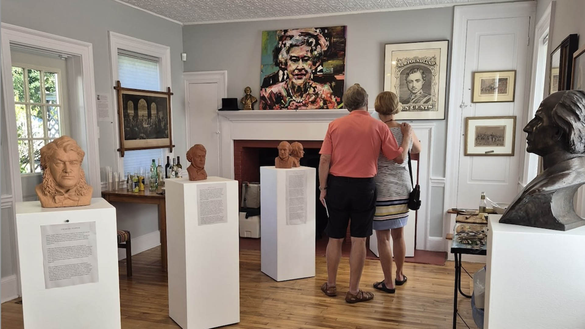
- Active_listing: 1
- Business: Mahone Portrait House
- Primary_contact: 3177, 3178
- Listing_type_tax: 4
- Google_rating: 5
- Attraction_type:
- Artisan_gallery_type: Artisan Shops & Galleries
- Art_product_type:
- Art_medium:
- Region: South Shore
- Street_address: 572 Main St
- City: 516, Mahone Bay
- General_area: 51, Mahone Bay Area
- Postal_code: B0J 2E0
- Latitude: 44.44872648246652
- Longitude: -64.37953846083634
- Contact_details: Phone, Email
- Phone: 647-990-5111
- Email: info@mahoneportraithouse.ca
- Description: The recently-opened Mahone Portrait House is home to a wide-ranging personal collection of portraits and sculpture by significant Canadian artists from across the country spanning two centuries. Items on display are for the public’s enjoyment not for purchase and admission is free.
The exhibition brings the history of the town, province and country to life through a wide range of subjects and styles, from Viola Desmond and Sidney Crosby, to Pierre Trudeau and Joseph Howe.
The collection occupies five rooms on the main floor of a colonial -style house c. 1865. The hundred-odd works are organized thematically. The ‘Harris Foyer’, highlights a family association with one of the town’s famous three churches. ‘The Atlantic Room’ holds paintings by artists from the region. the ‘Canadas Room’ features Indigenous and Quebec subjects; and “The Back Room” focusses on political subjects and leaders associated with Confederation.
- Period_of_operation: Open within a date range
- Open_start_date: May 23, 2026
- Open_end_date: October 11, 2026
- Rate_details: Free admission
- Images: https://novascotia.com/wp-content/uploads/2025/09/1-1920x1080-1.jpg, https://novascotia.com/wp-content/uploads/2025/09/Mahone-portrait-house-opening-August-16-2025-24-copy-3-1920x1080-1.jpg, https://novascotia.com/wp-content/uploads/2025/09/2-1920x1080-1.png, https://novascotia.com/wp-content/uploads/2025/09/3-1920x1080-1.jpg
- Accessibility: Partially accessible
- Onsite_amenities: Parking
- Website: https://www.mahoneportraithouse.ca
- Notes:
Pages
Listings Page 1
Listings Page 2
Listings Page 3
Listings Page 4
Listings Page 5
Listings Page 6
Listings Page 7
Listings Page 8
Listings Page 9
Listings Page 10
Listings Page 11
Listings Page 12
Listings Page 13
Listings Page 14
Listings Page 15
Listings Page 16
Listings Page 17
Listings Page 18
Listings Page 19
Listings Page 20
Listings Page 21
Listings Page 22
Listings Page 23
Listings Page 24
Listings Page 25
Listings Page 26
Listings Page 27